Winkelwagen
Geen items in winkelwagen
Ga naar winkelwagen
Kaarten
De beste wegenkaarten, routekaarten, fiets- of wandelkaarten en topografische kaarten vindt u hier!
Gaat u wandelen, met de auto toeren of op andere manier de omgeving op uw vakantiebestemming verkennen? Onze tip: neem een goede kaart mee! Er zijn speciale kaarten beschikbaar voor campervakanties, fietsroutes, pelgrimsroutes, wandeltochten en veel meer. Ook wegenatlassen en wegenkaarten kunnen handig zijn onderweg.
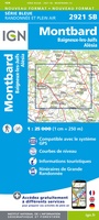 Topografische kaart - Wandelkaart 2921 Baigneux-les-Juifs, Alésia, Montbard | IGN - Institut Géographique National
 Wandelkaart - Topografische kaart 2922 SB - Serie Bleue Semur-en-Auxois – Vitteaux | IGN - Institut Géographique National★★★★★
 Wandelkaart - Topografische kaart 2923 SB - Serie Bleue Pouilly-en-Auxois – Thoisy-la-Berchère | IGN - Institut Géographique National
 Wandelkaart - Topografische kaart 2924 SB - Serie Bleue Arnay-le-Duc – Epignac | IGN - Institut Géographique National★★★★★
 Wandelkaart - Topografische kaart 2925 SB - Serie Bleue Autun - Le Creusot | IGN - Institut Géographique National
 Wandelkaart - Topografische kaart 2926 SB - Serie Bleue Montceau-les-Mines, Ecuisses | IGN - Institut Géographique National
 Wandelkaart - Topografische kaart 2927 SB - Serie Bleue St-Bonnet-de-Joux – Saint-Gengoux-le-National | IGN - Institut Géographique National
 Wandelkaart - Topografische kaart 2928 SB - Serie Bleue Cluny Matour | IGN - Institut Géographique National
 Wandelkaart - Topografische kaart 2929ET Beaujeu - Belleville - Haut Beaujolais – Rhônevallei – Bourgondië | IGN - Institut Géographique National
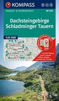 Wandelkaart 293 Dachsteingebirge - Schladminger Tauern | Kompass★★★★★
 Wandelkaart - Topografische kaart 293 OS Explorer Map Kingston upon Hull, Beverley | Ordnance Survey
 Topografische kaart 293 MT50 Berga | CNIG - Instituto Geográfico Nacional1
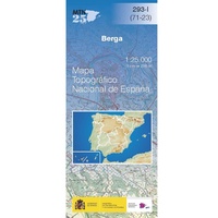 Topografische kaart 293-I Berga | CNIG - Instituto Geográfico Nacional
 Topografische kaart 293-II Borredà | CNIG - Instituto Geográfico Nacional
 Topografische kaart 293-III Gironella | CNIG - Instituto Geográfico Nacional
 Topografische kaart 293-IV Prats de Lluçanès | CNIG - Instituto Geográfico Nacional
 Wandelkaart - Topografische kaart 2930ET Villefranche-sur-Saône | IGN - Institut Géographique National
 Wandelkaart - Topografische kaart 2931ET L'Arbresle - Monts de Tarare – Col de la Luère – Rhônevallei - Bourgondië | IGN - Institut Géographique National
 Wandelkaart - Topografische kaart 2932ET Monts du Lyonnais | IGN - Institut Géographique National
 Wandelkaart - Topografische kaart 2933ET Massif du Pilat - St-Etienne - St-Chamond - PNR du Pilat Ardéche | IGN - Institut Géographique National
Laatste reviews

Matig
Deze gids is dun en makkelijk mee te nemen tijdens je wandeltocht. Het beschrijft echter een andere route dan de gebruikelijke route vanaf Echternach. Jammer …
★★★★★ door Sven 22 april 2026 | Heeft dit artikel gekocht
Mooie en degelijke wereldbol
Mooie en degelijke wereldbol. Voldoet volledig aan mijn wensen.
★★★★★ door Ben te Molder 21 april 2026 | Heeft dit artikel gekocht
Mooie kaart
Grote sortering en prima verzending
★★★★★ door Willem 21 april 2026 | Heeft dit artikel gekocht
Lichtgewicht en handzaam
Heel blij mee! Super handzaam, lichtgewicht boekje om mee te nemen op de camino. Alles staat er overzichtelijk in wat nodig is. Deze gaat zeker …
★★★★★ door Greetje 20 april 2026 | Heeft dit artikel gekocht