Kaarten
De beste wegenkaarten, routekaarten, fiets- of wandelkaarten en topografische kaarten vindt u hier!
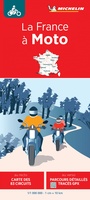 Wegenkaart - landkaart La France a Moto - Frankrijk met de motor | Michelin
Speciale kaart van Michelin waarbij de nadruk ligt op mooie motorroutes, circuits, toeren waarbij op de ene kant 83 rondtochten van 100-150 km staan ingetekend en op de andere zijde …
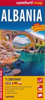 Wegenkaart - landkaart Comfortmap Albania - Albanië | ExpressMap
De idyllische vallei van Valbona, een rondvaart over het Komanmeer, sfeervolle straatjes van Berat en Gjirokaster. Mediterrane zon, Adriatische stranden en resorts aan de Albanese Rivièra. Aan beide zijden gelamineerd, …
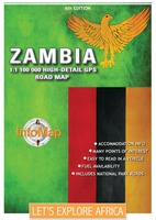 Wegenkaart - landkaart Zambia | Infomap
Zambia boasts some of the most beautiful, wild and pristine wilderness in Southern Africa. With 19 national parks including the world famous Kafue and South Luangwa National Parks, Zambia is …
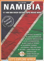 Wegenkaart - landkaart Namibië | Infomap
Another InfoMap classic – now in its 13th edition and highly recommended! Famous for its Namib desert, the oldest desert in the world, which straddle the western shore along …
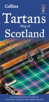 Historische Kaart Tartans Map of Scotland | Collins
Discover Scotland with this authoritative guide to tartans and their origins. This popular touring map has a huge amount of detail with over 1,000 places of tourist interest plotted and …
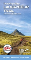 Wandelkaart Laugavegur Trail and Fimmvorduhals Trail | Knife Edge Outdoor
Waterproof sheet map for Iceland's Laugavegur Trail (& Fimmvorduhals Trail): 1:40,000. Includes free GPX downloads for the trails. The definitive map to Iceland's two best trails: larger scale and more …
★★★★★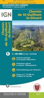 Wandelkaart Wandelkaart Chemin de Saint-Guilhem-le-Désert | IGN - Institut Géographique National
Une carte à l'échelle du 1 : 90 000 incontournable pour parcourir le Chemin de St-Guilhem-le-Désert.
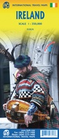 Wegenkaart - landkaart Ierland | ITMB
As technology improves, we are able to produce more detailed maps than was previously possible. Such is the case with Ireland, a part of the world consisting of two countries …
 Wegenkaart - landkaart Northern British Columbia | ITMB
British Columbia is big! Gargantuan huge, in fact, although it is lightly populated. ITMB published a map of the more densely populated southern half of the province a number of …
 Wegenkaart - landkaart Madrid & Castile/La Mancha | ITMB
ITMB is pleased to introduce this new map, using our own artwork, for Madrid, covering essentially all the area within the circular ring road motorway. All the streets are named …
 Wandelkaart 167 Hamont-Achel | NGI - Nationaal Geografisch Instituut
Topografische kaart met: - Wandelwegen - Bezienswaardigheden - Toeristische accommodaties Het gebied rond de Warmbeek is een uitzonderlijk gebied. In de deelgemeenten Hamont en Achel ontstond dit grote natuurgebied. …
 Wegenkaart - landkaart Planning Map South Australia | Lonely Planet
Lonely Planet: The world's number one travel guide publisher* Durable and waterproof, with a handy slipcase and an easy-fold format, Lonely Planet's South Australia Planning Map helps you explore with …
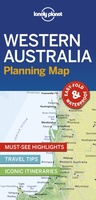 Wegenkaart - landkaart Planning Map Western Australia | Lonely Planet
Lonely Planet: The world's number one travel guide publisher* Durable and waterproof, with a handy slipcase and an easy-fold format, Lonely Planet's Western Australia Planning Map helps you explore with …
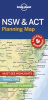 Wegenkaart - landkaart Planning Map New South Wales & ACT | Lonely Planet
From Lonely Planet: The world's number one travel guide publisher* Durable and waterproof, with a handy slipcase and an easy-fold format, Lonely Planet's New South Wales & the Australian Capital …
 Wegenkaart - landkaart Planning Map Tasmania | Lonely Planet
Lonely Planet: The world's number one travel guide publisher* Durable and waterproof, with a handy slipcase and an easy-fold format, Lonely Planet's Tasmania Planning Map helps you explore with ease. …
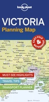 Wegenkaart - landkaart Planning Map Victoria | Lonely Planet
Lonely Planet: The world's number one travel guide publisher* Durable and waterproof, with a handy slipcase and an easy-fold format, Lonely Planet's Victoria Planning Map helps you explore with ease. …
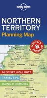 Wegenkaart - landkaart Planning Map Northern Territory | Lonely Planet
From Lonely Planet: The world's number one travel guide publisher* Durable and waterproof, with a handy slipcase and an easy-fold format, Lonely Planet's Northern Territory Planning Map helps you explore …
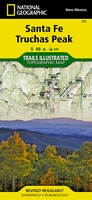 Wandelkaart 731 Santa Fe, Truchas Peak | National Geographic
Prachtige geplastificeerde kaart van het bekende nationaal park. Met alle recreatieve voorzieningen als campsites, maar ook met topografische details en wandelroutes ed. Door uitgekiend kleurgebruik zeer prettig in gebruik. Scheur …
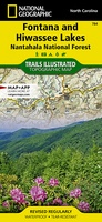 Wandelkaart 784 Fontana and Hiwassee Lakes | National Geographic
Prachtige geplastificeerde kaart van het bekende nationaal park. Met alle recreatieve voorzieningen als campsites, maar ook met topografische details en wandelroutes ed. Door uitgekiend kleurgebruik zeer prettig in gebruik. Scheur …
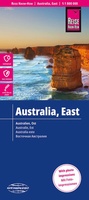 Wegenkaart - landkaart Australië Oost- Australien Ost | Reise Know-How Verlag
Hochreißfeste und 100% wasserfeste Landkarte "Australien, Ost" aus der Serie world mapping project. Reise Know-How Landkarten zeichnen sich durch besonders stabiles Kunststoffpapier aus, das beschreibbar ist wie Papier, sogar …
Laatste reviews

We hebben een landkaart van Albanië besteld. Deze hebben we in goede staat ontvangen
★★★★★ door Ida van der Heiden 26 april 2024 | Heeft dit artikel gekocht
Zoals gewend van de Alpverein weer een mooie en duidelijke kaart voor dit mooie wandelgebied incl. hutten.
★★★★★ door B van R 26 april 2024 | Heeft dit artikel gekocht
Duidelijke en mooie kaart van het gebied. Oogt stevig/dik waardoor niet snel kapot tijdens wandelingen. Sommige tekens zijn wel wat aan de kleine kant waardoor …
★★★★★ door B van R 26 april 2024 | Heeft dit artikel gekocht
Voor een reis Ivoorkust is er weiniginformatie te vinden. Dit boek brengt het meeste. Duidelijk en overzichtelijk.
★★★★★ door Annemiek van Riezen 26 april 2024 | Heeft dit artikel gekocht