Winkelwagen
Geen items in winkelwagen
Ga naar winkelwagen
Kaarten
De beste wegenkaarten, routekaarten, fiets- of wandelkaarten en topografische kaarten vindt u hier!
Gaat u wandelen, met de auto toeren of op andere manier de omgeving op uw vakantiebestemming verkennen? Onze tip: neem een goede kaart mee! Er zijn speciale kaarten beschikbaar voor campervakanties, fietsroutes, pelgrimsroutes, wandeltochten en veel meer. Ook wegenatlassen en wegenkaarten kunnen handig zijn onderweg.
 Wandelkaart - Topografische kaart 1936ET Les Eyzies, St.-Cyprien, le Bugue, Beynac | IGN - Institut Géographique National★★★★★
 Wandelkaart - Topografische kaart 1937 SB - Serie Bleue Belves, Beaumont-du-Périgord | IGN - Institut Géographique National★★★★★
 Wandelkaart - Topografische kaart 1938 SB - Serie Bleue Fumel - Monflanquin | IGN - Institut Géographique National
 Wandelkaart - Topografische kaart 1939 SB - Serie Bleue Penne-d'Agenais | IGN - Institut Géographique National
 Wandelkaart - Topografische kaart 194 Landranger Dorchester & Weymouth, Cerne Abbas & Bere Regis | Ordnance Survey
 Wandelkaart - Topografische kaart 194 OS Explorer Map Hertford, Bishop's Stortford | Ordnance Survey
 Wandelkaart 194 Südlicher Oberpfälzer Wald | Kompass
 Wandelkaart - Topografische kaart 1940 SB - Serie Bleue Valence | IGN - Institut Géographique National
 Wandelkaart - Topografische kaart 1941 SB - Serie Bleue Saint-Nicolas-de-la-Grave | IGN - Institut Géographique National
 Wandelkaart - Topografische kaart 1942 SB - Serie Bleue Beaumont-de-Lomagne | IGN - Institut Géographique National
 Wandelkaart - Topografische kaart 1943 SB - Serie Bleue L'Isle-Jourdain | IGN - Institut Géographique National
 Wandelkaart - Topografische kaart 1944 SB - Serie Bleue Samatan | IGN - Institut Géographique National
 Wandelkaart - Topografische kaart 1945 SB - Serie Bleue Le Fousseret - Aurignac | IGN - Institut Géographique National
 Wandelkaart - Topografische kaart 1946 SB - Serie Bleue St-Gaudens, Salies-du-Salat | IGN - Institut Géographique National
 Wandelkaart - Topografische kaart 1947OT Aspet, Pic de Mauberme | IGN - Institut Géographique National★★★★★
 Wandelkaart - Topografische kaart 195 Landranger Bournemouth & Purbeck | Ordnance Survey
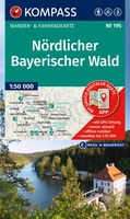 Wandelkaart 195 Nördlicher Bayerischer Wald | Kompass★★★★★
 Wandelkaart 195 Clavier en Tinlot, Condroz | NGI - Nationaal Geografisch Instituut
 Fietskaart 195 Dresden Elbland Sächsische Schweiz | Publicpress
 Wandelkaart - Topografische kaart 195 OS Explorer Map Braintree, Saffron, Walden | Ordnance Survey
Laatste reviews

Een zeer onhandige wegenkaart
Wij dachten er goed aanrecht doen een zeer uitgebreide wegenatlas aan te schaffen, maar toen wij deze goed bestudeerden kwamen wij erachter dat dit een …
★★★★★ door Herman van Mal 18 juni 2026 | Heeft dit artikel gekocht
Nuttige en handige reisgids!
De gids geeft brede informatie over Transsylvanië, inclusief zijn gecompliceerde geschiedenis, musea, kerken en andere bezienswaardigheden, en wat praktische zaken. Dit laatste onderwerp is wel …
★★★★★ door Frank Bakx 16 juni 2026 | Heeft dit artikel gekocht
Super service
Makkelijk bestelproces. Snel geleverd en goede service!
★★★★★ door tanja kleerekoper 16 juni 2026 | Heeft dit artikel gekocht
Wandelkaart Noord Drente / Drentse Aa
Prachtige wandelkaart.Handzaam mooie routes. Prima verpakt en snel verzonden!
★★★★★ door Gerard 16 juni 2026 | Heeft dit artikel gekocht