Winkelwagen
Geen items in winkelwagen
Ga naar winkelwagen
Kaarten
De beste wegenkaarten, routekaarten, fiets- of wandelkaarten en topografische kaarten vindt u hier!
Gaat u wandelen, met de auto toeren of op andere manier de omgeving op uw vakantiebestemming verkennen? Onze tip: neem een goede kaart mee! Er zijn speciale kaarten beschikbaar voor campervakanties, fietsroutes, pelgrimsroutes, wandeltochten en veel meer. Ook wegenatlassen en wegenkaarten kunnen handig zijn onderweg.
 Wandelkaart - Topografische kaart 175 OS Explorer Map Southend-on-Sea, Basildon | Ordnance Survey
 Wegenkaart - landkaart 175 Four Corners USA | Michelin★★★★★★★★★★
 Topografische kaart 175 MT50 Sigüés | CNIG - Instituto Geográfico Nacional1
 Wandelkaart - Topografische kaart 175 Landranger Reading & Windsor, Henley-on-Thames & Bracknell | Ordnance Survey
 Wandelkaart 175 Mittlere Fränkische Alb | Kompass
 Topografische kaart 175-II Sigüés | CNIG - Instituto Geográfico Nacional
 Wandelkaart - Topografische kaart 176 OS Explorer Map Blackwater Estuary | Ordnance Survey
 Wandelkaart 176 Regensburg - Amberg - Schwandorf | Kompass
 Topografische kaart 176 MT50 Jaca | CNIG - Instituto Geográfico Nacional
 Wandelkaart - Topografische kaart 176 Landranger West London, Rickmansworth & Staines | Ordnance Survey★★★★★
 Topografische kaart 176-III Bailo | CNIG - Instituto Geográfico Nacional
 Topografische kaart 176-IV Jaca | CNIG - Instituto Geográfico Nacional1
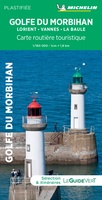 Wegenkaart - landkaart 17612 Golfe du Morbihan - Bretagne | Michelin
 Wegenkaart - landkaart 17614 Corse - Corsica | Michelin★★★★★
 Wegenkaart - landkaart 17617 Plages du Débarquement | Invasiestranden D-Day | Michelin
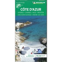 Wegenkaart - landkaart 17618 Côte d’Azur | Michelin
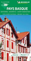 Wegenkaart - landkaart 17619 Pays Basque - Baskenland | Michelin
 Wegenkaart - landkaart 17620 Auvergne | Michelin
 Wegenkaart - landkaart 17632 Toscane | Michelin
 Wegenkaart - landkaart 17634 Côte amalfitaine Amalfi-kust Napels | Michelin
Laatste reviews

Een zeer onhandige wegenkaart
Wij dachten er goed aanrecht doen een zeer uitgebreide wegenatlas aan te schaffen, maar toen wij deze goed bestudeerden kwamen wij erachter dat dit een …
★★★★★ door Herman van Mal 18 juni 2026 | Heeft dit artikel gekocht
Nuttige en handige reisgids!
De gids geeft brede informatie over Transsylvanië, inclusief zijn gecompliceerde geschiedenis, musea, kerken en andere bezienswaardigheden, en wat praktische zaken. Dit laatste onderwerp is wel …
★★★★★ door Frank Bakx 16 juni 2026 | Heeft dit artikel gekocht
Super service
Makkelijk bestelproces. Snel geleverd en goede service!
★★★★★ door tanja kleerekoper 16 juni 2026 | Heeft dit artikel gekocht
Wandelkaart Noord Drente / Drentse Aa
Prachtige wandelkaart.Handzaam mooie routes. Prima verpakt en snel verzonden!
★★★★★ door Gerard 16 juni 2026 | Heeft dit artikel gekocht