Ultramap XT40
De ultieme Harvey XT40 wandelkaart voor alle avonturen!
De UltraMap XT40-serie is een superlichte, waterdichte set kaarten in zakformaat die enkele van de meest populaire gebieden in het Verenigd Koninkrijk bestrijkt met een schaal van 1:40.000. Deze zijn ideaal voor hardlopers, fastpackers en wandelaars die een kaart willen voor eenvoudige navigatie bij het afleggen van langere afstanden.
Eigenschappen
- Heeft de voordelen van zijn grotere broers
- Volledig gedetailleerde echte HARVEY-mapping
- Gebruik zonder kaarthoes: stevig en 100% waterdicht
- Opent direct aan beide zijden van het blad
- Gewicht: 24g
- Schaal: 1:40.000
- Verhouding: 2,5 cm = 1 km
- Plat formaat: 870 x 304 mm (87 x 30,4 cm)
- Afmetingen opgevouwen: 73 x 152 mm (7,3 x 15,2 cm)
- Kaartgebied: 700 vierkante kilometer
- Dubbelzijdig: ja
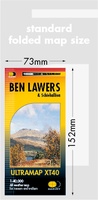 Wandelkaart Ben Lawers & Schiehallion | Harvey Maps
40 years’ experience have gone into HARVEY’s most creative new series. Slim and light, the Ultramap covers a large area and yet is handily compact. Pocket perfect! Includes Ben …
 Wandelkaart Arran | Harvey Maps
Covers a large area yet is handily compact. Pocket perfect! Features the renowned Goat Fell, A'Chir ridge, Beinn Bharrain, Glen Sannox & Glen Rosa. Detailed map for runners …
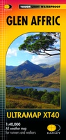 Wandelkaart Glen Affric | Harvey Maps
Covers a large area yet is handily compact. Pocket perfect! Detailed map for runners and walkers of the remote Glen Affric area at the magic scale of 1:40,000. …
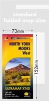 Wandelkaart North York Moors West | Harvey Maps
Covers a large area yet is handily compact. Pocket perfect! Detailed map for runners and walkers of the western section of the North York Moors National Park at the …
 Wandelkaart Dartmoor Noord | Harvey Maps
Covers a large area yet is handily compact. Pocket perfect! Detailed map for runners and walkers of the north section of Dartmoor National Park at the magic scale of …
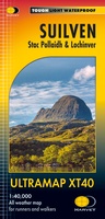 Wandelkaart Suilven / Stac Pollaidh / Lochinver | Harvey Maps
Detailed map for runners and walkers of Suilven and the surrounding area at the magic scale of 1:40,000. Covers a large area yet is handily compact. Pocket perfect! This is …
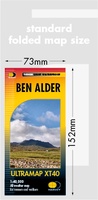 Wandelkaart Ben Alder | Harvey Maps
Covers a large area yet is handily compact. Pocket perfect!Detailed map for runners and walkers of the hills between Loch Tay and Loch Rannoch at the magic scale of 1:40,000.Includes …
 Wandelkaart Lake District South East - Zuid Oost XT40 ultra | Harvey Maps
 Wandelkaart Snowdonia Zuid | Harvey Maps
 Wegenkaart - landkaart Galloway Hills XT40 ultra | Harvey Maps
 Wandelkaart Snowdonia Noord | Harvey Maps★★★★★
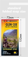 Wandelkaart Glen Coe | Harvey Maps
Covers a large area yet is handily compact. Pocket perfect! Detailed map for runners and walkers of Glen Coe and the Aonach Eagach ridge at the magic scale of …
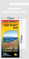 Wandelkaart Peak District Noord | Harvey Maps
HARVEY launch innovative new series: Ultramap XT40. 16 titles featuring in Trail magazine through spring 2016. 40 years experience have gone into HARVEY's most creative new series. The Ultramap covers …
 Wandelkaart Ochil Hills | Harvey Maps
Pocket perfect! Well known hills are Dumyat, Ben Cleuch and Castle Craig Hill. Magnificent views over the Forth Valley. Places of interest and enlargements of the steep and narrow glens: …
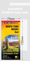 Wandelkaart North York Moors Oost | Harvey Maps
Covers a large area yet is handily compact. Pocket perfect! Detailed map for runners and walkers of the eastern section of the North York Moors National Park at the …
 Wandelkaart Lake District West XT40 ultra | Harvey Maps
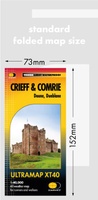 Wandelkaart Crieff & Comrie | Harvey Maps
 Wandelkaart Loch Earn | Harvey Maps
Covers a large area yet is handily compact. Pocket perfect! Detailed map for runners and walkers of Loch Earn, Glen Ogle and Killin at the magic scale of 1:40,000. …
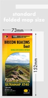 Wandelkaart Brecon Beacons Oost | Harvey Maps
Covers a large area yet is handily compact. Pocket perfect! Detailed map for runners and walkers of the eastern part of the Brecon Beacons National Park and the Black …
 Wandelkaart Yorkshire Dales Noord Oost | Harvey Maps
Covers a large area yet is handily compact. Pocket perfect! Detailed map for runners and walkers of the north eastern part of the Yorkshire Dales National Park at the …
Laatste reviews

Op zich een goede kaart, maar het is eigenlijk gewoon een uitvergroting van de bekende 1:200.000-kaarten, dus weinig tot geen extra informatie. Wel wat duidelijker …
★★★★★ door FGM Ballhaus 13 mei 2026 | Heeft dit artikel gekocht
Duidelijke kaart, goed voor fietsen, iets minder voor wandelen door de schaal, maar er is heel weinig kaartmateriaal voor dit gebied dus daarom toch dik …
★★★★★ door FGM Ballhaus 13 mei 2026 | Heeft dit artikel gekocht
Fietskaart is een goede aanvulling op de Nederlandse fietskaarten, laat de Achterhoek zien maar ook een heel stuk Duitsland in (naar het oosten). Kwalitatief ook …
★★★★★ door FGM Ballhaus 13 mei 2026 | Heeft dit artikel gekocht
Keurig verpakt, snel verzonden. Boek voldoet aan mijn verwachtingen!
★★★★★ door Beatrice 12 mei 2026 | Heeft dit artikel gekocht