Top 25
De kaarten van IGN (kort voor Institute Geographique National), wandelkaarten voor Frankrijk, zijn van een ongekend hoog niveau. Met name de wandelkaarten 1:25.000 vinden wij geweldig: werkelijk alles staat erop, de kaarten bevatten zeer veel details en het kleurgebruik is fantastisch, waardoor alles ook nog eens heel goed leesbaar. Je hoort het: wij zijn fan van deze kaarten!
 Wandelkaart 2047OT St-Girons / Couserans | IGN - Institut Géographique National
 Wandelkaart - Topografische kaart 2048OT Aulus-les-Bains, Mont Valier | IGN - Institut Géographique National
 Wandelkaart - Topografische kaart 2103ET Calais | IGN - Institut Géographique National★★★★★
 Wandelkaart - Topografische kaart 2104ET Boulogne-Sur-Mer | IGN - Institut Géographique National★★★★★
 Wandelkaart 2105ET Le Touquet-Paris-Plage / Berck / Vallée de la Canche | IGN - Institut Géographique National
 Wandelkaart - Topografische kaart 2106ET Baie de Somme, Le Crotoy, Fort-Mahon-Plage | IGN - Institut Géographique National★★★★★
 Wandelkaart - Topografische kaart 2107OT Le Tréport | IGN - Institut Géographique National★★★★★
 Wandelkaart - Topografische kaart 2108OT Foret d'Eu, Blangy-sur-Bresle, Gamaches | IGN - Institut Géographique National
 Wandelkaart 2113ET Mantes-la-Jolie / Boucles de la Seine / PNR Vexin Fr. | IGN - Institut Géographique National
 Wandelkaart - Topografische kaart 2121OT Blois - Chambord - Cheverny | IGN - Institut Géographique National
 Wandelkaart 2136ET Rocamadour / Padirac / Vallée de la Dordogne | IGN - Institut Géographique National★★★★★
 Wandelkaart - Topografische kaart 2138OT Cahors | IGN - Institut Géographique National★★★★★
 Wandelkaart - Topografische kaart 2147ET Foix - Tarascon sur Ariege, Ussat, les Monts-d'Olmes | IGN - Institut Géographique National
 Wandelkaart 2148ET Ax-les-Thermes, Ussat, Les Cabannes, Ax-Bonascre | IGN - Institut Géographique National
 Wandelkaart - Topografische kaart 2148OT Vicdessos, Pic d'Estats et de Montcalm, Pyrenees-Ariegeoises | IGN - Institut Géographique National★★★★★
 Wandelkaart - Topografische kaart 2148OTR Vicdessos | IGN - Institut Géographique National
 Wandelkaart - Topografische kaart 2214ET Versailles, Forêts de Marly et de St-Germain | IGN - Institut Géographique National
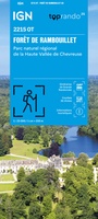 Wandelkaart 2215OT Forêt de Rambouillet / PNR Haute-Vallée de Chevreuse | IGN - Institut Géographique National
 Wandelkaart 2215OTR Forêt de Rambouillet / PNR Haute-Vallée de Chevreuse | IGN - Institut Géographique National
 Wandelkaart - Topografische kaart 2216ET Etampes, Dourdan | IGN - Institut Géographique National
Laatste reviews

De ontvanger van dit cadeau is er erg blij mee. De Zwerver heeft het mooi naar het cadeaukaarten verstuurd. Er wordt vaak mee gespeeld.
★★★★★ door Carola 26 december 2025 | Heeft dit artikel gekocht
Super gedetailleerde kaart met alle routes en wandelroutes. Ik ben er blij mee.
★★★★★ door Rob 26 december 2025 | Heeft dit artikel gekocht
Zeer gedetaillerd, fijn groot formaat atlas voor reizen met auto of camper. Niet geschikt voor backpackers want groot en vrij zwaar.
★★★★★ door Inge Hens 23 december 2025 | Heeft dit artikel gekocht
Ik heb iemand met Sinterklaas héél blij gemaakt met de kaarten. Hij kon er niet genoeg van krijgen en gaf geregeld aan dat hij verheugd …
★★★★★ door Peet Maessen 23 december 2025 | Heeft dit artikel gekocht