Top 25
De kaarten van IGN (kort voor Institute Geographique National), wandelkaarten voor Frankrijk, zijn van een ongekend hoog niveau. Met name de wandelkaarten 1:25.000 vinden wij geweldig: werkelijk alles staat erop, de kaarten bevatten zeer veel details en het kleurgebruik is fantastisch, waardoor alles ook nog eens heel goed leesbaar. Je hoort het: wij zijn fan van deze kaarten!
 Wandelkaart - Topografische kaart 3619OTR Bussang - La Bresse | IGN - Institut Géographique National
 Wandelkaart - Topografische kaart 3620ET Grand Ballon | IGN - Institut Géographique National★★★★★
 Wandelkaart - Topografische kaart 3621ET Dannemarie - Delle - Sundgau | IGN - Institut Géographique National
 Wandelkaart - Topografische kaart 3621OT Belfort - Montbeliard | IGN - Institut Géographique National
 Wandelkaart - Topografische kaart 3622OT Montbéliard | IGN - Institut Géographique National
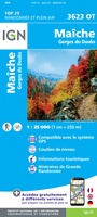 Wandelkaart - Topografische kaart 3623OT Maîche | IGN - Institut Géographique National
 Wandelkaart - Topografische kaart 3630OT Chamonix-Mont-Blanc | IGN - Institut Géographique National★★★★★★★★★★
 Wandelkaart 3630OTR Chamonix-Mont-Blanc | IGN - Institut Géographique National★★★★★
 Wandelkaart - Topografische kaart 3633ET Tignes - Val d'Isère | IGN - Institut Géographique National★★★★★
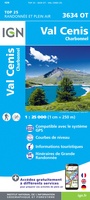 Wandelkaart - Topografische kaart 3634OT Val Cenis | IGN - Institut Géographique National★★★★★★★★★★
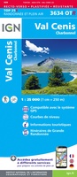 Wandelkaart - Topografische kaart 3634OTR Val Cenis | IGN - Institut Géographique National
 Wandelkaart - Topografische kaart 3637OT Mont Viso | IGN - Institut Géographique National★★★★★
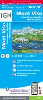 Wandelkaart - Topografische kaart 3637OTR Mont Viso | IGN - Institut Géographique National★★★★★
 Wandelkaart - Topografische kaart 3639OT Haute Tinée 1 | IGN - Institut Géographique National
 Wandelkaart - Topografische kaart 3640ET Haute Tinée 2 | IGN - Institut Géographique National
 Wandelkaart - Topografische kaart 3640OT Haut Cians | IGN - Institut Géographique National
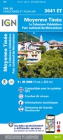 Wandelkaart - Topografische kaart 3641ET Moyenne Tinée | IGN - Institut Géographique National
 Wandelkaart - Topografische kaart 3641OT Moyen Var | IGN - Institut Géographique National
 Wandelkaart - Topografische kaart 3642ET Vallée de l'Esteron | IGN - Institut Géographique National
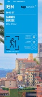 Wandelkaart 3643ET Cannes / Grasse / Côte d'Azur | IGN - Institut Géographique National
Laatste reviews

De ontvanger van dit cadeau is er erg blij mee. De Zwerver heeft het mooi naar het cadeaukaarten verstuurd. Er wordt vaak mee gespeeld.
★★★★★ door Carola 26 december 2025 | Heeft dit artikel gekocht
Super gedetailleerde kaart met alle routes en wandelroutes. Ik ben er blij mee.
★★★★★ door Rob 26 december 2025 | Heeft dit artikel gekocht
Zeer gedetaillerd, fijn groot formaat atlas voor reizen met auto of camper. Niet geschikt voor backpackers want groot en vrij zwaar.
★★★★★ door Inge Hens 23 december 2025 | Heeft dit artikel gekocht
Ik heb iemand met Sinterklaas héél blij gemaakt met de kaarten. Hij kon er niet genoeg van krijgen en gaf geregeld aan dat hij verheugd …
★★★★★ door Peet Maessen 23 december 2025 | Heeft dit artikel gekocht