Top 25
De kaarten van IGN (kort voor Institute Geographique National), wandelkaarten voor Frankrijk, zijn van een ongekend hoog niveau. Met name de wandelkaarten 1:25.000 vinden wij geweldig: werkelijk alles staat erop, de kaarten bevatten zeer veel details en het kleurgebruik is fantastisch, waardoor alles ook nog eens heel goed leesbaar. Je hoort het: wij zijn fan van deze kaarten!
 Wandelkaart - Topografische kaart 3537ET Guillestre | IGN - Institut Géographique National★★★★★
 Wandelkaart - Topografische kaart 3538ET Aiguille de Chamberyron | IGN - Institut Géographique National
 Wandelkaart - Topografische kaart 3540ET Haute Vallée du Var | IGN - Institut Géographique National★★★★★
 Wandelkaart - Topografische kaart 3540OT Barcelonnette | IGN - Institut Géographique National
 Wandelkaart - Topografische kaart 3540OTR Barcelonnette | IGN - Institut Géographique National
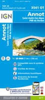 Wandelkaart - Topografische kaart 3541OT Annot | IGN - Institut Géographique National
 Wandelkaart - Topografische kaart 3542ET Haute Estéron | IGN - Institut Géographique National
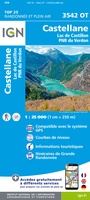 Wandelkaart - Topografische kaart 3542OT Castellane | IGN - Institut Géographique National
 Wandelkaart - Topografische kaart 3543ET Haute Siagne | IGN - Institut Géographique National★★★★★
 Wandelkaart - Topografische kaart 3543OT Draguignan | IGN - Institut Géographique National
 Topografische kaart - Wandelkaart 3544ET Fréjus - Saint-Raphaël | IGN - Institut Géographique National★★★★★
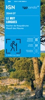 Wandelkaart 3544OT Le Muy / Lorgues | IGN - Institut Géographique National
 Wandelkaart - Topografische kaart 3545OT Saint-Tropez - Sainte-Maxime | IGN - Institut Géographique National
 Wandelkaart - Topografische kaart 3613ET Sarreguemines | IGN - Institut Géographique National
 Wandelkaart - Topografische kaart 3614ET Sarre-Union - Phalsbourg | IGN - Institut Géographique National
 Wandelkaart - Topografische kaart 3616OT Lac de Pierre-Percée - Le Donon | IGN - Institut Géographique National★★★★★
 Wandelkaart - Topografische kaart 3617OT St-Dié-des-Vosges | IGN - Institut Géographique National
 Wandelkaart - Topografische kaart 3618OT Le Hohneck - Gérardmer | IGN - Institut Géographique National★★★★★★★★★★
 Wandelkaart - Topografische kaart 3618OTR Le Hohneck - Gérardmer | IGN - Institut Géographique National★★★★★
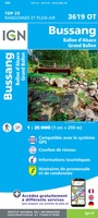 Wandelkaart - Topografische kaart 3619OT Bussang - La Bresse | IGN - Institut Géographique National★★★★★★★★★★
Laatste reviews

Rother wandelgidsen stellen nooit teleur. Mooie routes, goede opgave kilometers, hoogtemeters en horeca. Een aanrader!
★★★★★ door Anita Geel 13 januari 2026 | Heeft dit artikel gekocht
Mooi boek met prachtige foto’s! Voldoet helemaal aan mijn verwachtingen.
★★★★★ door Hans Eldering 13 januari 2026 | Heeft dit artikel gekocht
het product voldeed aan mijn verwachtingen en was geplastificeerd wat natuurlijk perfect is voor kaart die veel wordt geraadpleegd!
★★★★★ door Peter Lantinga 13 januari 2026 | Heeft dit artikel gekocht
Ik heb de wegenkaart Maleisië aangeschaft om zelf een rondreis per huurauto te kunnen plannen. Deze kaart heeft daar heel goed bij geholpen doordat er …
★★★★★ door M. Rizvi 13 januari 2026 | Heeft dit artikel gekocht