Top 25
De kaarten van IGN (kort voor Institute Geographique National), wandelkaarten voor Frankrijk, zijn van een ongekend hoog niveau. Met name de wandelkaarten 1:25.000 vinden wij geweldig: werkelijk alles staat erop, de kaarten bevatten zeer veel details en het kleurgebruik is fantastisch, waardoor alles ook nog eens heel goed leesbaar. Je hoort het: wij zijn fan van deze kaarten!
 Wandelkaart 3236OT Villard-de-Lans | IGN - Institut Géographique National★★★★★
 Wandelkaart - Topografische kaart 3236OTR Villard-de-Lans / Mont Aiguille / PNR du Vercors | IGN - Institut Géographique National1
 Wandelkaart - Topografische kaart 3237OT Glandasse | IGN - Institut Géographique National
 Wandelkaart - Topografische kaart 3237OTR Glandasse / Col de la Croix-Haute / PNR du Vercors | IGN - Institut Géographique National
 Wandelkaart 3238OT Luc-en-Diois | IGN - Institut Géographique National★★★★★★★★★★
 Wandelkaart 3239OT Rosans / Orpierre / Baronnies Orientales | IGN - Institut Géographique National★★★★★
 Wandelkaart - Topografische kaart 3240OT Banon - Sault | IGN - Institut Géographique National★★★★★
 Wandelkaart - Topografische kaart 3242OT Apt | IGN - Institut Géographique National
 Wandelkaart - Topografische kaart 3243OT Pertuis - Lourmarin | IGN - Institut Géographique National★★★★★
 Wandelkaart - Topografische kaart 3244ET Montagne - Sainte-Victoire | IGN - Institut Géographique National★★★★★
 Topografische kaart - Wandelkaart 3245ET Aubagne - La Ciotat | IGN - Institut Géographique National★★★★★
 Topografische kaart - Wandelkaart 3315ET Nancy / Toul / Forêt de Haye | IGN - Institut Géographique National
 Wandelkaart - Topografische kaart 3323ET Besançon - Forêt de Chailluz | IGN - Institut Géographique National
 Wandelkaart - Topografische kaart 3324ET Arc-et-Senans | IGN - Institut Géographique National
 Wandelkaart 3325OT Arbois / Salins-les-Bains / Forêt Domaniale de la Joux | IGN - Institut Géographique National
 Wandelkaart - Topografische kaart 3326ET Champagnole | IGN - Institut Géographique National★★★★★
 Wandelkaart - Topografische kaart 3327ET Morez - les Rousses | IGN - Institut Géographique National★★★★★★★★★★
 Topografische kaart - Wandelkaart 3327OT St-Claude / Lac de Vouglans / PNR du Haut Jura | IGN - Institut Géographique National★★★★★
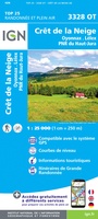 Wandelkaart - Topografische kaart 3328OT Crêt de la Neige | IGN - Institut Géographique National
 Wandelkaart - Topografische kaart 3330OT Bellegarde-sur-Valserine | IGN - Institut Géographique National
Laatste reviews

Bevat de gehele Picos de Europa. Goed in detail. Alle routes GR en PR-PNPE. Refugres en nog veel meer. Schaal 1 op 25.000 is fijn …
★★★★★ door M H 03 april 2026 | Heeft dit artikel gekocht
De bestelling snel en netjes afgehandeld
★★★★★ door Tiny Waltmans 03 april 2026 | Heeft dit artikel gekocht
Ik ben dol op de veldkaarten over verschillende vogelsoorten, per land of werelddelen. Deze keer de kaart besteld over vogelsoorten in Afrika en tijdens mijn …
★★★★★ door Kelly Bosch 02 april 2026 | Heeft dit artikel gekocht
Precies wat ik zocht. De informatie op de website was duidelijk en klopte. Het was eerst niet leverbaar, maar ik had aangegeven dat ik bericht …
★★★★★ door Mieke van den Broek 01 april 2026 | Heeft dit artikel gekocht