Winkelwagen
Geen items in winkelwagen
Ga naar winkelwagen
Top 25
De kaarten van IGN (kort voor Institute Geographique National), wandelkaarten voor Frankrijk, zijn van een ongekend hoog niveau. Met name de wandelkaarten 1:25.000 vinden wij geweldig: werkelijk alles staat erop, de kaarten bevatten zeer veel details en het kleurgebruik is fantastisch, waardoor alles ook nog eens heel goed leesbaar. Je hoort het: wij zijn fan van deze kaarten!
 Wandelkaart - Topografische kaart 3227OT Saint Amour | IGN - Institut Géographique National
 Wandelkaart - Topografische kaart 3228OT Oyonnax | IGN - Institut Géographique National
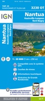 Wandelkaart - Topografische kaart 3230OT Nantua - Hauteville-Lompnes - Nord Bugey | IGN - Institut Géographique National
 Wandelkaart - Topografische kaart 3231OT Ambérieu-en-Bugey | IGN - Institut Géographique National
 Wandelkaart - Topografische kaart 3232ET Belley | IGN - Institut Géographique National
 Wandelkaart - Topografische kaart 3235OT Autrans | IGN - Institut Géographique National★★★★★
 Wandelkaart 3236OT Villard-de-Lans | IGN - Institut Géographique National★★★★★
 Wandelkaart - Topografische kaart 3236OTR Villard-de-Lans / Mont Aiguille / PNR du Vercors | IGN - Institut Géographique National1
 Wandelkaart - Topografische kaart 3237OT Glandasse | IGN - Institut Géographique National
 Wandelkaart - Topografische kaart 3237OTR Glandasse / Col de la Croix-Haute / PNR du Vercors | IGN - Institut Géographique National
 Wandelkaart 3238OT Luc-en-Diois | IGN - Institut Géographique National★★★★★★★★★★
 Wandelkaart 3239OT Rosans / Orpierre / Baronnies Orientales | IGN - Institut Géographique National★★★★★
 Wandelkaart - Topografische kaart 3240OT Banon - Sault | IGN - Institut Géographique National★★★★★
 Wandelkaart - Topografische kaart 3242OT Apt | IGN - Institut Géographique National
 Wandelkaart - Topografische kaart 3243OT Pertuis - Lourmarin | IGN - Institut Géographique National★★★★★
 Wandelkaart - Topografische kaart 3244ET Montagne - Sainte-Victoire | IGN - Institut Géographique National★★★★★
 Topografische kaart - Wandelkaart 3245ET Aubagne - La Ciotat | IGN - Institut Géographique National★★★★★
 Topografische kaart - Wandelkaart 3315ET Nancy / Toul / Forêt de Haye | IGN - Institut Géographique National
 Wandelkaart - Topografische kaart 3323ET Besançon - Forêt de Chailluz | IGN - Institut Géographique National
 Wandelkaart - Topografische kaart 3324ET Arc-et-Senans | IGN - Institut Géographique National
Laatste reviews

Bruikbare kaart
Bruikbare kaart door interessante delen van Spanje. Er moet wel nog informatie bijgezocht worden
★★★★★ door Jef 27 december 2025 | Heeft dit artikel gekocht
Prima kaart
Prima kaart die veel informatie biedt. Goed om ritten te plannen over geasfalteerde wegen
★★★★★ door Jef 27 december 2025 | Heeft dit artikel gekocht
Prima kaart
Goede kaart om ritten over geasfalteerde wegen te plannen. Biedt veel informatie.
★★★★★ door Jef 27 december 2025 | Heeft dit artikel gekocht
adventure ver zoek
Overbodige kaart die niet biedt wat de titel beloofd. Bevat nauwelijks bruikbare informatie
★★★★★ door Jef 27 december 2025 | Heeft dit artikel gekocht