Top 25
De kaarten van IGN (kort voor Institute Geographique National), wandelkaarten voor Frankrijk, zijn van een ongekend hoog niveau. Met name de wandelkaarten 1:25.000 vinden wij geweldig: werkelijk alles staat erop, de kaarten bevatten zeer veel details en het kleurgebruik is fantastisch, waardoor alles ook nog eens heel goed leesbaar. Je hoort het: wij zijn fan van deze kaarten!
 Wandelkaart - Topografische kaart 3044OT Port-Saint-Louis-du-Rhône | IGN - Institut Géographique National
 Wandelkaart - Topografische kaart 3112ET Forêts de Verdun et du Mort-Homme | IGN - Institut Géographique National★★★★★
 Wandelkaart - Topografische kaart 3136ET Combe Laval | IGN - Institut Géographique National★★★★★
 Wandelkaart - Topografische kaart 3137OT Die – Crest – Saillans | IGN - Institut Géographique National★★★★★
 Wandelkaart - Topografische kaart 3138OT Dieulefit | IGN - Institut Géographique National★★★★★
 Wandelkaart - Topografische kaart 3139OT Nyons - Rémuzat | IGN - Institut Géographique National★★★★★
 Wandelkaart - Topografische kaart 3140ET Mont Ventoux | IGN - Institut Géographique National★★★★★★★★★★
 Wandelkaart - Topografische kaart 3142OT Cavaillon | IGN - Institut Géographique National
 Wandelkaart - Topografische kaart 3143ET Aix-en-Provence | IGN - Institut Géographique National
 Wandelkaart - Topografische kaart 3143OT Salon-de-Provence | IGN - Institut Géographique National
 Wandelkaart - Topografische kaart 3144OT Étang de Berre | IGN - Institut Géographique National★★★★★
 Wandelkaart 3145ET Marseille / Les Calanques | IGN - Institut Géographique National
 Wandelkaart - Topografische kaart 3224 Dole | IGN - Institut Géographique National
 Topografische kaart - Wandelkaart 3226ET Lons-le-Saunier / Poligny / Reculée de Baume | IGN - Institut Géographique National
 Wandelkaart - Topografische kaart 3227OT Saint Amour | IGN - Institut Géographique National
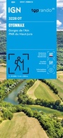 3228OT Oyonnax / Gorges de l'Ain / PNR Haut-Jura | IGN - Institut Géographique National1
 Wandelkaart - Topografische kaart 3230OT Nantua - Hauteville-Lompnes - Nord Bugey | IGN - Institut Géographique National
 Wandelkaart - Topografische kaart 3231OT Ambérieu-en-Bugey | IGN - Institut Géographique National
 Wandelkaart - Topografische kaart 3232ET Belley | IGN - Institut Géographique National
 Wandelkaart - Topografische kaart 3235OT Autrans | IGN - Institut Géographique National★★★★★
Laatste reviews

Bevat de gehele Picos de Europa. Goed in detail. Alle routes GR en PR-PNPE. Refugres en nog veel meer. Schaal 1 op 25.000 is fijn …
★★★★★ door M H 03 april 2026 | Heeft dit artikel gekocht
De bestelling snel en netjes afgehandeld
★★★★★ door Tiny Waltmans 03 april 2026 | Heeft dit artikel gekocht
Ik ben dol op de veldkaarten over verschillende vogelsoorten, per land of werelddelen. Deze keer de kaart besteld over vogelsoorten in Afrika en tijdens mijn …
★★★★★ door Kelly Bosch 02 april 2026 | Heeft dit artikel gekocht
Precies wat ik zocht. De informatie op de website was duidelijk en klopte. Het was eerst niet leverbaar, maar ik had aangegeven dat ik bericht …
★★★★★ door Mieke van den Broek 01 april 2026 | Heeft dit artikel gekocht