Top 25
De kaarten van IGN (kort voor Institute Geographique National), wandelkaarten voor Frankrijk, zijn van een ongekend hoog niveau. Met name de wandelkaarten 1:25.000 vinden wij geweldig: werkelijk alles staat erop, de kaarten bevatten zeer veel details en het kleurgebruik is fantastisch, waardoor alles ook nog eens heel goed leesbaar. Je hoort het: wij zijn fan van deze kaarten!
 Topografische kaart - Wandelkaart 2722ET Avallon - Vézelay | IGN - Institut Géographique National
 Topografische kaart - Wandelkaart 2723ET Château-Chinon | IGN - Institut Géographique National★★★★★
 Wandelkaart - Topografische kaart 2740ET Corniche des Cevennes | IGN - Institut Géographique National
 Wandelkaart - Topografische kaart 2741ET Saint-Hippolyte-du-Fort | IGN - Institut Géographique National
 Wandelkaart - Topografische kaart 2742ET St.-Martin-de-Londres, Ganges | IGN - Institut Géographique National
 Wandelkaart 2743ET Montpellier / Palavas-les-Flots | IGN - Institut Géographique National
 Wandelkaart - Topografische kaart 2822OT Quarre-les-Tombes | IGN - Institut Géographique National
 Topografische kaart - Wandelkaart 2823ET Saulieu - Lac de Settons | IGN - Institut Géographique National★★★★★
 Wandelkaart - Topografische kaart 2824OT Autun - Mont Beuvray | IGN - Institut Géographique National★★★★★
 Wandelkaart 2835OT Le Puy-en-Velay / Yssingeaux | IGN - Institut Géographique National
 Wandelkaart 2836OT Gerbier de Jonc / Mézenc / Vivarais | IGN - Institut Géographique National
 Wandelkaart - Topografische kaart 2838OT Largentière | IGN - Institut Géographique National★★★★★
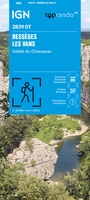 Wandelkaart 2839OT Bessèges / Les Vans / Vallée du Chassezac | IGN - Institut Géographique National
 Wandelkaart - Topografische kaart 2840OT Ales | IGN - Institut Géographique National
 Wandelkaart - Topografische kaart 2929ET Beaujeu - Belleville - Haut Beaujolais – Rhônevallei – Bourgondië | IGN - Institut Géographique National
 Wandelkaart - Topografische kaart 2930ET Villefranche-sur-Saône | IGN - Institut Géographique National
 Wandelkaart - Topografische kaart 2931ET L'Arbresle - Monts de Tarare – Col de la Luère – Rhônevallei - Bourgondië | IGN - Institut Géographique National
 Wandelkaart - Topografische kaart 2932ET Monts du Lyonnais | IGN - Institut Géographique National
 Wandelkaart - Topografische kaart 2933ET Massif du Pilat - St-Etienne - St-Chamond - PNR du Pilat Ardéche | IGN - Institut Géographique National
 Wandelkaart - Topografische kaart 2934ET Bourg-Argental - Col de la République - PNR du Pilat Ardéche | IGN - Institut Géographique National
Laatste reviews

Bevat de gehele Picos de Europa. Goed in detail. Alle routes GR en PR-PNPE. Refugres en nog veel meer. Schaal 1 op 25.000 is fijn …
★★★★★ door M H 03 april 2026 | Heeft dit artikel gekocht
De bestelling snel en netjes afgehandeld
★★★★★ door Tiny Waltmans 03 april 2026 | Heeft dit artikel gekocht
Ik ben dol op de veldkaarten over verschillende vogelsoorten, per land of werelddelen. Deze keer de kaart besteld over vogelsoorten in Afrika en tijdens mijn …
★★★★★ door Kelly Bosch 02 april 2026 | Heeft dit artikel gekocht
Precies wat ik zocht. De informatie op de website was duidelijk en klopte. Het was eerst niet leverbaar, maar ik had aangegeven dat ik bericht …
★★★★★ door Mieke van den Broek 01 april 2026 | Heeft dit artikel gekocht