Top 25
De kaarten van IGN (kort voor Institute Geographique National), wandelkaarten voor Frankrijk, zijn van een ongekend hoog niveau. Met name de wandelkaarten 1:25.000 vinden wij geweldig: werkelijk alles staat erop, de kaarten bevatten zeer veel details en het kleurgebruik is fantastisch, waardoor alles ook nog eens heel goed leesbaar. Je hoort het: wij zijn fan van deze kaarten!
 Wandelkaart - Topografische kaart 2706OT Foret De Mormal | IGN - Institut Géographique National★★★★★
 Topografische kaart - Wandelkaart 2722ET Avallon - Vézelay | IGN - Institut Géographique National
 Topografische kaart - Wandelkaart 2723ET Château-Chinon | IGN - Institut Géographique National★★★★★
 Wandelkaart - Topografische kaart 2739OT Mont Lozère - Florac | IGN - Institut Géographique National★★★★★
 Wandelkaart - Topografische kaart 2740ET Corniche des Cevennes | IGN - Institut Géographique National
 Wandelkaart - Topografische kaart 2741ET Saint-Hippolyte-du-Fort | IGN - Institut Géographique National
 Wandelkaart - Topografische kaart 2742ET St.-Martin-de-Londres, Ganges | IGN - Institut Géographique National
 Wandelkaart 2743ET Montpellier / Palavas-les-Flots | IGN - Institut Géographique National
 Wandelkaart - Topografische kaart 2822OT Quarre-les-Tombes | IGN - Institut Géographique National
 Topografische kaart - Wandelkaart 2823ET Saulieu - Lac de Settons | IGN - Institut Géographique National★★★★★
 Wandelkaart - Topografische kaart 2824OT Autun - Mont Beuvray | IGN - Institut Géographique National★★★★★
 Wandelkaart 2835OT Le Puy-en-Velay / Yssingeaux | IGN - Institut Géographique National
 Wandelkaart 2836OT Gerbier de Jonc / Mézenc / Vivarais | IGN - Institut Géographique National
 Wandelkaart - Topografische kaart 2837OT Lac d'Issarlès - Thueyts | IGN - Institut Géographique National
 Wandelkaart - Topografische kaart 2838OT Largentière | IGN - Institut Géographique National★★★★★
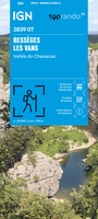 Wandelkaart 2839OT Bessèges / Les Vans / Vallée du Chassezac | IGN - Institut Géographique National
 Wandelkaart - Topografische kaart 2840OT Ales | IGN - Institut Géographique National
 Wandelkaart - Topografische kaart 2842OT Sommières, Vergèze | IGN - Institut Géographique National
 Wandelkaart - Topografische kaart 2843OT Aigues - Mortes - La Grande Motte | IGN - Institut Géographique National
 Wandelkaart - Topografische kaart 2929ET Beaujeu - Belleville - Haut Beaujolais – Rhônevallei – Bourgondië | IGN - Institut Géographique National
Laatste reviews

Rother wandelgidsen stellen nooit teleur. Mooie routes, goede opgave kilometers, hoogtemeters en horeca. Een aanrader!
★★★★★ door Anita Geel 13 januari 2026 | Heeft dit artikel gekocht
Mooi boek met prachtige foto’s! Voldoet helemaal aan mijn verwachtingen.
★★★★★ door Hans Eldering 13 januari 2026 | Heeft dit artikel gekocht
het product voldeed aan mijn verwachtingen en was geplastificeerd wat natuurlijk perfect is voor kaart die veel wordt geraadpleegd!
★★★★★ door Peter Lantinga 13 januari 2026 | Heeft dit artikel gekocht
Ik heb de wegenkaart Maleisië aangeschaft om zelf een rondreis per huurauto te kunnen plannen. Deze kaart heeft daar heel goed bij geholpen doordat er …
★★★★★ door M. Rizvi 13 januari 2026 | Heeft dit artikel gekocht