Top 25
De kaarten van IGN (kort voor Institute Geographique National), wandelkaarten voor Frankrijk, zijn van een ongekend hoog niveau. Met name de wandelkaarten 1:25.000 vinden wij geweldig: werkelijk alles staat erop, de kaarten bevatten zeer veel details en het kleurgebruik is fantastisch, waardoor alles ook nog eens heel goed leesbaar. Je hoort het: wij zijn fan van deze kaarten!
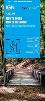 Wandelkaart 4251OT Monte d'Oro / Monte Rotondo / PNR de Corse | IGN - Institut Géographique National★★★★★
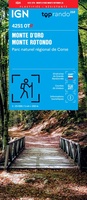 Wegenkaart - landkaart 4251OTR Monte d'Oro - Monte Rotondo | IGN - Institut Géographique National
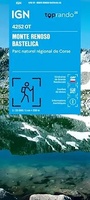 Wandelkaart 4252OT Monte Renoso / Bastelica / PNR de Corse | IGN - Institut Géographique National
 Wandelkaart 4252OTR Monte Renoso / Bastelica / PNR de Corse | IGN - Institut Géographique National
 Wandelkaart 4253ET Aiguilles de Bavella / Solenzara / PNR de Corse | IGN - Institut Géographique National
 Wandelkaart 4253ETR Aiguilles de Bavella - Solenzara | IGN - Institut Géographique National
 Wegenkaart - landkaart 4253OT Petreto-Bicchisano / Zicavo | IGN - Institut Géographique National1
 Wandelkaart 4254ET Porto-Vecchio / PNR de Corse | IGN - Institut Géographique National
 Wegenkaart - landkaart 4254OT Sartène | IGN - Institut Géographique National
 Wandelkaart 4255OT Bonifacio | IGN - Institut Géographique National
 Wegenkaart - landkaart 4347OT Cap Corse | IGN - Institut Géographique National
 Wandelkaart 4348OT Bastia / Golfe de St-Florent | IGN - Institut Géographique National
 Wegenkaart - landkaart 4349OT Vescovato - Castagniccia | IGN - Institut Géographique National
 Wandelkaart 4351OT Cervione / PNR de Corse | IGN - Institut Géographique National
 Wandelkaart 4352OT Aléria / Ghisonaccia / PNR de Corse | IGN - Institut Géographique National
 Wandelkaart - Topografische kaart 4401RT Saint-Paul-Le-Port, Reunion | IGN - Institut Géographique National
 Wandelkaart - Topografische kaart 4402RT St-Denis, La Reunion | IGN - Institut Géographique National
 Wandelkaart - Topografische kaart 4402RTR Saint-Denis - Cirques Mafate & Salasie PN Réunion | IGN - Institut Géographique National1
 Wandelkaart - Topografische kaart 4403RT St-Benoit, St-André, la Reunion | IGN - Institut Géographique National
 Wandelkaart - Topografische kaart 4404RT Saint-Leu, l'Étang Salé, La Reunion | IGN - Institut Géographique National
Laatste reviews

Zeer fijne duidelijke kaart, je kunt Australië in z’n geheel overzien als je de kaart uitvouwt. Goede kaart om reis met de auto te plannen
★★★★★ door Marlies 28 oktober 2026 | Heeft dit artikel gekocht
Net terug van onze vakantie in Griekenland. We hebben 3 dagen op het eiland Andros verbleven en dit boekje was een waardige wandelgids.
★★★★★ door Frank Uytterschaut 27 oktober 2026 | Heeft dit artikel gekocht
een hele grote tas, fijn voor niet te zware spullen. En makkelijk om overal mee naar toe te nemen. En ook belangrijk, hij ziet er …
★★★★★ door Lisette Emmen 27 oktober 2026 | Heeft dit artikel gekocht
ik had nog een hele oude liggen, nu een handzamer formaat dus ook makkelijker om mee te nemen bij meerdaagse fietstochten
★★★★★ door Lisette 27 oktober 2026 | Heeft dit artikel gekocht