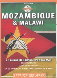
This 7th edition has been completely redesigned and updated. With a scale of 1: 1 740 000 this map includes neighbours Mozambique and Malawi. Despite their proximity, these two countries are in many ways very different. Mozambique was a Portuguese colony – it had almost 500 years of Portuguese activity in the region – and has gone through years of conflict. Malawi on the other hand – formally Nyasaland and a British protectorate – has experienced peaceful political transitions throughout its modern existence. Yet both countries are poor and underdeveloped, with agriculture still being one of the main economic activities.
Widely regarded as one of Africa’s friendliest and safest destinations Malawi has much to offer. With nine national parks, many of which have a wide range of animals including elephant, lion, rhino, hippo, zebra and buffalo, it is a fantastic safari destination. There have been recent efforts to increase the country’s lion population too, which will no doubt have a positive effect on tourism. Popular parks include Liwonde in the south, Kasungu in the east and Nyika in the north. The country also has some great sites for trekking including the Mulanje mountains not far from the capital Blantyre. Emerald green and a gem of country Malawi’s crown jewel is undoubtedly Lake Malawi. The third largest lake in Africa, it offers spectacular snorkeling, water activities and sight seeing. Bordering Lake Malawi’s western side is Malawi’s neighbor, Mozambique.
A Portuguese colony before 1977, tourists flocked to Mozambique to spend days tanning on its tropical beaches, and nights dancing in its Afro-Portuguese colonial resorts or towns – as was epitomized in Bob Dylan’s song by the same name. Almost thirty years of warfare changed much of that. In 1993 Mozambique finally achieved peace with a democratically elected government and stability. Almost immediately tourists began returning to this tropical paradise. Although the industry has grown much since the end of the war – as much as 37% a year in some years – a limited infrastructure continues to plague the country’s attempt to reach its real tourism potential. Various resorts and national parks such as the Gorongosa that were decimated during the war period are slowly being restored, while beach lodges and developments at some of the island archipelagos attract sun-seeking tourists. The areas of Inhambane, Vilanculos, Bazaruto, Ponta de Ouro and the Archipelago das Quirimbas are important holiday centres, while the Niassa reserve in the far north is a large, remote but significant wildlife reserve with many animals including elephant and wild dog.
Our Mozambique and Malawi map includes primary and secondary roads in both countries, border posts, accommodation options and fuel availability, national parks and distances. It also has a street-plan inset of Maputo – Mozambique’s bustling capital.


