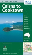
Wegenkaart - landkaart Cairns to Cooktown | Hema Maps (9781865002262)
- ISBN / CODE: 9781865002262
- Schaal: 1:250000
- Uitgever: Hema Maps
- Soort: Wegenkaart
- Taal: Engels
- Schrijf als eerste een review
-
€ 11,25
Uitverkocht, nooit meer leverbaar
.jpg)
.gif)
Beschrijving
Detailkaart van een deel van Australië. Zeer goed leesbaar, met naast de topografische details veel symbolen waarmee allerhande toeristische zaken worden aangeduid als campsites, nationale parken, attracties, wandelmogelijkheden etc.
This beautiful map covers the tropical Far North Queensland in extensive detail. The map is packed with information, colour photos, and inset maps of Cooktown, Daintree, Kuranda, Mossman, Cairns, and Port Douglas.
Detailed road map highlighting attractions along the coast of the Great Barrier Reef between Cairns and Cooktown, and its immediate hinterland along the Peninsula Developmental Road. National parks, state forests and recreational areas are highlighted. Symbols show facilities in coastal resorts and inland towns, indicating various types of accommodation including campsites and youth hostels, places of interest, essential services, fuel supplies, etc. Also marked are ferry routes to islands and coral reefs. Geographical coordinates are given only for the map corners.
On the reverse there are street plans of central Cairns plus a more general plan of the town with its suburbs, Cooktown, Daintree, Kuranda, Mareeba, Mossman and Port Douglas, plus a plan of the Northern Beaches area north of Cairns with a more detailed plan of Palm Cove. The map also includes descriptions of these towns, a table of facilities in the national parks, a distance table, and a climate chart.
Reviews
Geen reviews gevonden voor dit product.
Schrijf een review
Graag horen wij wat u van dit artikel vindt. Vindt u het goed, leuk, mooi, slecht, lelijk, onbruikbaar of erg handig: schrijf gerust alles op! Het is niet alleen leuk om te doen maar u informeert andere klanten er ook nog mee!
Ook interessant voor oceanie/australie/queenslandnoordoostaustralie
-

Reisgids Experience East Coast Austr
€ 23,95Reisgidsen New South Wales Zuidoost Australië -

Stadsplattegrond Brisbane and Region
€ 14,95Stadsplattegronden Queensland - Noordoost Australië -

Wegenkaart - landkaart Sydney to Bri
€ 17,50Wegenkaarten New South Wales Zuidoost Australië -

Wegenatlas Cape York Atlas & Guide |
€ 45,95Wegenatlassen Queensland - Noordoost Australië -

Wegenkaart - landkaart Great Desert
€ 17,95Wegenkaarten Northern Territories - Noord Australië