Wegenkaart - landkaart Sunshine Coast and Hinterland | Hema Maps (9781865002156)
- ISBN / CODE: 9781865002156
- Schaal: 1:130000
- Uitgever: Hema Maps
- Soort: Wegenkaart
- Taal: Engels
- Schrijf als eerste een review
-
€ 11,25
Uitverkocht, nooit meer leverbaar
.jpg)
.jpg)
.gif)
Beschrijving
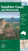
Detailkaart van een deel van Australië. Zeer goed leesbaar, met naast de topografische details veel symbolen waarmee allerhande toeristische zaken worden aangeduid als campsites, nationale parken, attracties, wandelmogelijkheden etc.
The map covers the entire Sunshine Coast region from Bribie Island in the south to Noosa in the north. It also features a detailed regional map of the Hinterland as well as detailed tourist information.
Detailed road map at approx.1:135,000 of the hinterland of the Sunshine Coast resorts reaching as far west as Kilcoy, north to Lake Cootharaba and south to Caboolture. National parks and state forests are highlighted and symbols mark accommodation including campsites and campgrounds, information centres, sport and recreational centres, emergency facilities, vineyards, places of interest, etc. The map has an index of towns and localities, plus places of interest. UTM grid lines are drawn at 5km intervals, with latitude and longitude margin ticks at 5’
On the reverse are indexed street maps at 1:29,000 of the main Sunshine Coast resorts providing continuous coverage of the coast from Noosa National Park, Noosaville and Tewantin in the north to Pelican Waters in the south. Additional insets show street maps of Nambour and the resorts of southern Bribie Island. Brief notes describe the region's attractions and tables summarize the facilities at the National Parks and State Forest Recreation Areas.
Reviews
Geen reviews gevonden voor dit product.
Schrijf een review
Graag horen wij wat u van dit artikel vindt. Vindt u het goed, leuk, mooi, slecht, lelijk, onbruikbaar of erg handig: schrijf gerust alles op! Het is niet alleen leuk om te doen maar u informeert andere klanten er ook nog mee!
Ook interessant voor oceanie/australie/queenslandnoordoostaustralie
-

Wegenkaart - landkaart 244 Sydney to
€ 12,95Wegenkaarten New South Wales Zuidoost Australië -

Stadsplattegrond Brisbane and Region
€ 14,95Stadsplattegronden Queensland - Noordoost Australië -
 & the Brisbane Islands atlas & guide | Hema Maps")
Wegenatlas K'gari (Fraser Island) &
€ 25,95Wegenatlassen Queensland - Noordoost Australië -

Wegenatlas Cape York Atlas & Guide |
€ 45,95Wegenatlassen Queensland - Noordoost Australië -

Reisgids Pocket Brisbane & the Gold
€ 12,95Reisgidsen Queensland - Noordoost Australië