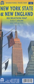
Wegenkaart - landkaart New England and New York State | ITMB (9781771295642)
- ISBN / CODE: 9781771295642
- Editie: meest recente versie
- Schaal: 1:800000
- Uitgever: ITMB
- Soort: Wegenkaart
- Taal: Engels
- Beoordeling: 4,0 ★★★★★ (1 review) Schrijf een review
-
€ 13,95
Op voorraad. Voor 17.00 uur op werkdagen besteld, morgen in huis in Nederland Levertijd Belgie
Gratis verzending in Nederland vanaf €35,-
Beschrijving
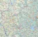
Goede dubbelzijdige wegenkaart waarbij met kleurgebruik de hoogte en natuurkundige aspecten wat duidelijker wordt weergegeven dan op andere kaarten. De wegen worden aangeduid met de bekende wegnummers en afstanden tussen steden staan weergegeven. Met symbolen worden toeristisch belangrijke aspecten getoond en ook bijvoorbeeld campings. Nationale parken zijn goed terug te vinden op deze kaart.
ITMB expands its coverage of the USA with a detailed map of New York State and New England on a double-sided map at a very detailed scale. The one side covers most of the state and the southern portion of the New England states, along with an inset map of the greater NYC area, the other side covers from Boston and Cape cod to the northern extremes of Maine and west into Vermont, with inset maps of Boston and Boston Region. The reality of mapping the USA is that it is too large a country and too populous to be mapped in detail except by regions. As a sophisticated economy, it has thousands of towns and an intensive road/rail network. Most American mapping companies took the easy route and mapped one state at a time. As some states are relatively small, this resulted in a visitor needing to acquire dozens of maps to cover the extent of their visit. Our approach is to map the USA in logical regions. Eventually, all of the USA will be mapped; this map is a giant step forward in providing sensible mapping for a great country to visit.
Reviews
Een compacte en duidelijke reiskaart voor wie een reis gaat maken naar New England en de staat New York. Ook handig is de stadskaart van Boston
★★★★★ door t mastenbroek 22 juni 2018 | Heeft dit artikel gekochtVond u dit een nuttige review? (login om te beoordelen)
Schrijf een review
Graag horen wij wat u van dit artikel vindt. Vindt u het goed, leuk, mooi, slecht, lelijk, onbruikbaar of erg handig: schrijf gerust alles op! Het is niet alleen leuk om te doen maar u informeert andere klanten er ook nog mee!


