Wegenkaart - landkaart Grote Meren Regio USA/Canada | ITMB (9781771293280)

- ISBN / CODE: 9781771293280
- Editie: 10-07-2025
- Druk: 2
- Aantal blz.: 1
- Schaal: 1:1000000
- Uitgever: ITMB
- Soort: Wegenkaart
- Taal: Engels
- Hoogte: 25.0 cm
- Breedte: 10.0 cm
- Gewicht: 50.0 g
- Uitvoering: Papier
- Bindwijze: -
- Schrijf als eerste een review
-
€ 12,95
Leverbaar in 3 - 5 werkdagen in huis in Nederland Levertijd Belgie
Gratis verzending in Nederland vanaf €35,-

Beschrijving
Van de uitgever
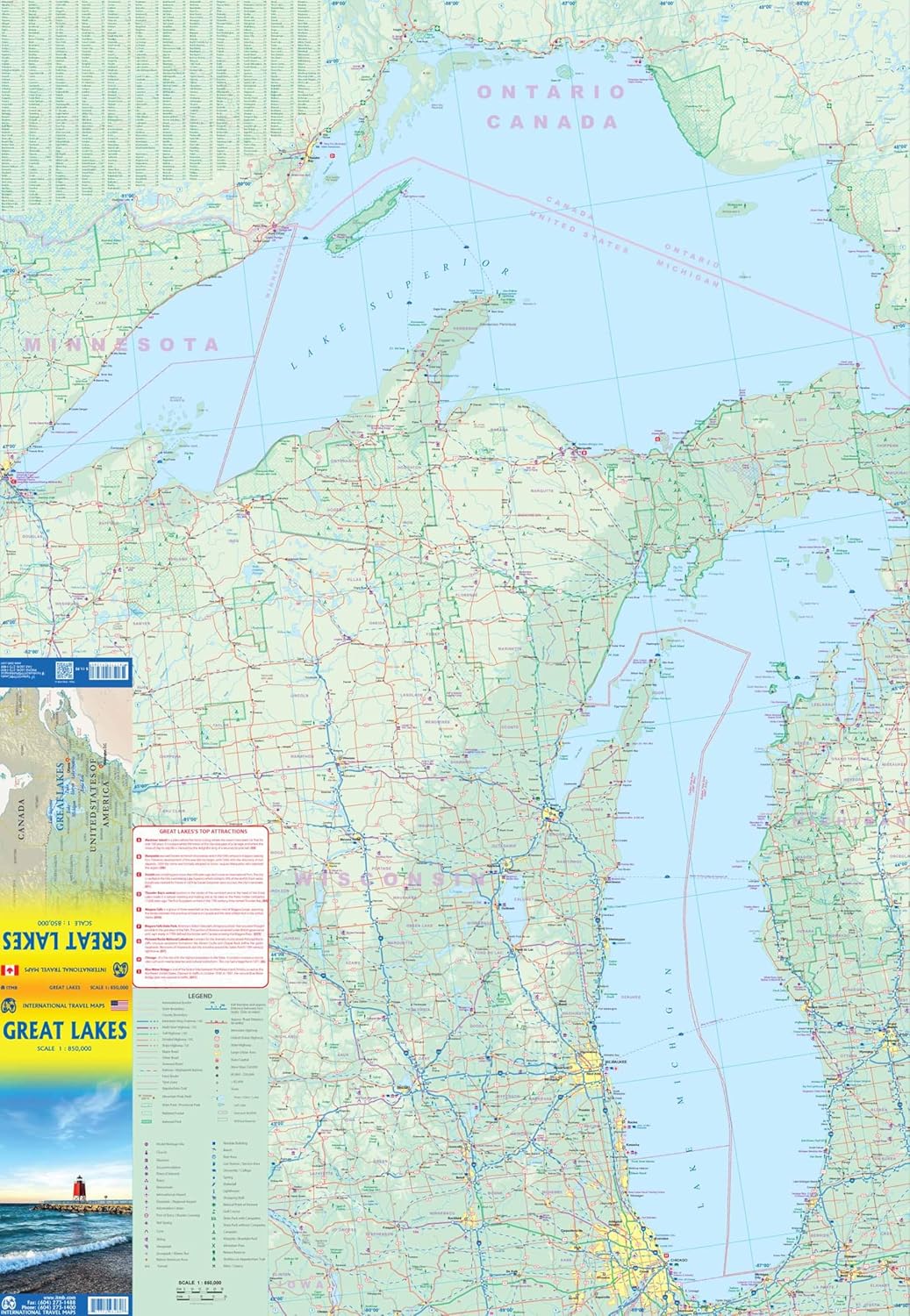
Natuurkundige wegenkaart van de Grote Meren op de grens tussen de Verenigde Staten en Canada. Met veel plaatsen en wegen, spoorlijnen en rivieren, hoogten, lengte- en breedtegraden.
To North Americans, there is only one “Great Lakes” – the waterway stretching far into the interior of the continent from the Gulf of St. Lawrence to the tip of Lake Superior. Using this map, one can explore Lakes Ontario and Erie as circular routes; also Huron and Superior; visit Ottawa and Toronto, Chicago and Duluth, and find Fort William or the Wawa Goose. This is a double-sided map covering from Ottawa in the north to Pittsburgh and Columbus in the south and Duluth and Thunder Bay in the west. Both Canada and the USA portions of the Great Lakes Region are included.
Reviews
Geen reviews gevonden voor dit product.
Schrijf een review
Graag horen wij wat u van dit artikel vindt. Vindt u het goed, leuk, mooi, slecht, lelijk, onbruikbaar of erg handig: schrijf gerust alles op! Het is niet alleen leuk om te doen maar u informeert andere klanten er ook nog mee!
Ook interessant voor noord-amerika/verenigde-staten-van-amerika
-

Wandelkaart 231 Kenai Fjords Nationa
€ 17,95Wandelkaarten Nationale Parken Verenigde Staten van Amerika -

Reisverhaal On the Road | Jack Kerou
€ 15,50Reisverhalen Verenigde Staten van Amerika -
 | ITMB")
Wegenkaart - landkaart San Francisco
€ 13,95Wegenkaarten San Francisco -

Wandkaart 20383 USA - Verenigde Stat
€ 32,95Wandkaarten van landen Verenigde Staten van Amerika -

Wandelgids 1505 Topographic Map Guid
€ 16,95Wandelgidsen Oostkust USA - Atlantic Coast