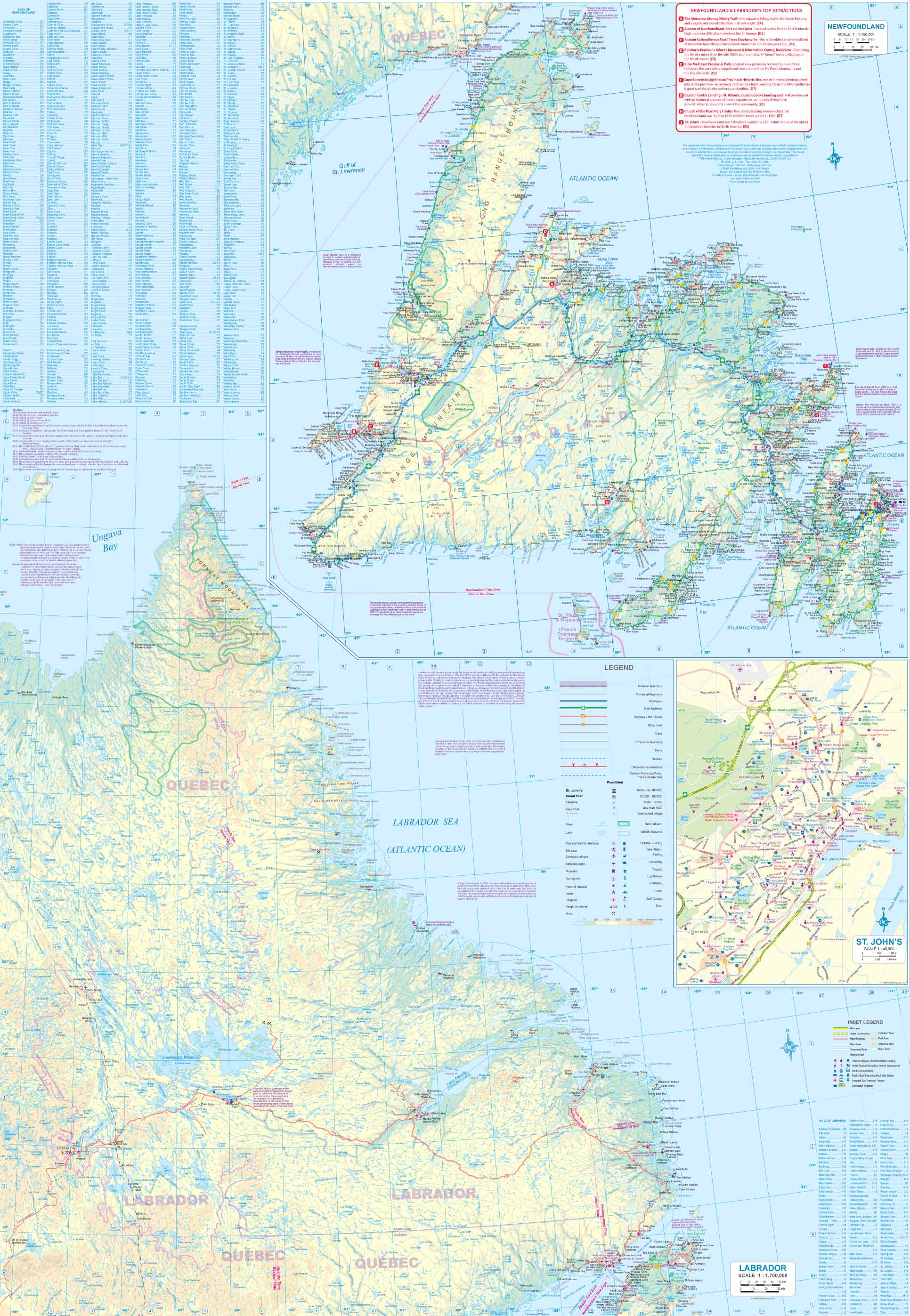
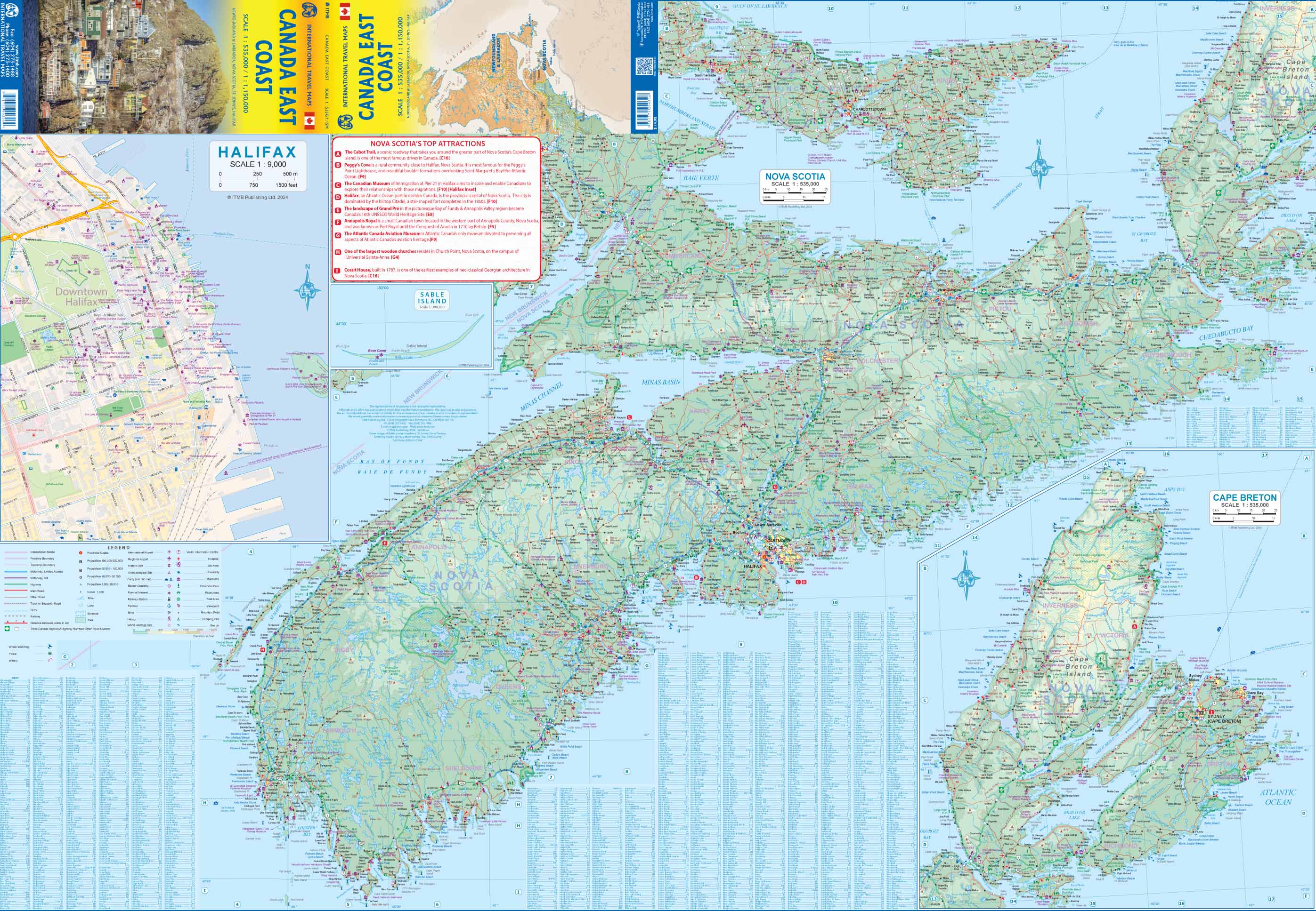
Wegenkaart - landkaart Canada East Coast | ITMB (9781771290326)

- ISBN / CODE: 9781771290326
- Editie: 01-01-2024
- Druk: 1
- Aantal blz.: 1
- Schaal: 1:535000
- Uitgever: ITMB
- Soort: Wegenkaart
- Taal: Engels
- Hoogte: 25.0 cm
- Breedte: 10.0 cm
- Gewicht: 55.0 g
- Uitvoering: Papier
- Bindwijze: -
- Schrijf als eerste een review
-
€ 14,95
Leverbaar in 3 - 5 werkdagen in huis in Nederland Levertijd Belgie
Gratis verzending in Nederland vanaf €50,-


Beschrijving
Reviews
Geen reviews gevonden voor dit product.
Schrijf een review
Graag horen wij wat u van dit artikel vindt. Vindt u het goed, leuk, mooi, slecht, lelijk, onbruikbaar of erg handig: schrijf gerust alles op! Het is niet alleen leuk om te doen maar u informeert andere klanten er ook nog mee!
Ook interessant voor noord-amerika/canada/overig-oost
-

Wegenkaart - landkaart Canada Oost |
€ 13,95Wegenkaarten Canada Oost -
 | MairDumont")
Reisgids Marco Polo ENG Canada East
€ 14,95Reisgidsen Canada Oost -

Reisgids Nova Scotia | Moon Travel G
€ 27,95Reisgidsen Atlantisch Canada -

Waterkaart Halifax & Nova Scotia | I
€ 14,95Waterkaarten Canada Oost -

Wegenkaart - landkaart Road maps Can
€ 14,95Wegenkaarten Canada Oost