Wandelkaart Canmore / Kananaskis village | Gem Trek Maps (9781990161193)
- ISBN / CODE: 9781990161193
- Editie: 01-11-2025
- Druk: 8
- Aantal blz.: 1
- Schaal: 1:50000
- Uitgever: Gem Trek Maps
- Soort: Wandelkaart
- Serie: Trail maps
- Taal: Engels
- Hoogte: 24.0 cm
- Breedte: 11.0 cm
- Gewicht: 91.0 g
- Uitvoering: Scheur- en watervast
- Bindwijze: -
- Schrijf als eerste een review
-
€ 17,95
Dit artikel is (tijdelijk) niet leverbaar


-
Overzicht Gem trek wandelkaarten British Columbia

Producten op deze overzichtskaart:
Klik op een product om naar de pagina van dat product te gaan.
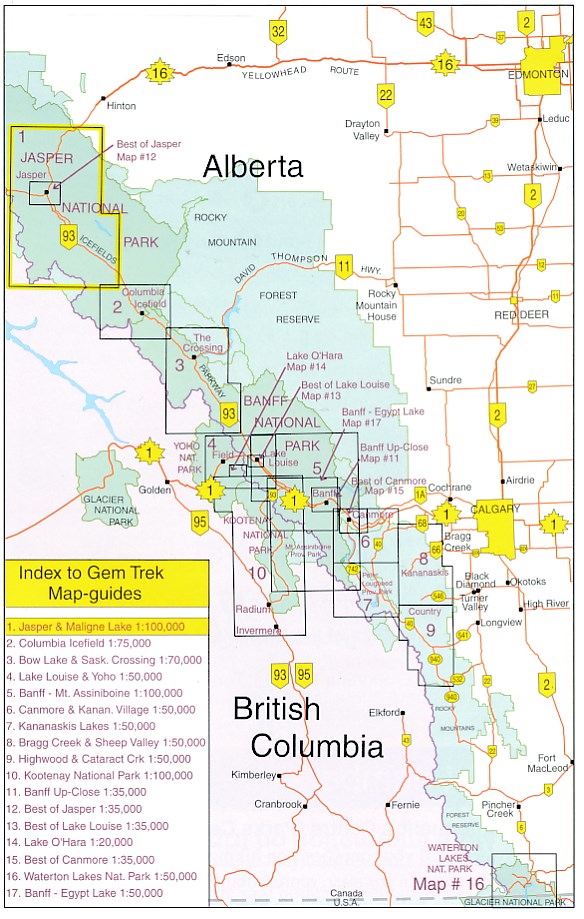
- Wandelkaart 01 Jasper National Park & Maligne Lake | Gem Trek Maps
- Wandelkaart 02 Columbia Icefield | Gem Trek Maps
- Wandelkaart 03 Bow Lake / Saskatchewan Crossing | Gem Trek Maps
- Wandelkaart 04 Lake Louise & Yoho | Gem Trek Maps
- Wandelkaart 05 Banff Mount Assiniboine | Gem Trek Maps
- Wandelkaart 06 Canmore & Kananaskis Village | Gem Trek Maps
- Wandelkaart 07 Kananaskis Lakes | Gem Trek Maps
- Wandelkaart 08 Bragg Creek and Sheep Valley | Gem Trek Maps
- Wandelkaart 09 Highwood / Cataract Creek | Gem Trek Maps
- Wandelkaart 10 Kootenay National Park | Gem Trek Maps
- Wandelkaart 11 Banff Up-Close | Gem Trek Maps
- Wandelkaart 12 Jasper Up-Close | Gem Trek Maps
- Wandelkaart 14 Lake O'Hara | Gem Trek Maps
- Wandelkaart 15 Canmore Up-Close | Gem Trek Maps
- Wandelkaart 16 Waterton Lakes NP | Gem Trek Maps
- Wandelkaart 17 Banff - Egypt Lake | Gem Trek Maps
- Wandelkaart Canmore / Kananaskis village | Gem Trek Maps
- Wandelkaart Lake Louise & Moraine Lake | Gem Trek Maps
Overzichtskaarten
Beschrijving
Van de uitgever
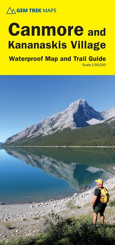
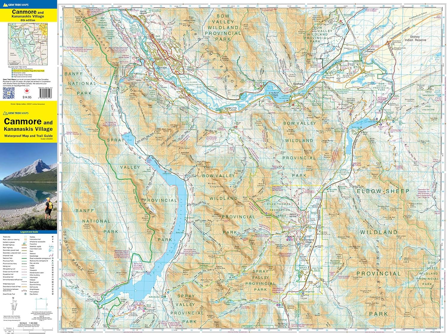
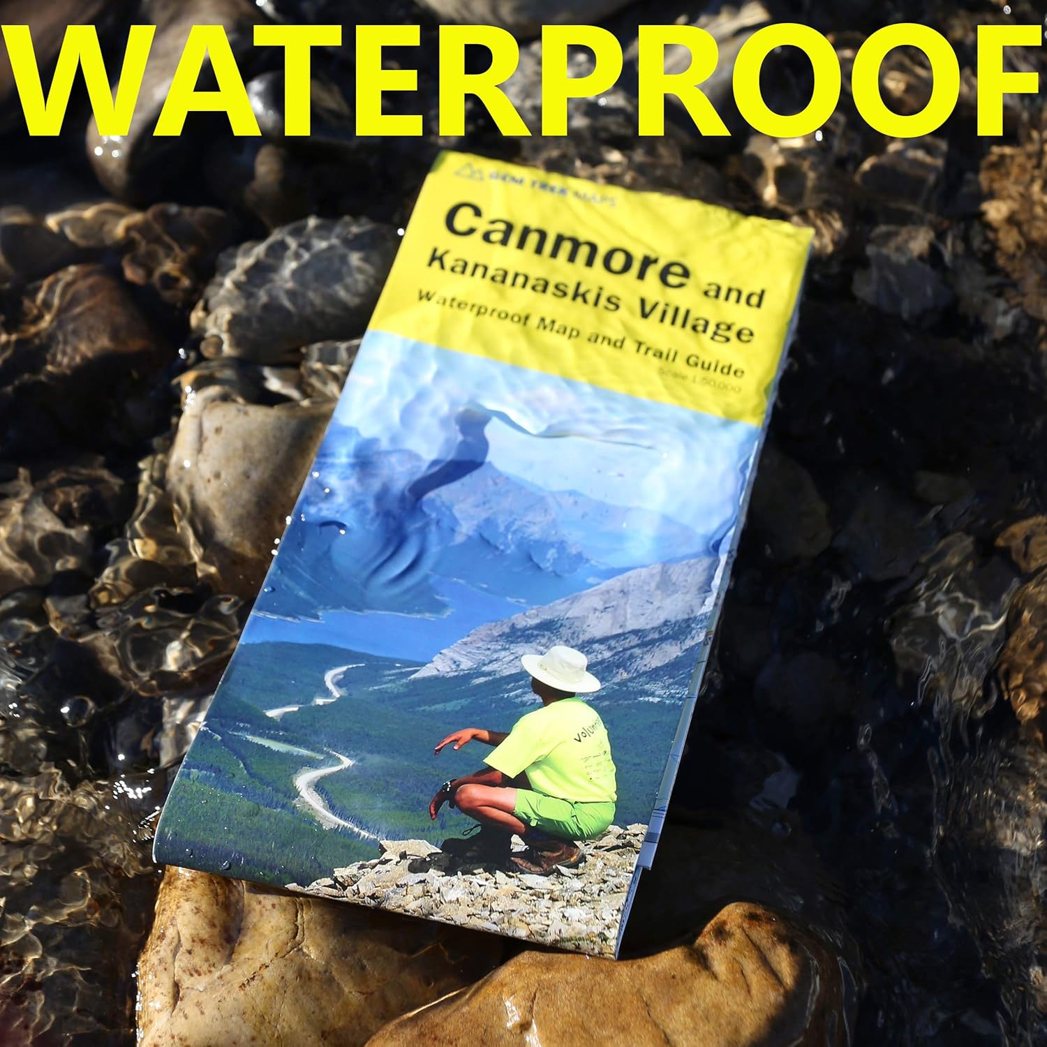
Gem Trek’s CANMORE & KANANASKIS VILLAGE MAP is designed for outdoor enthusiasts looking to explore the northern portion of Kananaskis Country. Whether you are touring along the roads or heading into the backcountry, you’ll find the waterproof and tear-resistant Canmore & Kananaskis Village Map to be an invaluable tool.
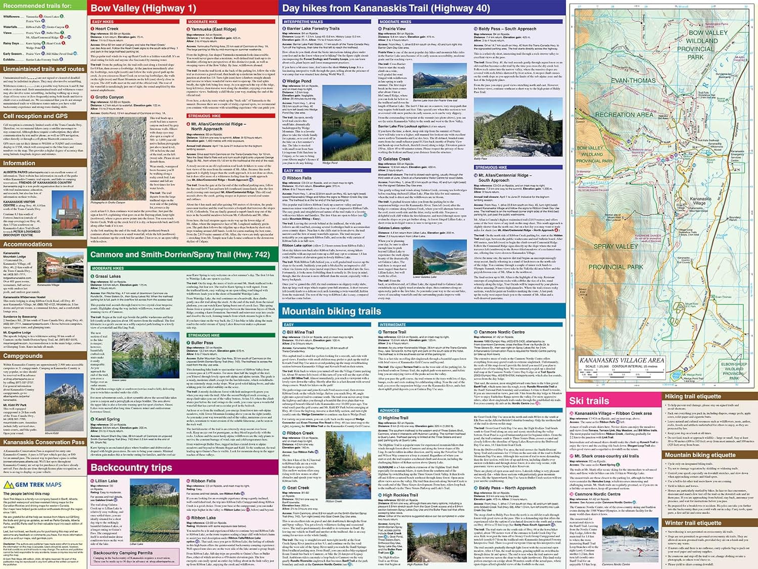
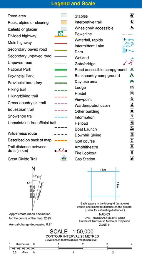
This map features detailed cartography, accurate hiking trails with distances, and details such as logging roads, campgrounds, equestrian routes, picnic areas, and fire lookouts. On the back are descriptions of the most popular hiking trails, as well as details of services such as campgrounds and visitor centres.
The Canmore & Kananaskis Village Map covers the town of Canmore west to the Stoney Reserve and south to Kananaskis Village along Highway 40. It includes all of Spray Valley Provincial Park, Bow Valley Provincial Park, Bow Valley Wildland Provincial Park, and the northern section of the Elbow-Sheep Wildland Provincial Park.
Popular hiking trails on the Canmore & Kananaskis Village Map include Grassi Lakes, Yamnuska, Ha Ling, Lady Macdonald, Barrier Lake Lookout, Mt. Allen via Centennial Ridge (the highest maintained trail in the Canadian Rockies), Ribbon Falls and Ribbon Lake, Lillian and Galatea lakes, Buller Pass, and trails originating from the Mount Shark Day Use Area.
A 1:25,000-scale inset map on the back increases coverage in the vicinity of Kananaskis Village and as far south as Wedge Pond. If you are staying at Kananaskis Village or Mount Kidd RV park, you will find this inset map invaluable.
Reviews
Geen reviews gevonden voor dit product.
Schrijf een review
Graag horen wij wat u van dit artikel vindt. Vindt u het goed, leuk, mooi, slecht, lelijk, onbruikbaar of erg handig: schrijf gerust alles op! Het is niet alleen leuk om te doen maar u informeert andere klanten er ook nog mee!
Ook interessant voor noord-amerika/canada/canadian-rockies-banff
-

Reisgids Road Trip USA Vancouver and
€ 23,95Reisgidsen Canadian Rockies & Banff -

Reisverhaal Van vuur naar ijs – Fiet
€ 22,99Reisverhalen Alaska -

Wandelgids Vancouver Island | Rother
€ 21,95Wandelgidsen Vancouver Island -

Natuurgids The Arctic | Bradt Travel
€ 26,95Natuurgidsen Noord Noorwegen -

Wegenkaart - landkaart 3115 Adventur
€ 17,50Wegenkaarten Atlantisch Canada