Mandje Tel: +31503126950 Menu
Winkelwagen
Geen items in winkelwagen
Ga naar winkelwagen

Wegenkaart - landkaart - Wegenatlas Pan-Americana North | ITMB (9781553419877)

Alaska tot Panama

  • ISBN / CODE: 9781553419877
  • Editie: 2013
  • Aantal blz.: 126
  • Uitgever: ITMB
  • Soort: Wegenatlas, Wegenkaart
  • Taal: Engels
  • Uitvoering: -
  • Bindwijze: -
  • Beoordeling: 5,0 ★★★★★ (1 review) Schrijf een review
  • 16,50

    Op voorraad. Binnen 2 - 3 werkdagen in huis in Belgie Levertijd Nederland Voor 17.00 uur op werkdagen besteld, morgen in huis in Nederland Levertijd Belgie

    Gratis verzending in Nederland vanaf €35,-

Beschrijving

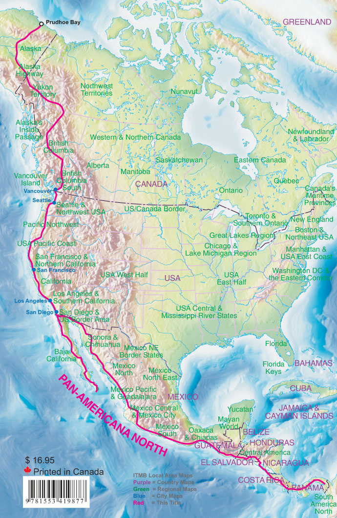
Wegenatlas - A5 formaat - verschillende schalen - voor de het Noord-Amerikaanse gedeelte van de Pan-Americana ( Pan-American Highway ) van Alaska langs the Pacific kust van British Colombia in Canada, de staten Washington, Oregon en Californie, Mexico, Guatemala tot Panama.


The Pan-American Highway was created by the USA to improve road communications within the Western Hemisphere post-WW2. The highway started at the Mexican border and eventually reached somewhere south of Santiago in Chile. It was a vote-buying gimmick by the Americans to fund allies, but it also created an essential 'spine' road through Central America to the Darien Gap and along the west coast of South America to the then-limits of Chile. Driving the Pan-Am has become a travel experience. More recently, the improvement in more northerly highways, such as the Dalton Highway from Fairbanks to Prudhoe Bay in Alaska, the paving of most of the Stewart Highway through British Columbia, and the tremendous improvement in highway infrastructure in Mexico over the past two decades, has made possible the long-awaited Panamericana Adventure Highway. Stretching from the Arctic Ocean at Prudhoe Bay south to the famous Alaska Highway, then east into Canada's Yukon, the Panamericana takes a westerly route along the coast and an easterly route through Edmonton and south to Texas. The western route is more interesting, in that much of it runs through pristine mountain wilderness. We have chosen the western route for this atlas, following the Pacific Coast as closely as possible through BC, Washington/Oregon/California to Tijuana. From here, the route can follow south through Baja California or head east and south along the eastern side of the Gulf of Colorado, past Mazatlan and Acapulco to join the original Pan-American at the Guatemala border. From Guatemala south to Panama, the Panamericana North (or Norte) is the original and well-maintained Pa-Am. The Darien Gap still prevents the North and South segments from joining, but this is more a political issue than a technical one. This is an epic atlas covering an epic journey. As often is the case with ITMB, this is another unique title of an interesting part of the world. We plan to do a South edition at a later date.
 
Legend Includes:
Roads by classification, International Boudaries, Time Zone Border, Points of interest, Historic site, Hotels, Museums, Golf courses, Restaurants, Caves, Lighthouses, Gas Stations, Waterfalls, Hotsprings,Hospitals, Historical Sites, Tourist information, Mountain Peaks, Churches,Schools, Embassies,Shipping Centers, Banks,Railway Stations, Bus Terminals, Police Station,Universities, Post Offices,Ferries, Parkings, Stadium and much more

Reviews

Wegenatlas Pan Americana North

Vlotte afhandeling. Foutloos. Prima! En bovendien een mooi product, goed te gebruiken

★★★★★ door Meindert J.H. Ligthart 19 juni 2022 | Heeft dit artikel gekocht

Vond u dit een nuttige review? (login om te beoordelen)

-
Nee (0)

Schrijf een review

Graag horen wij wat u van dit artikel vindt. Vindt u het goed, leuk, mooi, slecht, lelijk, onbruikbaar of erg handig: schrijf gerust alles op! Het is niet alleen leuk om te doen maar u informeert andere klanten er ook nog mee!