Kaarten - Schotse Hooglanden & Speyside
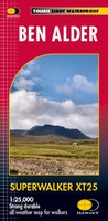 Wandelkaart Ben Alder | Harvey Maps
Superwalker is designed to be the most practical tool for navigation outdoors. The Superwalker XT25 is based on original HARVEY mapping with all the information a walker would expect on …
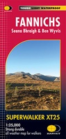 Wandelkaart Fannichs Seana Bhraigh & Ben Wyvis | Harvey Maps
Detailed map for hillwalkers of the Fannichs ridge at the popular 1:25,000 scale. This is an area located to the south of Ullapool and to the west of Dingwall. Includes …
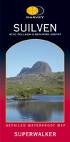 Wandelkaart Suilven / Stac Pollaidh & Ben More Assynt harve | Harvey Maps
Suilven covers the spectacular group of remote northerly munros popular with walkers and climbers. The map area includes Suilven, Canisp, CulMor,Breabag Stac Pollaidh, Conival & Ben More Assynt. This map …
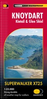 Wandelkaart Knoydart / Kintail / Glen Shiel harvey | Harvey Maps
This remote and beautiful area is often known as 'Scotland's last wilderness'. Detailed map for hillwalkers of Knoydart and Glen Shiel at the popular scale of 1:25,000. Includes …
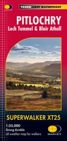 Wandelkaart Pitlochry Loch Tummel & Blair Atholl | Harvey Maps
Detailed map for hillwalkers of Pitlochry, Loch Tummel and Blair Atholl at the popular 1:25,000 scale. Includes Ben Vrackie, Beinn a’ Ghlo and Pass of Killiecrankie. Shows Aberfeldy in …
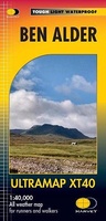 Wandelkaart Ben Alder | Harvey Maps
Covers a large area yet is handily compact. Pocket perfect!Detailed map for runners and walkers of the hills between Loch Tay and Loch Rannoch at the magic scale of 1:40,000.Includes …
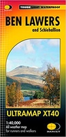 Wandelkaart Ben Lawers & Schiehallion | Harvey Maps
40 years’ experience have gone into HARVEY’s most creative new series. Slim and light, the Ultramap covers a large area and yet is handily compact. Pocket perfect! Includes Ben …
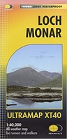 Wandelkaart Loch Monar | Harvey Maps
40 years’ experience have gone into HARVEY’s most creative new series. Slim and light, the Ultramap covers a large area and yet is handily compact. Pocket perfect! The Ultramap …
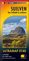 Wandelkaart Suilven / Stac Pollaidh / Lochinver | Harvey Maps
Detailed map for runners and walkers of Suilven and the surrounding area at the magic scale of 1:40,000. Covers a large area yet is handily compact. Pocket perfect! This is …
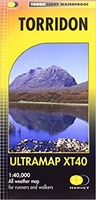 Wandelkaart Torridon | Harvey Maps
Covers a large area yet is handily compact. Pocket perfect!Includes Slioch, Beinn Eighe, Liathach and Beinn Alligin.Detailed map for runners and walkers of the Torridon Hills at the magic scale …
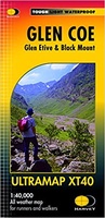 Wandelkaart Glen Coe | Harvey Maps
Covers a large area yet is handily compact. Pocket perfect! Detailed map for runners and walkers of Glen Coe and the Aonach Eagach ridge at the magic scale of …
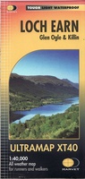 Wandelkaart Loch Earn | Harvey Maps
Covers a large area yet is handily compact. Pocket perfect! Detailed map for runners and walkers of Loch Earn, Glen Ogle and Killin at the magic scale of 1:40,000. …
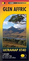 Wandelkaart Glen Affric | Harvey Maps
Covers a large area yet is handily compact. Pocket perfect! Detailed map for runners and walkers of the remote Glen Affric area at the magic scale of 1:40,000. …
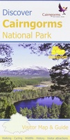 Wandelkaart Discover Cairngorms National Park | Footprint maps
Since it was created in 2003 the Cairngorms National Park has provided the ultimate destination for visitors in the UK wanting to experience a unique mixture of wilderness and cultural …
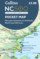 Wegenkaart - landkaart Pocket Map NC500 | Collins
Handy little full colour map of the popular North Coast 500 route. A perfect guide for travelling around Northern Scotland. Detailed mapping and tourist information ideal for any road trip. …
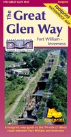 Wandelkaart The Great Glen Way | Footprint maps
The complete map/guide of both routes between Fort William and Inverness. Also contains compact and concise practical information for walkers. For every copy of this map sold, a …
 Wandelkaart The Fife Pilgrim Way | Footprint maps
A handy, waterproof map breaking down the Fife Pilgrim Way into seven sections. The Fife Pilgrim Way runs between North Queensferry or Culross and St Andrews. It is designed as …
 Wegenkaart - landkaart National Park Pocket Map Cairngorms | Collins
Handige kleine kaart van dit Nationaal Park. De kaart geeft een goed en helder overzicht van het gebied met alle plaatsen, doorgaande wandelpaden (alhoewel grof van schaal), bezienswaardigheden etc. Met …
 Wegenkaart - landkaart National Park Pocket Map Loch Lomond and the Trossachs | Collins
Handige kleine kaart van dit Nationaal Park. De kaart geeft een goed en helder overzicht van het gebied met alle plaatsen, doorgaande wandelpaden (alhoewel grof van schaal), bezienswaardigheden etc. Met …
 Wandelkaart - Topografische kaart OL52 OS Explorer Map Glen Shee & Braemar | Ordnance Survey
Discover Glen Shee, less than two hours’ drive from all of Scotland’s major cities, yet a place of otherworldly beauty as its name, which translates to ‘the fairy glen’, attests. …
Laatste reviews

Zoals altijd een prima gids van Cicerone, in feite onmisbare gids voor hiken in dit gebied. De gids bevat verschillende dagtochten van ± 1 tot …
★★★★★ door Pieter Boddaert 16 mei 2024 | Heeft dit artikel gekocht
Heel blij met de kaart geweest, uiteindelijk wel 5 keer per dag in handen gehad tijdens mijn tocht. Gebruikersvriendelijk en dankzij platsificeering ook uiterst geschickt …
★★★★★ door Jasmin 16 mei 2024 | Heeft dit artikel gekocht
Snelle levering
★★★★★ door Pierre 16 mei 2024 | Heeft dit artikel gekocht
Snelle levering
★★★★★ door Pierre Dilissen 16 mei 2024 | Heeft dit artikel gekocht