Schotland
 Wandelgids 5990 Wanderführer Schottland - an den Küsten und in den Highlands - Schotland | Kompass
Goede Duitstalige wandelgids met heldere beschrijvingen van de wandeltochten. Met hoogteprofiel, kaartje en de benodigde praktische informatie als bijvoorbeeld de startlocatie met GPS coordinaten. De wandelingen zijn ingedeeld in zwaarte …
 Reisgids National Geographic Schotland | Kosmos Uitgevers
National Geographic Reisgids Schotland is een exclusieve gids met sublieme fotografie die je meeneemt naar de bekende en minder bekende bezienswaardigheden. De experts van National Geographic nemen een kijkje achter …
 Campinggids Wild Camping UK and Ireland | Conway
Als je echt op zoek bent naar bijzondere kampeerplekken in Engeland, Schotland en Ierland dan is dit je boek: het beschijft de meest afgelegen plekkenin het wild waar je je …
 Reisgids Scotland from the Rails | Bradt Travel Guides
From the author of the acclaimed Britain from the Rails, an entertaining armchair read and practical guide rolled into one. Engaging, eccentric, informative, inspirational and only very occasionally trainspotter-ish, Scotland …
 Accommodatiegids - Wandelgids The Book of the Bothy | Cicerone
A celebration of 26 of the author's favourite bothies, as she shares her memories of her favourite 'stone tents' all over the UK in remote and wild locations. Packed with …
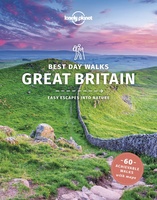 Wandelgids Best Day Walks Great Britain - Groot Brtittanië | Lonely Planet
Lonely Planet heeft een nieuwe serie uitgebracht: Best Day Walks in verschillende landen. Het zijn de - door Lonely Planet uitgekozen - mooiste wandelingen verspreid over het land. Goed beschreven, …
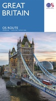 Wegenkaart - landkaart Great Britain OS route | Ordnance Survey
Tweezijdige overzichtskaart van heel Engeland en Schotland. Goed duildelijk leesbaar kaartbeeld met de doorgaande en grotere wegen. Ook Nationsle Parken staan er goed op. Ordnance Survey's double-sided OS Route Map …
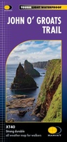 Wandelkaart John O'Groats trail | Harvey Maps
Mooie, duidelijke kaart van de John O'Groats trail in Schotland. Geplastificeerd met veel extra informatie en uitsnedes van de route. The John o' Groats Trail is a 237 km (147 …
★★★★★★★★★★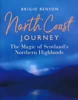 Reisgids North Coast Journey - Schotland | Birlinn
Als je echt enthousiast wilt worden over deze fantastische streek, dan is boek een echte aanrader. Veel illustraties maken het een lust voor het oog. Daarnaast veel tips over dit …
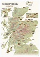 Scratch Map Scotch Whisky Collect & Scratch | Maps International
Deze kaart maakt deel uit van de nieuwe reeks 'Collect and Scratch' kaarten en toont een selectie Single Malt Scotch Whisky Distilleerderijen in Schotland. Ze worden allemaal weergegeven door middel …
★★★★★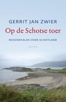 Reisverhaal Op de Schotse toer | Gerrit Jan Zwier
Op de Schotse toer van Gerrit Jan Zwier zingt niet alleen de lof van het hoogland, het laagland en de eilanden, maar geeft ook een indringend beeld van het romantische …
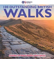 Wandelgids 100 outstanding British Walks | Ordnance Survey
Beschrijving van de 100 mooiste Pathfinder wandelingen in Engeland, Wales en Schotland. Uitstekende beschrijving van de route met een zeer duidelijke topografische kaart waarop de route is ingetekend. This magnificent …
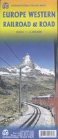 Spoorwegenkaart Europe Western Railroad & Road | ITMB
Spoorwegen kaart van West Europa in kleur. Schaal 1:2,500,000. Toont spoorlijnen, snelwegen, secundaire wegen en andere wegen, veerboten en belangrijke scheepvaartdiensten; internationale grenzen, de grenzen van de gebieden met reisbeperkingen; …
★★★★★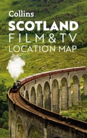 Wegenkaart - landkaart Pocket Map Scotland Film and TV Location Map | Collins
Full-colour, handy guide to more than 60 of the most popular film and TV locations in Scotland. Striking images and detailed descriptions allow for a comprehensive guide to Scotland's most …
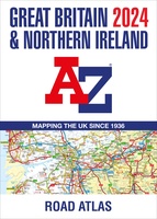 Wegenatlas Great Britain and Northern Ireland Road Atlas 2024 | A-Z Map Company
A full-colour, paperback road atlas of Great Britain, now fully revised and updated. Clear detailed road mapping at a scale of 3.5 miles to 1 inch. Presented in a large, …
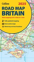 Wegenkaart - landkaart Road Map of Britain 2025 | Collins
Full-colour, double-sided road map of Great Britain at a scale of 8.7 miles to 1 inch. Northern England, Scotland and the Isle of Man are on one side with Southern …
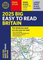 Wegenatlas Philip's Easy to Read Road Atlas of Britain 2025 | A3-Formaat | Paperback | Philip's Maps
With the detail you need at a size you can read, the latest edition of 2025 Philip's Big Easy to Read Road Atlas of Britain is super-clear, super-sized and bang …
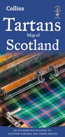 Historische Kaart Tartans Map of Scotland | Collins
Discover Scotland with this authoritative guide to tartans and their origins. This popular touring map has a huge amount of detail with over 1,000 places of tourist interest plotted and …
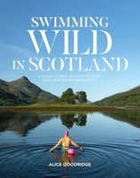 Reisgids Swimming Wild in Scotland | Vertebrate Publishing
Swimming Wild in Scotland by Alice Goodridge is an informative and inspiring book for both new and experienced wild swimmers, featuring over 100 of the best wild swimming spots across …
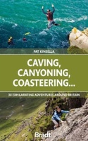 Reisgids Caving, Canyoning, Coasteering | Bradt Travel Guides
You don't need to be ultra-fit or highly experienced in the outdoors to enjoy outdoor guru Patrick Kinsella's selection of 30 activities across Britain. 'A sense of adventure and an …
Laatste reviews

Zoals altijd een prima gids van Cicerone, in feite onmisbare gids voor hiken in dit gebied. De gids bevat verschillende dagtochten van ± 1 tot …
★★★★★ door Pieter Boddaert 16 mei 2024 | Heeft dit artikel gekocht
Heel blij met de kaart geweest, uiteindelijk wel 5 keer per dag in handen gehad tijdens mijn tocht. Gebruikersvriendelijk en dankzij platsificeering ook uiterst geschickt …
★★★★★ door Jasmin 16 mei 2024 | Heeft dit artikel gekocht
Snelle levering
★★★★★ door Pierre 16 mei 2024 | Heeft dit artikel gekocht
Snelle levering
★★★★★ door Pierre Dilissen 16 mei 2024 | Heeft dit artikel gekocht