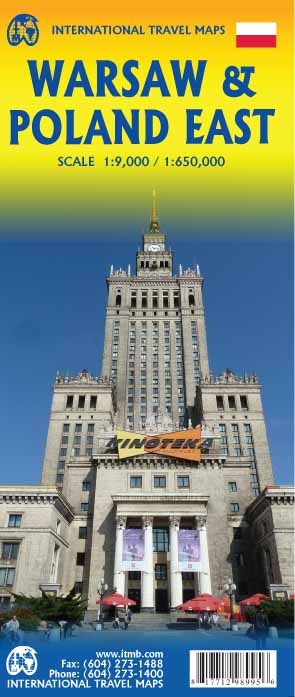
Wegenkaart - landkaart - Stadsplattegrond Poland east - Warsaw, Oost Polen en Warschau | ITMB (9781771298995)
- ISBN / CODE: 9781771298995
- Editie: 25-03-2018
- Druk: 2
- Aantal blz.: 1
- Schaal: 1:9000
- Uitgever: ITMB
- Soort: Stadsplattegrond, Wegenkaart
- Taal: Engels
- Hoogte: 25.0 cm
- Breedte: 10.0 cm
- Gewicht: 52.0 g
- Uitvoering: Papier
- Bindwijze: -
- Schrijf als eerste een review
-
€ 14,95
Leverbaar in 3 - 5 werkdagen in huis in Nederland Levertijd Belgie
Gratis verzending in Nederland vanaf €50,-


Beschrijving
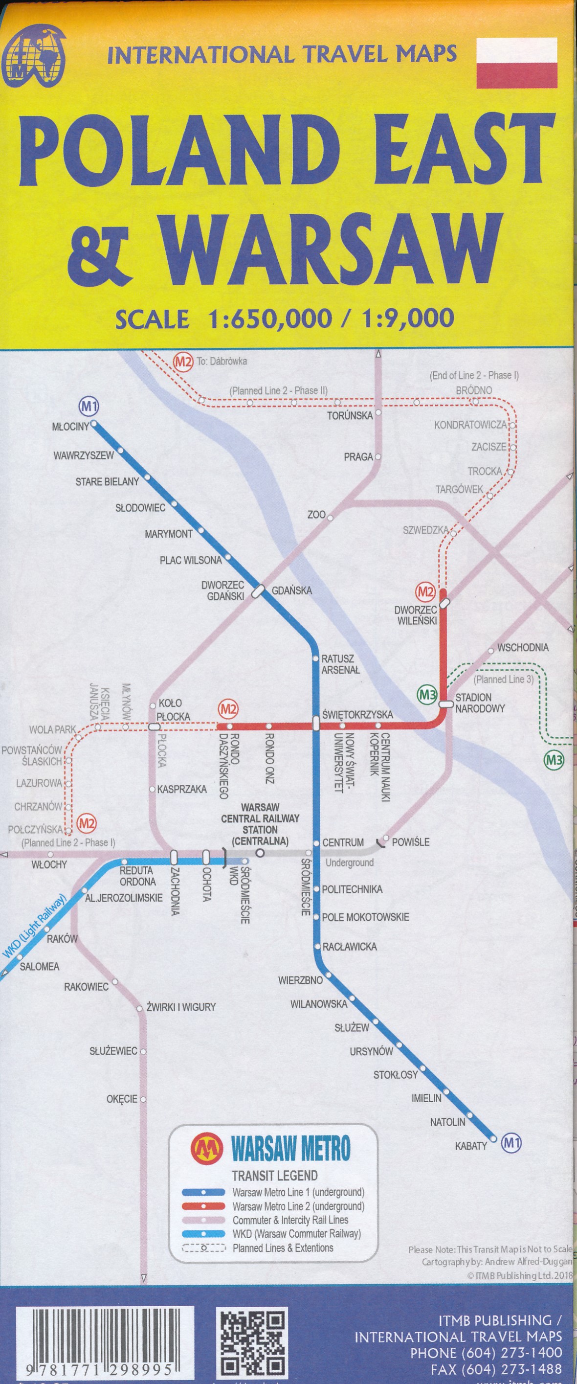
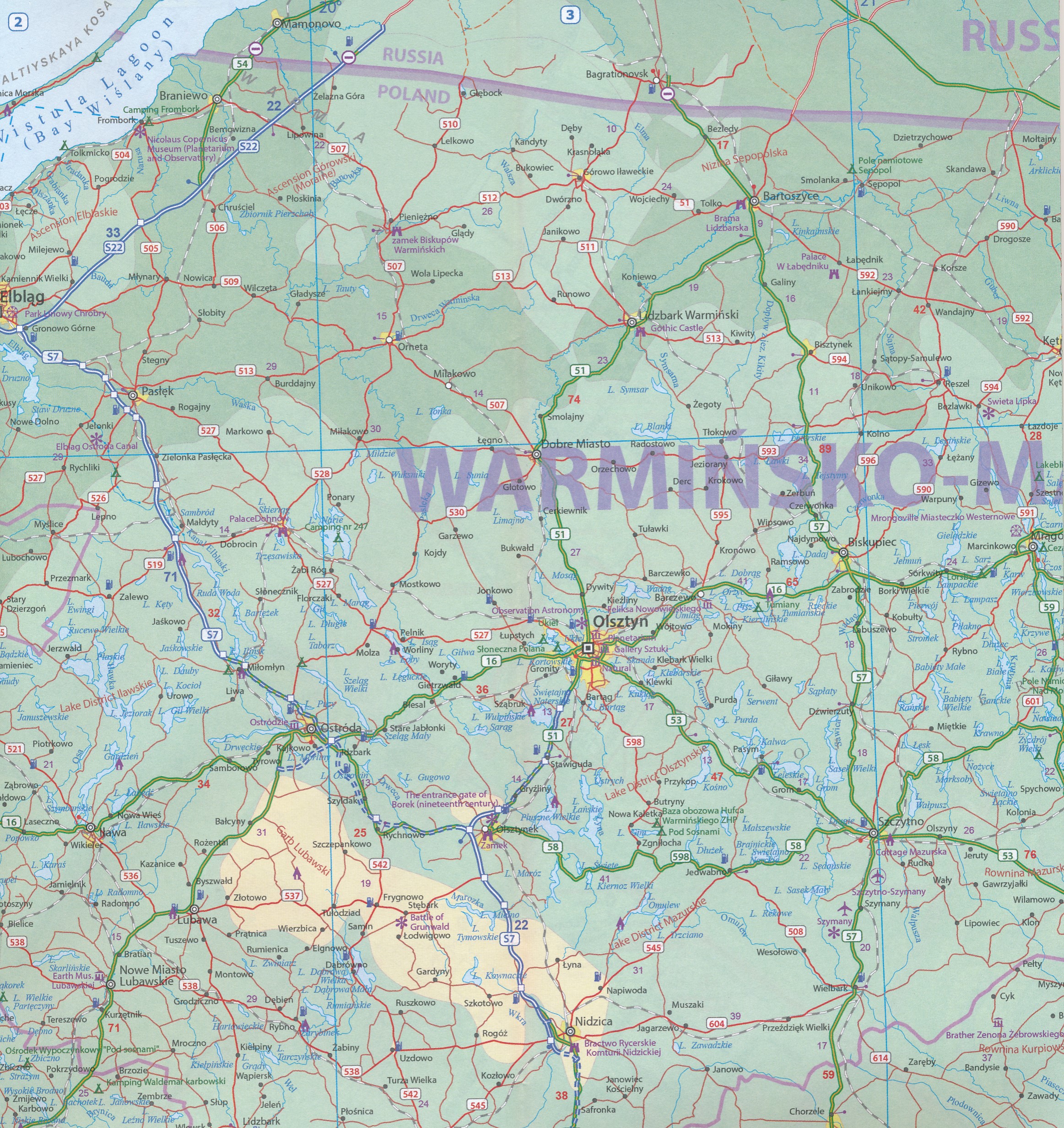
ITMB wegenkaarten en wandelkaarten kenmerken zich door het kleurgebruik waarbij zo de nadruk wordt gelegd op de natuurkundige aspecten van het land of de streek. Het soort landschap en de hoogte worden hierdoor zeer duidelijk zichtbaar. Natuurlijk vind je ook de 'gewone' zaken als wegennet, spoorwegen, vliegvelden, ferrys, toeristische bezienswaardigheden en nationale parken er op terug.. Vaak - maar niet op alle kaarten - staat op de achterzijde een stadsplattegrond van hoofdstad of belangrijkste stad in de regio.
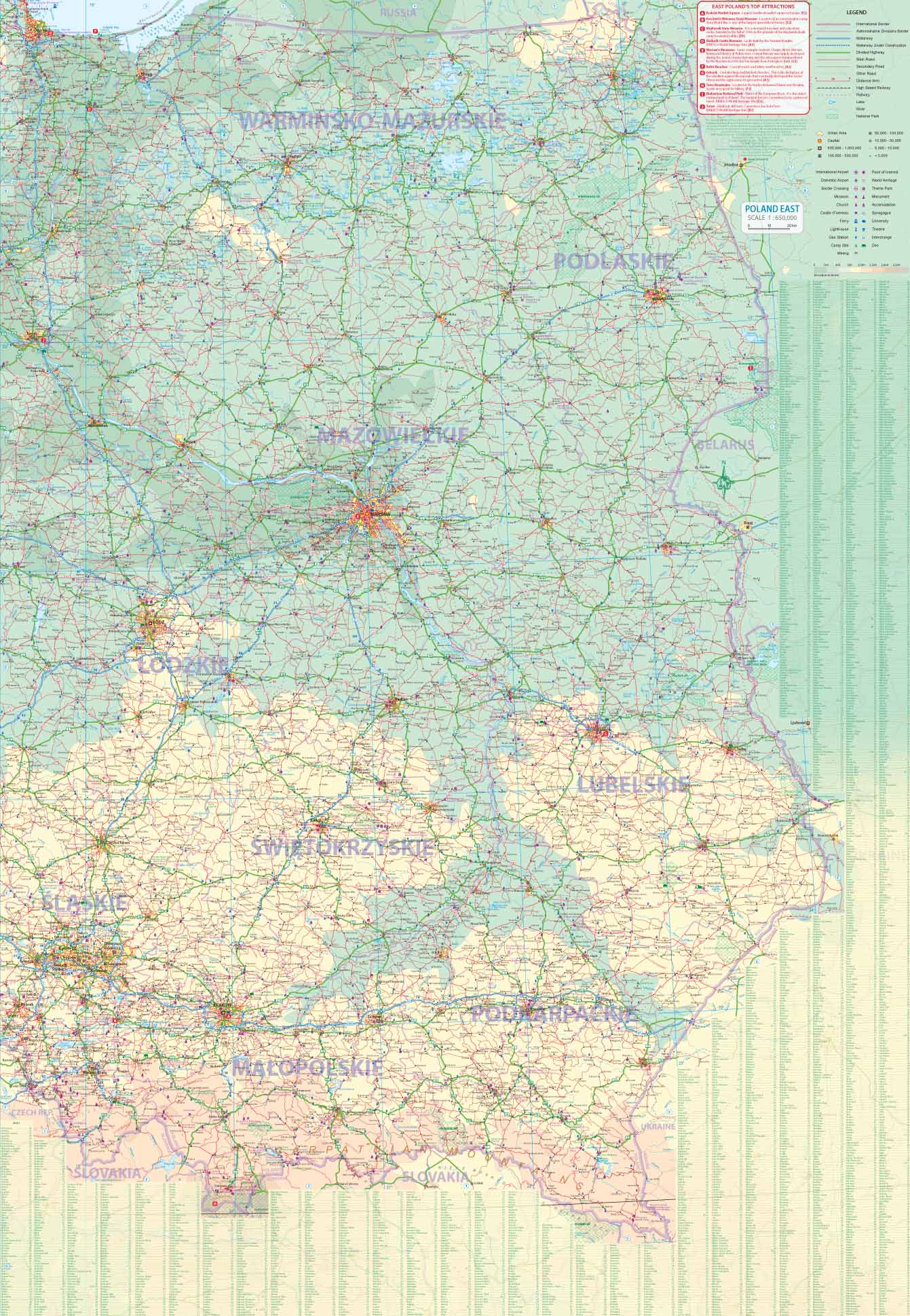
Voorzijde: Oost Polen shcaal 1:650.000
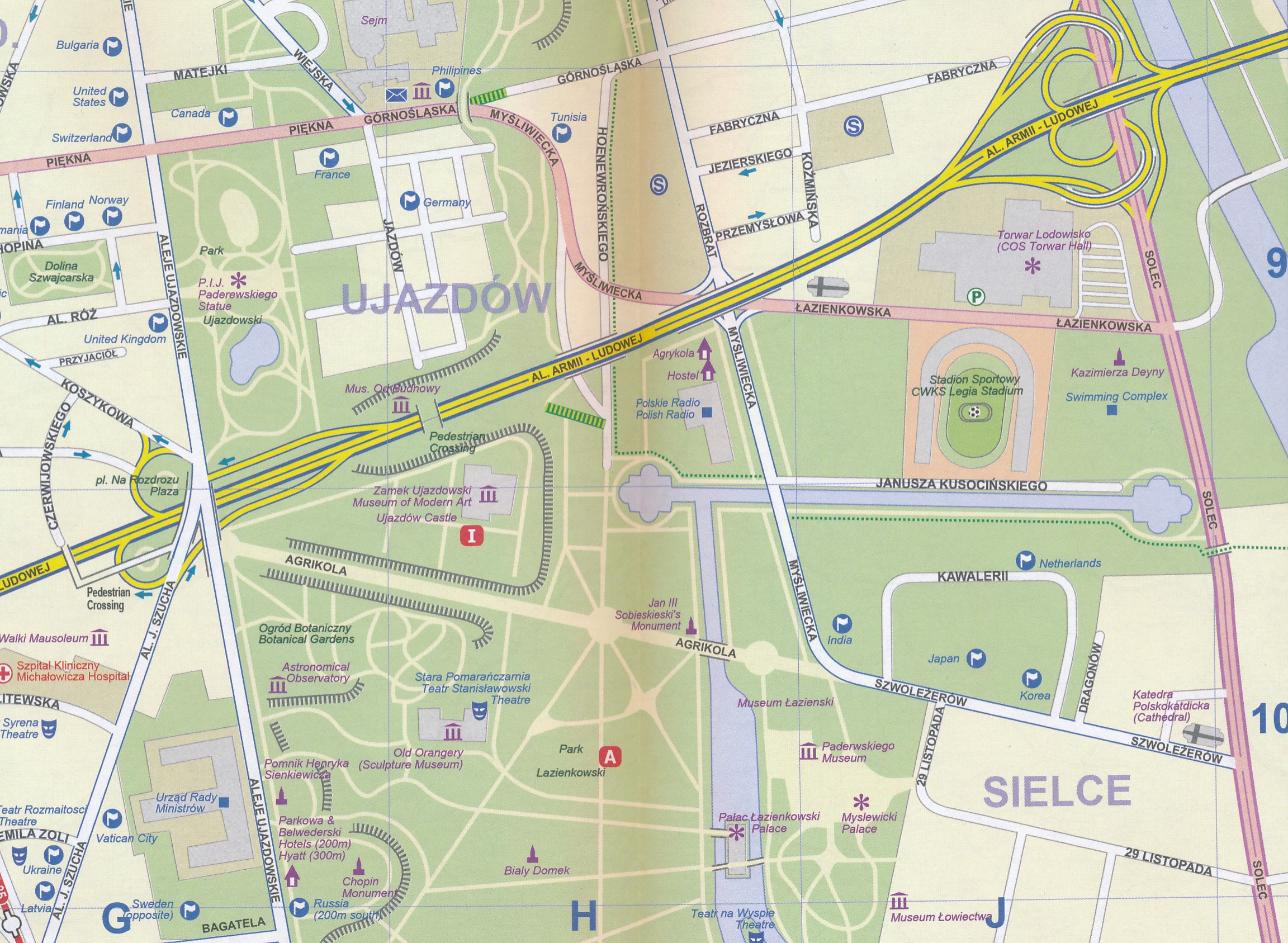
Achterzijde: Warschau, schaal 1:9.000
Reviews
Geen reviews gevonden voor dit product.
Schrijf een review
Graag horen wij wat u van dit artikel vindt. Vindt u het goed, leuk, mooi, slecht, lelijk, onbruikbaar of erg handig: schrijf gerust alles op! Het is niet alleen leuk om te doen maar u informeert andere klanten er ook nog mee!
Ook interessant voor europa/polen/noord
-

Reisgids Michelin groene gids weeken
€ 14,99Reisgidsen Warschau -

Reisverhaal BOOTREIS NAAR POLEN | Ju
€ 19,08Reisverhalen Polen -

Wandelkaart - Fietskaart - Wegenkaar
€ 9,95Fietskaarten Oost Polen -

Reisinspiratieboek Under the Stars -
€ 27,95Reisinspiratieboeken Wales -

Ansichtkaart Polen met reliëf | GeoR
€ 5,95Ansichtkaarten Polen