Winkelwagen
Geen items in winkelwagen
Ga naar winkelwagen
Wandelkaart Tatry Zachodnie | Sygnatura (9788374992527)
Poolse en Slowaakse kant van Trate gebergte

- ISBN / CODE: 9788374992527
- Editie: meest recente editie
- Schaal: 1:25000
- Uitgever: Sygnatura
- Soort: Wandelkaart
- Taal: Engels, andere talen
- Bindwijze: -
- Uitvoering: Papier
- Schrijf als eerste een review
-
€ 9,95
Dit artikel is (tijdelijk) niet leverbaar

Beschrijving
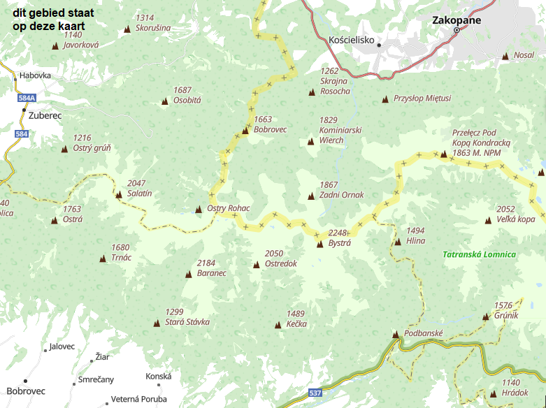
Goede wandelkaart van het grote westelijke deel van het Tatra gebergte, zowel aan de Poolse als aan de SLowaakse kant. Wandelpaden, campings, hutten, alles staat er op.
Western Tatra Mountains in Poland and Slovakia at 1:25,000 on a contoured and GPS compatible map from CartoMedia highlighting waymarked hiking trails, mountain huts and campsites, places of interest, etc, Coverage extends from Zakopane westwards to Habovka. On the reverse are panels with an overview of the waymarked hiking trails for planning longer routes, a road map showing access to this part of the Tatra Mountains from both sides of the border, a directory of local mountain huts and other useful tourist information, etc.
Maps in the Cartomedia hiking series present topography is by contours at 20m intervals, enhanced by relief shading and, where appropriate, graphic relief for exposed rocky areas. Waymarked hiking trails indicate approximate walking times in both directions and possible danger points. Most titles also show cross-country and alpine ski routes and mountain bike trails. Symbols mark various types of tourist accommodation including mountain huts and campsites, mountain rescue and medical facilities, places of interest, etc. Road network indicates scenic routes, petrol stations and border crossings for motorized traffic. The maps have latitude and longitude lines at 1’ intervals. Map legends include English.
On the reverse most titles carry additional tourist information, including directories of accommodation and other relevant tourist facilities, street plans, etc.
Reviews
Geen reviews gevonden voor dit product.
Schrijf een review
Graag horen wij wat u van dit artikel vindt. Vindt u het goed, leuk, mooi, slecht, lelijk, onbruikbaar of erg handig: schrijf gerust alles op! Het is niet alleen leuk om te doen maar u informeert andere klanten er ook nog mee!
Alle gerelateerde rubrieken >
Ook interessant voor europa/polen/hogetatra
-

Wandelgids Niedere Tatra und Slowaki
€ 18,50Wandelgidsen Hoge Tatra -

Wandelkaart 2100 Tatra - Tatry | Kom
€ 16,50Wandelkaarten Hoge Tatra -

Reisgids Tatra Mountains Poland & Sl
€ 24,95Reisgidsen Hoge Tatra -

Wandelkaart 2130 Tatry - Tatra, Hoge
€ 16,95Wandelkaarten Hoge Tatra -
 | Sygnatura")
Wandelkaart Tatrzanski Park Narodowy
€ 8,95Wandelkaarten Zuid Polen