Winkelwagen
Geen items in winkelwagen
Ga naar winkelwagen
Kaarten - Franche-Comté
 Fietskaart 09 Velo Ballons des Vosges a Velo | IGN - Institut Géographique National
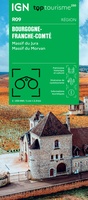 Wegenkaart - landkaart 09 TOP 250 Bourgogne - Franche-Comté | IGN - Institut Géographique National
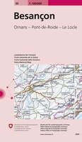 Fietskaart - Topografische kaart - Wegenkaart - landkaart 30 Besançon | Swisstopo
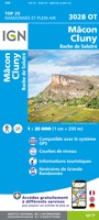 Wandelkaart - Topografische kaart 3028OT Mâcon - Cluny | IGN - Institut Géographique National
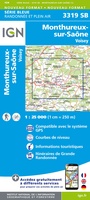 Wandelkaart - Topografische kaart 3319 SB - Serie Bleue Monthureux-sur-Saône - Voisey | IGN - Institut Géographique National
 Wandelkaart - Topografische kaart 3320 SB - Serie Bleue Jussey - Faverney | IGN - Institut Géographique National
 Wandelkaart 3321 SB - Serie Bleue Port-sur-Saône / Fresne-St-Mamès | IGN - Institut Géographique National
 Wandelkaart - Topografische kaart 3322 SB - Serie Bleue Gy - Rioz | IGN - Institut Géographique National
 Wandelkaart - Topografische kaart 3323ET Besançon - Forêt de Chailluz | IGN - Institut Géographique National
 Wandelkaart - Topografische kaart 3324ET Arc-et-Senans | IGN - Institut Géographique National
 Wandelkaart 3325OT Arbois / Salins-les-Bains / Forêt Domaniale de la Joux | IGN - Institut Géographique National
 Wandelkaart - Topografische kaart 3326ET Champagnole | IGN - Institut Géographique National★★★★★
 Wandelkaart - Topografische kaart 3327ET Morez - les Rousses | IGN - Institut Géographique National★★★★★★★★★★
 Topografische kaart - Wandelkaart 3327OT St-Claude / Lac de Vouglans / PNR du Haut Jura | IGN - Institut Géographique National★★★★★
 Wandelkaart - Topografische kaart 3328OT Crêt de la Neige | IGN - Institut Géographique National
 Wandelkaart - Topografische kaart 3419 Bains-les-Bains | IGN - Institut Géographique National
 Wandelkaart - Topografische kaart 3420 SB - Serie Bleue Luxeuil-les-Bains, Conflans-sur-Lanterne | IGN - Institut Géographique National
 Wandelkaart - Topografische kaart 3421 SB - Serie Bleue Vesoul | IGN - Institut Géographique National
 Wandelkaart - Topografische kaart 3422 SB - Serie Bleue Baume-les-Dames | IGN - Institut Géographique National
 Wandelkaart - Topografische kaart 3423ET Baumes-les-Dames, Vallee du Doubs | IGN - Institut Géographique National
- 1
- 2
- 3
- Volgende >>
- 5
Laatste reviews

Prima fietskaart
Ik denk dat ik met deze fietskaart prima uit de voeten kan. Maar dat weet ik pas na de zomer.
★★★★★ door Prins 27 maart 2026 | Heeft dit artikel gekocht
handzame praktische kaart
Heel handige set routekaartjes, gemakkelijk in je jaszak te doen, weerbestendig, veel detailinformatie.
★★★★★ door Marco van Schaik 26 maart 2026 | Heeft dit artikel gekocht
Onweerstaanbaar die OS-kaarten
De topografische kaarten van Ordnance Survey (OS Explorer) op schaal 1:25.000 zijn altijd een genot om mee te werken. Geen detail mist. En dan ook …
★★★★★ door Bert ter Horst 26 maart 2026 | Heeft dit artikel gekocht
Vertrouwd en blijvend actueel
De wegenkaart van West Australie is zeer aan te bevelen.
★★★★★ door Henk 25 maart 2026 | Heeft dit artikel gekocht