Wales
 Wegenatlas Big Atlas Britain & Ireland 2023 A3-Formaat | Philip's Maps
Goede gedetailleerde wegenatlas van Groot-Brittannië, schaal 1:200.000 met een overzichtskaart van Ierland, schaal 1:1.000.000. Groot formaat, A3, en in ringband. Philip's is No. 1 in the UK for clear maps …
★★★★★ Reisgids I love the seaside Great Britain - Ireland, Groot Brittannie en Ierland | Mo'Media | Momedia
The I Love the Seaside Surf & Travel Guide to Great Britain & Ireland is a 464-page printed book (English language) exploring the (surf) coast of Britain and Ireland. From …
 Reisgids The Beaches of Wales | Vertebrate Publishing
Surrounded on three sides by water, Wales has hundreds of beaches to choose from. The Beaches of Wales by Alistair Hare is the first guide to every beach and cove …
 Campinggids Wild Camping UK and Ireland | Conway
Als je echt op zoek bent naar bijzondere kampeerplekken in Engeland, Schotland en Ierland dan is dit je boek: het beschijft de meest afgelegen plekkenin het wild waar je je …
 Reisgids Wild Guide Wales | Wild Things Publishing
A new compendium of adventures, from the best-selling Wild Guide series (winner of travel guidebook of the year 2015). This guide to Wales and the Welsh Marches, one of Europe's …
★★★★★★★★★★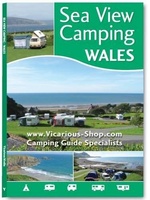 Campinggids - Campergids Sea View Camping Wales | Vicarious Books
This unique guide shows and tells you about 111 campsites, camping and caravan parks and holiday parks with sea views around the Welsh coast. Whether walker, surfer, history buff or …
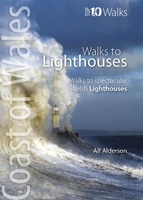 Wandelgids Walks to Lighthouses Wales | Northern Eye Books
Klein, handzaam wandelgidsje met spectaculaire wandelingen naar vuurtorens. Met goede kaartjes van Ordnance Survey. This attractive and cleverly structured guide gives walkers ten of the finest walks to the ten …
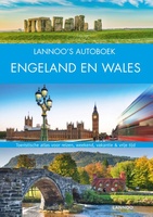 Reisgids Lannoo's Autoboek Engeland en Wales | Lannoo
Drie uitgestippelde autoroutes en twee stadswandelingen loodsen je oor de fraaiste regio's Atlas met kaarten op schaal 1:750.000 en meer dan 700 kleurenfoto's Handige geografische indeling en sterrenquotering England en …
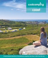 Campinggids - Campergids Cool Camping Coast | Punk Publishing
In recognition of the nation's love for the Great British coastline, 2018 sees the launch of a brand new guidebook - Cool Camping: Coast - the latest title in the …
 Wandelgids North Wales Coast walks | Northern Eye Books
Zeer handzaam boekje van een tiental rondwandelingen, met goede kaarten en beschrijving. Leuke toevoeging op de route of als je alleen maar naar die streek gaat en op zoek bent …
 Fietsgids Cols and Passes of the British Isles
A col is the lowest point on the saddle between two mountains. Graham Robb has spent years uncovering and cataloguing the 2,002 cols and 105 passes scattered across the British …
 Wandelatlas Adventure Atlas Glyndwr's Way | A-Z Map Company
AZ heeft de meest gedetailleerde wandelkaarten van de Glyndwr's Way gebundeld in een atlasje. Daardoor is het heel handig qua formaat. De kaarten zelf zijn perfect voor het wandelen. Schaal …
 Fietskaart Cycle Route Map Lôn Las Cymru South | Sustrans
Het is niet een heel overzichtelijke kaart, het zijn juist blokken van een deel van de route waarop deze staat ingetekend. Daarin juist wel heel goed met handige stedenkaarten en …
 Fietskaart Cycle Route Map Lôn Las Cymru North | Sustrans
Het is niet een heel overzichtelijke kaart, het zijn juist blokken van een deel van de route waarop deze staat ingetekend. Daarin juist wel heel goed met handige stedenkaarten en …
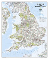 Wandkaart Engeland en Wales, 76 x 92 cm | National Geographic
This classic-style map of England and Wales shows political boundaries, major highways and roads, cities and towns, airports, and other geographic details. Thousands of place-names and exact borders are carefully …
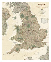 Wandkaart Engeland en Wales, antiek, 76 x 91 cm | National Geographic
This earth-toned, executive-style map of England and Wales shows political boundaries, major highways and roads, cities and towns, airports, and other geographic details. Thousands of place-names and exact borders are …
 Wandelgids Walking in the Wye Valley | Cicerone
This guidebook includes 30 day walks in the stunning and varied lands of the Wye Valley. From its source on Plynlimon in the Welsh Cambrian mountains, down along the Wales-England …
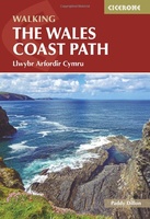 Wandelgids Walking the Wales Coast Path | Cicerone
The Wales Coast Path offers an unparalleled opportunity to walk a nation's coastline in its entirety. Stretching 1400km (870 miles) from Chester to Chepstow, including Anglesey, the waymarked trail takes …
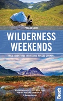 Reisgids Great British Wilderness Weekends - Engeland en Schotland | Bradt Travel Guides
Prachtige reisgids met veel ideeen om er een mooi weekend van te maken! Bed down among some of the most dramatic landscapes in the world and discover your own bolthole …
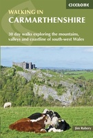 Wandelgids Walking in Carmarthenshire | Cicerone
This guidebook presents 30 contrasting day walks exploring the mountains, valleys and coastline of Carmarthernshire in south-west Wales. Ranging from 2 to 10 miles in length and suitable for walkers …
Laatste reviews

Ondanks de moderne tijd met navigatie e.d. hebben we diverse reisboeken besteld. Dit is een prima keuze geweest. Het geeft veel meer rust om in …
★★★★★ door Con en Lizet Heijenrath 01 juni 2024 | Heeft dit artikel gekocht
Ik ben heel tevreden. Het waren de best beschikbare kaarten voor dat gebied. Met dank.
★★★★★ door Nico Kool 01 juni 2024 | Heeft dit artikel gekocht
Ik ben heel tevreden. Het waren de best beschikbare kaarten voor dat gebied. Met dank.
★★★★★ door Nico Kool 01 juni 2024 | Heeft dit artikel gekocht
De informatie per regio ‘the guide’ is prima. De praktische informatie ‘toolkit’ is erg oppervlakkig en bevat daardoor weinig bruikbare informatie. Jammer.
★★★★★ door Astrid 01 juni 2024 | Heeft dit artikel gekocht