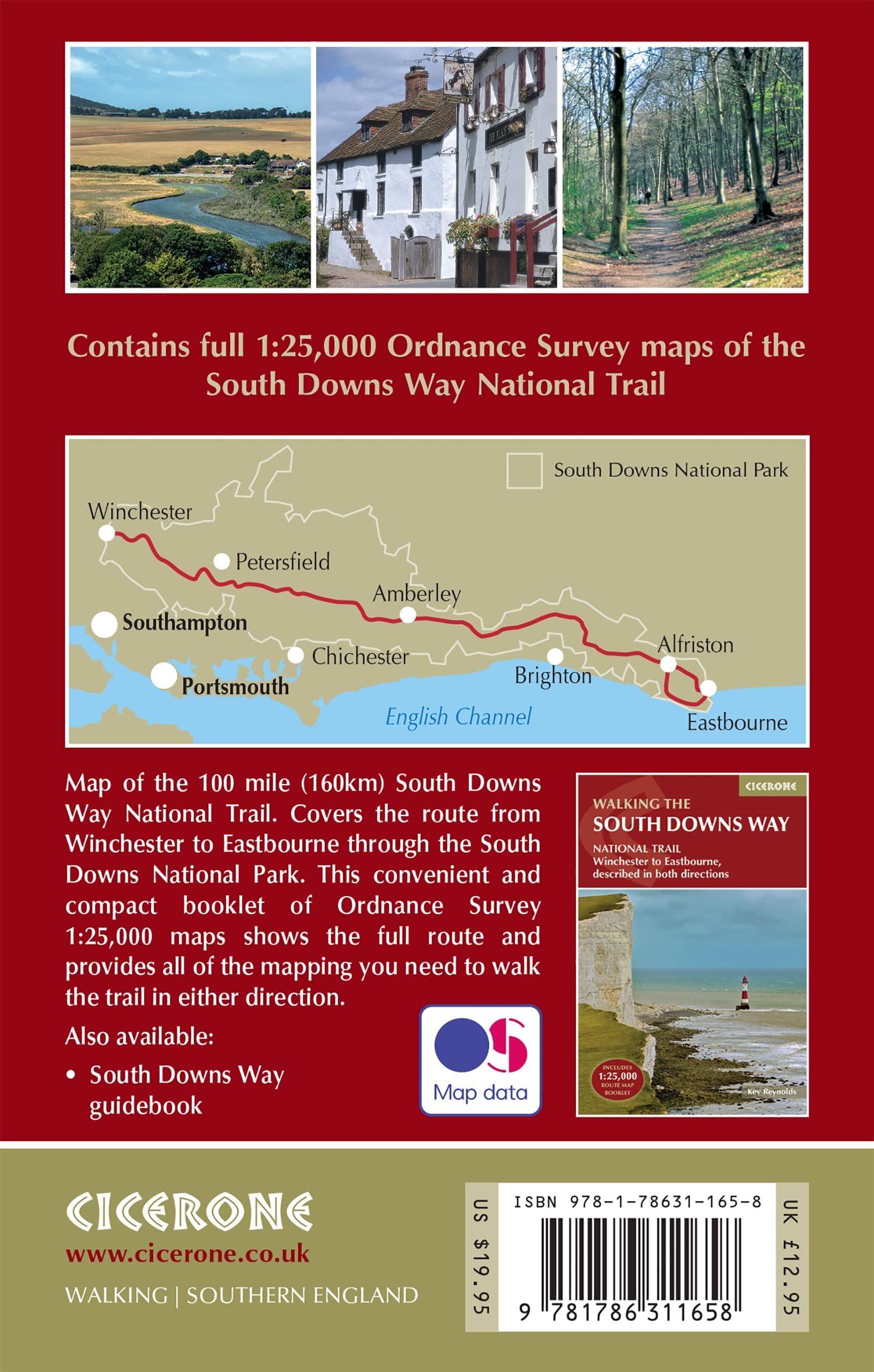
Wandelkaart - Kaart The South Downs Way Map Booklet | Cicerone (9781786311658)
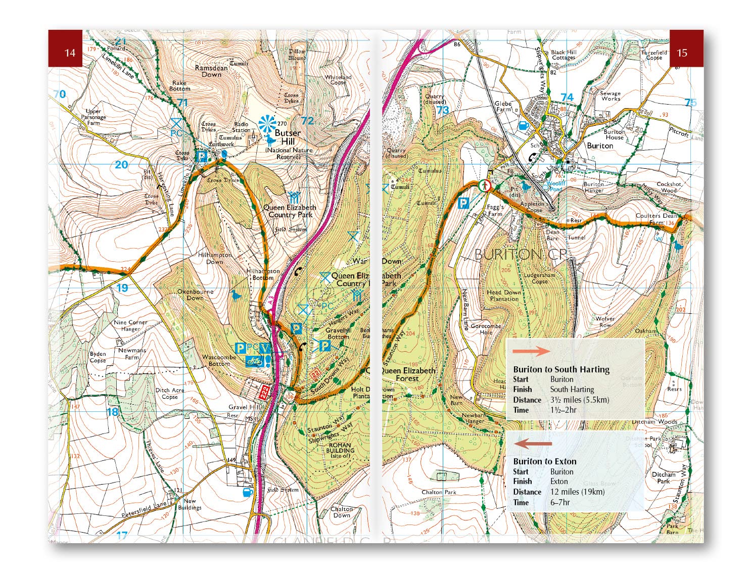
1:25,000 OS Route Mapping

- ISBN / CODE: 9781786311658
- Editie: 28-06-2023
- Druk: 2
- Aantal blz.: 64
- Schaal: 1:25000
- Auteur(s): Kev Reynolds
- Uitgever: Cicerone
- Soort: Kaart, Wandelkaart
- Taal: Engels
- Hoogte: 17.0 cm
- Breedte: 11.0 cm
- Dikte: 0.4 cm
- Gewicht: 71.0 g
- Bindwijze: Paperback
- Uitvoering: -
- Schrijf als eerste een review
-
€ 18,95
Op voorraad
Op werkdagen vóór 17:00 besteld = dezelfde dag verzonden
Bezorging meestal binnen 1–2 werkdagen. Levertijd BelgieGratis verzending in Nederland vanaf €50,-
Beschrijving
Reviews
Geen reviews gevonden voor dit product.
Schrijf een review
Graag horen wij wat u van dit artikel vindt. Vindt u het goed, leuk, mooi, slecht, lelijk, onbruikbaar of erg handig: schrijf gerust alles op! Het is niet alleen leuk om te doen maar u informeert andere klanten er ook nog mee!
Ook interessant voor europa/engeland/south-downs-nationaal-park
-

Fietskaart 04 Cycle Maps UK South Do
€ 12,95Fietskaarten ♦ New Forrest National Park -

Reisgids Slow Travel Sussex - South
€ 23,95Reisgidsen South East England -

Wandelkaart - Topografische kaart OL
€ 20,95Topografische kaarten South East England -

Wegenkaart - landkaart National Park
€ 7,95Wegenkaarten South West England -

Wandelgids South Downs National Park
€ 10,95Wandelgidsen ♦ South Downs Nationaal Park