Kaarten - Engeland
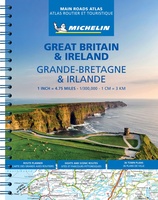 Wegenatlas Great Britain and Ireland 2025 - Groot Brittannie en Ierland | Michelin
Zoals je mag verwachten van Michelin ook voor Engeland, Schotland en Ierland weer een handige atlas in ringband op A4 formaat. De kaarten zijn goed leesbaar, altijd een pluspunt bij …
★★★★★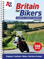 Wegenatlas Britain for Bikers | Voor Motoren | A-Z Map Company
Discover the best biking routes around Great Britain and Northern Ireland. Your essential rideout roadbook covering the best biking routes around Great Britain and Northern Ireland, including short trips and …
 Wegenkaart - landkaart South Georgia Explorer – Zuid-Georgië | Ocean Explorer Maps
Overzichtskaart van Zuid-Georgië en de Zuidelijke Sandwich Eilanden. - Met geillustreerde biografieën van ondekkers en andere notabelen. - Historische tijdslijn - Kleuren foto's en wildlife - Details van veel bezienswaardigheden …
★★★★★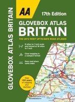 Wegenatlas AA Glovebox Atlas Britain | AA Publishing
This handy atlas fits in the glovebox of your car, perfect for quick referencing on the move. The clear mapping includes a range of essential motoring and useful touring information …
★★★★★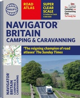 Wegenatlas Navigator Camping and Caravanning – Atlas of Britain | Philip's Maps
THE MUST-HAVE ATLAS OF BRITAIN FOR CAMPING, CARAVANNING AND MOTORHOMES'A map that beats all others' - The Daily Telegraph'Scale, accuracy and clarity are without parallel' - Driving Magazine'No. 1 in …
★★★★★ Wegenatlas Philip's Easy to Read Road Atlas of Britain 2025 | A4-Formaat | Ringband | Philip's Maps
"The detail you need at a size you can read". The latest 2025 Philip's Easy to Read Road Atlas of Britain from the best-selling Road Atlas range has over 350 …
 Wegenkaart - landkaart Groot-Brittanië en Ierland | ANWB Media
De ANWB heeft een grote serie wegenkaarten van de belangrijkste landen en streken. Het zijn echte overzichtskaarten van vaak een wat groter gebied. Deze keuze zorgt er voor dat de …
★★★★★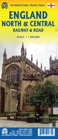 Spoorwegenkaart England North and Central Rail and Road | ITMB
This is a new title for ITMB, and continues our expanded coverage of the United Kingdom. Many publishers carry a map of Great Britain (or of the UK), and a …
 Wegenatlas Big Road Atlas Britain 20256 - A3 | Paperback | AA Publishing
This A3 format atlas is available in two binding styles; softback and spiral bound. Each page has been titled with its geographical location so you can turn to the page …
 Wegenkaart - landkaart Great Britain OS route | Ordnance Survey
Tweezijdige overzichtskaart van heel Engeland en Schotland. Goed duildelijk leesbaar kaartbeeld met de doorgaande en grotere wegen. Ook Nationsle Parken staan er goed op. Ordnance Survey's double-sided OS Route Map …
 Wegenatlas Road Atlas Britain and Ireland 2025 | Ringband | A4-Formaat | Philip's Maps
Let op! Ierland en een gedeelte van Schotland hebben een andere schaal dan de rest van de atlas. 'Good balance between detail and clarity with excellent town maps' What …
★★★★★ Wegenkaart - landkaart Groot - Brittannië | Borch
Mooie geplasticieerde kaart van Groot - Brittanië. Deze kaart biedt een goed overzicht van het land met detailkaarten. Our soft-laminated folded map of Great Britain shows: Scotland and Northern …
★★★★★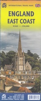 Wegenkaart - landkaart Engeland East Coast - Engeland Oostkust | ITMB
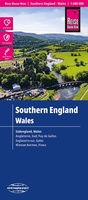 Wegenkaart - landkaart Engeland Zuid & Wales | Reise Know How★★★★★
 Wegenatlas Philip's Easy to Read Road Atlas of Britain 2025 | A3-Formaat | Paperback | Philip's Maps
With the detail you need at a size you can read, the latest edition of 2025 Philip's Big Easy to Read Road Atlas of Britain is super-clear, super-sized and bang …
 Wegenkaart - landkaart Schottland - Nordengland - Schotland + Engeland Noord | Freytag & Berndt
Wegenkaart Schotland – Noord-Engeland (1:400.000) | freytag & berndt Deze gedetailleerde autokaart van Schotland en Noord-Engeland op schaal 1:400.000 is een ideale reisgenoot voor wie het ruige noorden van Groot-Brittannië …
 Wegenatlas Big Easy Read Britain 2026 | A3 | Ringband | AA Publishing
This A3 format atlas provides giant scale mapping and type throughout making it very easy to use. It is available in two binding styles; paperback and spiral bound. Each page …
 Wegenkaart - landkaart Britain road map 2026 | Collins
 Wandelatlas Slow Ways Pocket Atlas | Urban Good
Discover a network of over 9,000 walking routes connecting all of Britain's towns, cities and national landscapes. This bright and beautiful new collection of maps shows every Slow Way route …
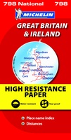 Wegenkaart - landkaart 798 Great Britain & Ireland | Michelin
Scheur- en watervast! Zoals je van Michelin mag verwachten is deze kaart zeer overzichtelijk en heeft een duidelijk helder kaartbeeld. De kaart geeft uitgebreid toeristische informatie weer. Met register, …
Laatste reviews

Prima levering. Prima kaart.
★★★★★ door Felix 11 december 2025 | Heeft dit artikel gekocht
Goed afleesbaar, waterbestendig, zal niet gauw scheuren. We hadden hem ook snel in huis.
★★★★★ door Margo 11 december 2025 | Heeft dit artikel gekocht
Compact , overzicht en handig in gebruik. Scherpe prijs, ik ga er zeker meer bestellen.
★★★★★ door Paula 09 december 2025 | Heeft dit artikel gekocht
Gewoon helemaal goed.
★★★★★ door Paula 09 december 2025 | Heeft dit artikel gekocht