Wandkaart Azië Politiek, 120 x 100 cm | Maps International (9781904892021)
papieren versie
- ISBN / CODE: 9781904892021
- Editie: 14-03-2023
- Aantal blz.: 1
- Schaal: 1:11000000
- Uitgever: Maps International
- Soort: Wandkaart van continenten
- Taal: Engels
- Hoogte: 99.0 cm
- Breedte: 120.0 cm
- Gewicht: 265.0 g
- Cartografie: politiek
- Bindwijze: -
- Uitvoering: Papier
- Beoordeling: 4,3 ★★★★★ ★★★★★ (3 reviews) Schrijf een review
-
€ 27,95
Uitverkocht, nooit meer leverbaar

Beschrijving
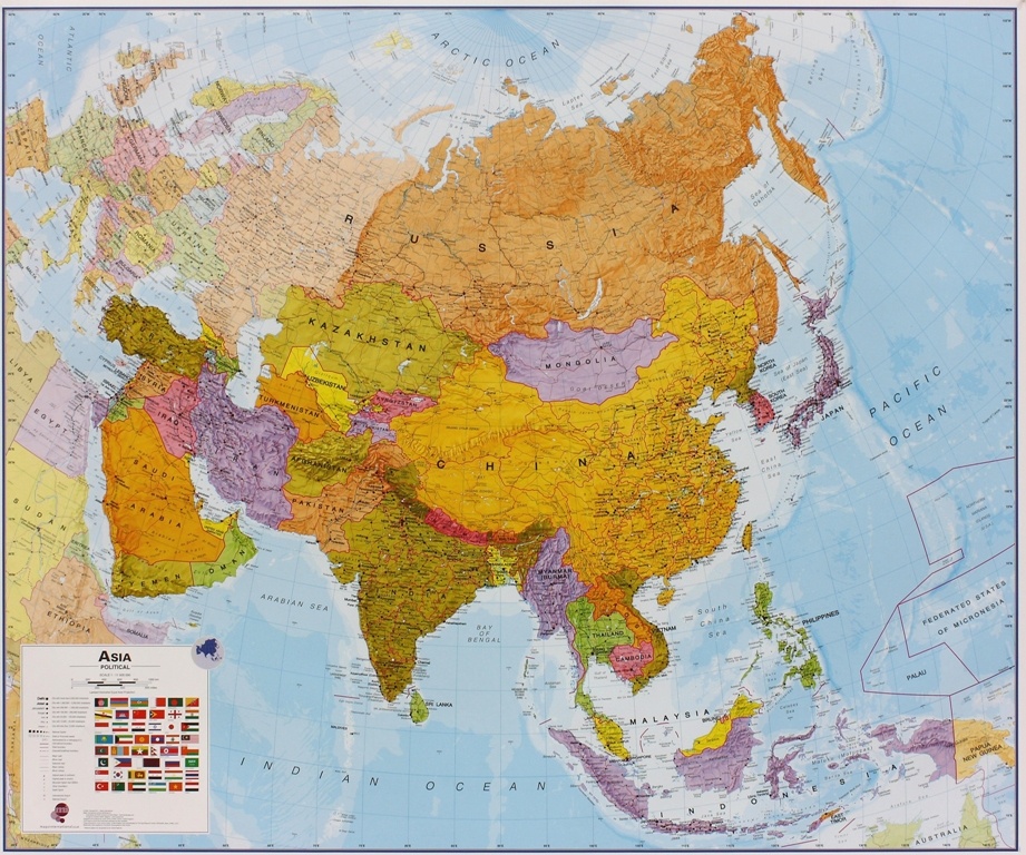
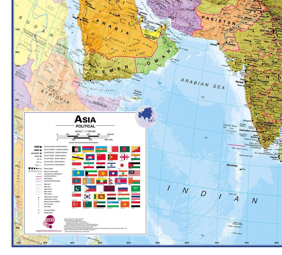
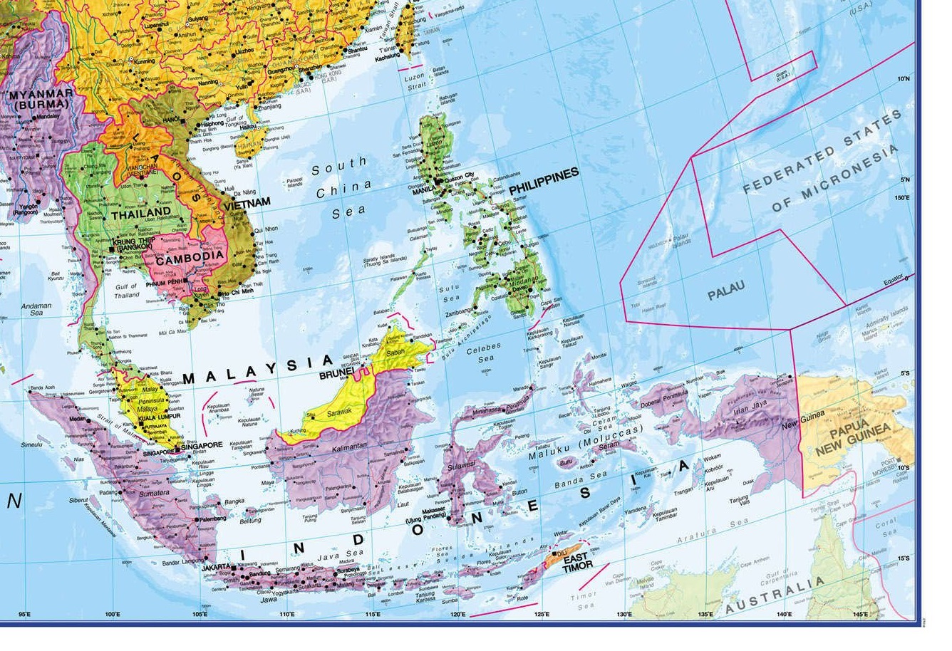
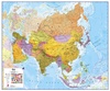
Fraaie politieke kaart van het continent, waarbij vooral de politieke aspecten heel duidelijk te lezen zijn. Alle landen hebben verschillende kleuren, steden en belangrijke verbindingen zijn goed te vinden. Papieren versie, geen ophangsysteem.
Maps International's political wall map of Asia shows all countries from Turkey in the West to Japan in the East, down to Indonesia in the South of Asia. The largest and most populated continent, Asia has a lot to fit onto a map! Rest assured though, with Maps International's high quality of mapping nothing is missed out!
This political wall map of Asia features countries marked in different colours, with international borders clearly shown. The map's key shows the flags from the countries displayed in this map. This Asia physical wall map also contains city population detail, capital cities and all the major towns and cities in this continent of Asia.
Dit product heeft meerdere varianten:


Reviews
We gaan een reis maken via de STAN-landen, China, Mongolië en via Rusland terug. Deze kaart is uitstekend om een globaal overzicht te krijgen over de route die we afleggen. Prima kwaliteit en prachtig formaat. Vlotte levering en geen 'gedoe'!
★★★★★ door Adriaan 10 30 januari 2014Vond u dit een nuttige review? (login om te beoordelen)
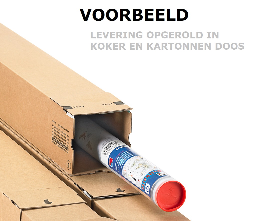
de bestelling is in goede orde ontvangen. De uitlevering was razend snel, de verpakking boven verwachting goed (super, de plastiek kokers). Uw service (reactietijd en vriendelijk) vind ik prima.
★★★★★ door Martin Siller 2 september 2013Vond u dit een nuttige review? (login om te beoordelen)
groot, leesbaar en glossy. Kreukt wel snel, maar mooi drukwerk
★★★★★ door BW Groot 10 juli 2009Vond u dit een nuttige review? (login om te beoordelen)
Schrijf een review
Graag horen wij wat u van dit artikel vindt. Vindt u het goed, leuk, mooi, slecht, lelijk, onbruikbaar of erg handig: schrijf gerust alles op! Het is niet alleen leuk om te doen maar u informeert andere klanten er ook nog mee!
Ook interessant voor azie
-

Wegenkaart - landkaart Continentkaar
€ 18,95Wegenkaarten Azië -

Aanwijswoordenboek - Woordenboek ICO
€ 9,50Aanwijswoordenboeken Afrika -

Magneetbord Azië, politiek, 84 x 96
€ 249,00Magneetborden Azië -

Reisgids ANWB extra Zuid-Korea | ANW
€ 16,50Reisgidsen Seoul -

Reisdagboek Azië | Uitgeverij Elmar
€ 12,95Reisdagboeken Azië
Contactgegevens
T: +31 (0)50 - 3 12 69 50
E: info@dezwerver.nl
![]()
![]()
![]()
![]()
![]()
Bankgegevens
IBAN: NL11 RABO 0140 1961 88
BIC: RABONL2U
Kamer van Koophandel
Kvk: 75240440
BTW-nummer
NL 860203633 B01
BE 0541 545 456
Openingstijden klantenservice
- Maandag10.00 - 12.30 en 13.30 - 17.00
- Dinsdag10.00 - 12.30 en 13.30 - 17.00
- Woensdag10.00 - 12.30 en 13.30 - 17.00
- Donderdag10.00 - 12.30 en 13.30 - 17.00
- Vrijdag10.00 - 12.30 en 13.30 - 17.00
- Zaterdaggesloten
- Zondaggesloten
Nieuwsbrief
Op de hoogte blijven van nieuwe reisgidsen, travelgadgets en kaarten? Geef u op voor onze nieuwsbrief. U ontvangt de nieuwsbrief 1x per maand.
Bekijk hier onze laatste nieuwsbrief:
Onze laatste Nieuwsbrief