Categorieën
- Nieuwe artikelen
- Boeken
-
Kaarten
- Camperkaarten
- Fietskaarten
- Fietsknooppuntenkaarten
- Historische Kaarten
- Pelgrimsroutes (kaarten)
- Spoorwegenkaarten
- Stadsplattegronden
- Topografische kaarten
- Wandelatlassen
- Wandelkaarten
- Wandelknooppuntenkaarten
- Waterkaarten
- Wegenatlassen
-
Wegenkaarten
-
Afrika
- Algerije
- Angola
- Ascension
- Benin
- Botswana
- Burkina Faso
- Burundi
- Centraal Afrikaanse Republiek
- Demokratische Republiek Kongo
- Djibouti
- Egypte
- Eritrea
- Ethiopië
- Gabon
- Gambia
- Ghana
- Guinee
- Guinee - Bissau
- Ivoorkust
- Kaapverdische eilanden
- Kameroen
- Kenia
- Kongo
- Lesotho
- Liberia
- Libië
- Madagascar
- Malawi
- Mali
- Marokko
- Mauretanië
- Mauritius
- Mozambique
- Namibië
- Niger
- Nigeria
- Oeganda
- Reunion
- Rwanda
- Senegal
- Seychellen
- Sierra Leone
- Sint Helena
- Somalië
- Sudan
- Swaziland
- Tanzania
- Togo
- Tristan da Cunha
- Tsjaad
- Tunesië
- Zambia
- Zimbabwe
- Zuid-Afrika
- Azië
- Europa
- Midden-Amerika
- Midden-Oosten
- Noord-Amerika
- Oceanië
- Wereld
- Zuid-Amerika
-
Afrika
- Opruiming
- Puzzels
- Travel Gadgets
- Wandkaarten
- Wereldbollen
Veilig online betalen
Betaal veilig via uw eigen bankomgeving
- U bent hier:
- Home
- Afrika
- Centraal Afrikaanse Republiek
- Kaarten
- Wegenkaarten
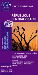
Wegenkaart - landkaart Republique Centrafricane - Centraal Afrikaanse Republiek | IGN - Institut Géographique National (3282118501113)
- ISBN / CODE: 3282118501113
- Schaal: 1:1500000
- Uitgever: IGN - Institut Géographique National
- Soort: Wegenkaart
- Taal: Frans
- Schrijf als eerste een review
-
€ 11,75
Op voorraad. Binnen 2 - 3 werkdagen in huis in Belgie Levertijd Nederland Voor 17.00 uur op werkdagen besteld, morgen in huis in Nederland Levertijd Belgie
Gratis verzending in Nederland vanaf €35,-
- Afbeeldingen
- Inkijkexemplaar
Beschrijving
Goede overzichtskaart van het Franse Cartografisch Instituut. Met autoroutes en stadsplattegronden van de belangrijkste steden.
Indexed map with a plan of Bangui and an administrative map of the country. Topography and terrain are indicated by relief shading and spot heights, with forests, savanna, deserts, areas of seasonal inundation, and boundaries of national parks and forest reserves. Road network includes minor roads and tracks and shows location of petrol stations. The map also indicates hospitals and medical centres, post offices, missions and other religions establishments, selected accommodation, places of interest, etc. Latitude and longitude are marked in the margins at 2º intervals and by cross ticks on the map itself. Map legend is in French only.
The map has an index of place names, and insets showing Bangui and the surrounding area at 1:50,000 with main streets and districts within the city, and an administrative map of the country.
Reviews
Geen reviews gevonden voor dit product.
Schrijf een review
Graag horen wij wat u van dit artikel vindt. Vindt u het goed, leuk, mooi, slecht, lelijk, onbruikbaar of erg handig: schrijf gerust alles op! Het is niet alleen leuk om te doen maar u informeert andere klanten er ook nog mee!
Ook interessant voor afrika/centraal-afrikaanse-republiek
-

Natuurgids Africa Wildlife an introd
€ 9,95Natuurgidsen Angola -

Vogelgids - Natuurgids Africa Birds
€ 9,95Natuurgidsen Algerije -

Wegenkaart - landkaart Kongo - CAR,
€ 13,95Wegenkaarten Centraal Afrikaanse Republiek -

Natuurgids Stuarts' Field Guide to t
€ 27,95Natuurgidsen Angola -

Natuurgids Field Guide to the Larger
€ 25,95Natuurgidsen Botswana


