Wegenkaart - landkaart Africa Equatorial - Afrika midden | ITMB (9781553411857)
- ISBN / CODE: 9781553411857
- Editie: 21-07-2014
- Druk: 1
- Aantal blz.: 1
- Schaal: 1:3400000
- Uitgever: ITMB
- Soort: Wegenkaart
- Taal: Engels
- Hoogte: 25.0 cm
- Breedte: 10.0 cm
- Gewicht: 52.0 g
- Bindwijze: -
- Uitvoering: Papier
- Schrijf als eerste een review
-
€ 14,95
Op voorraad
Op werkdagen vóór 17:00 besteld = dezelfde dag verzonden
Bezorging meestal binnen 1–2 werkdagen. Levertijd BelgieGratis verzending in Nederland vanaf €50,-


Beschrijving
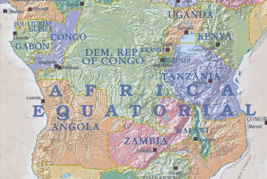
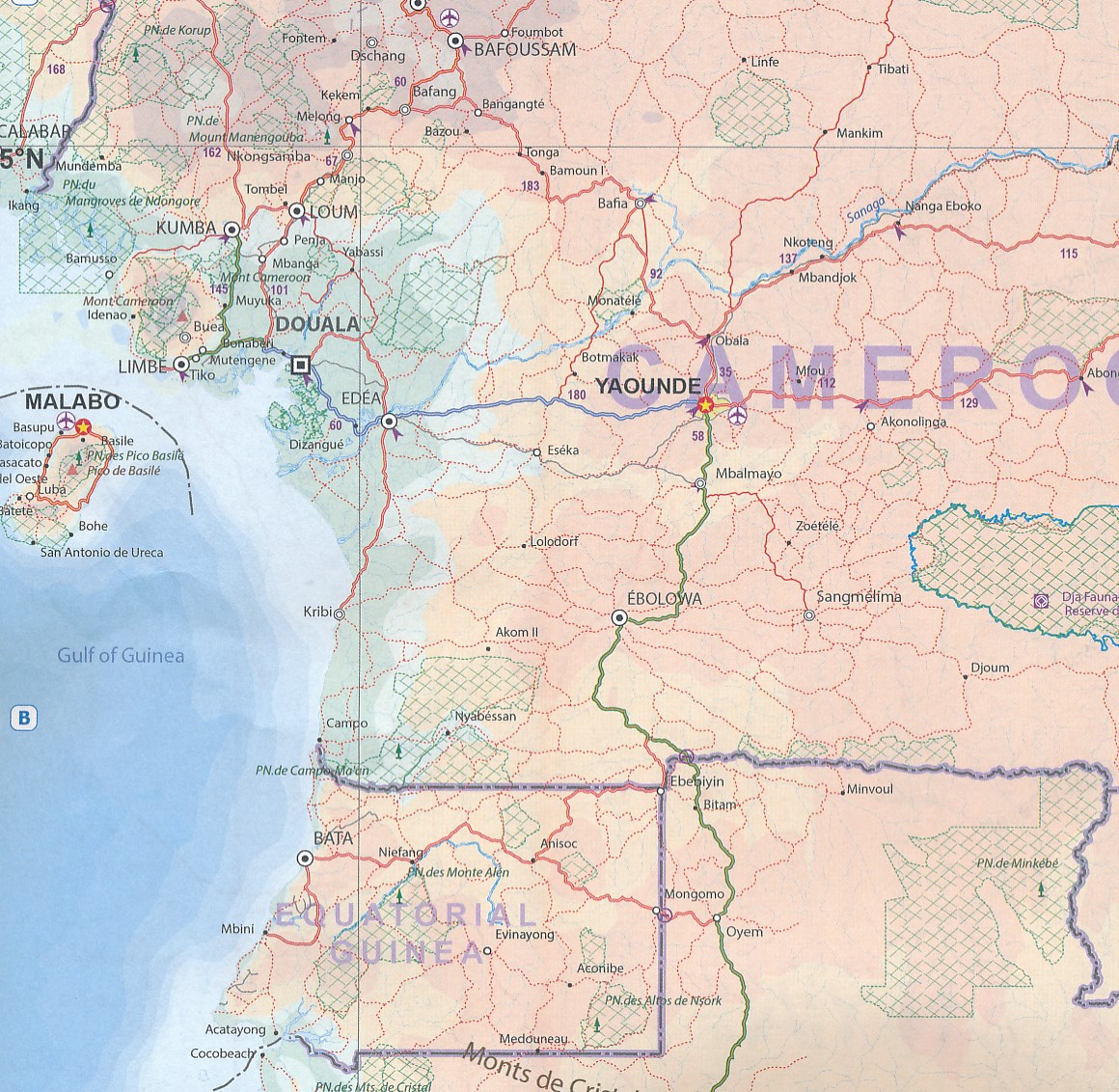
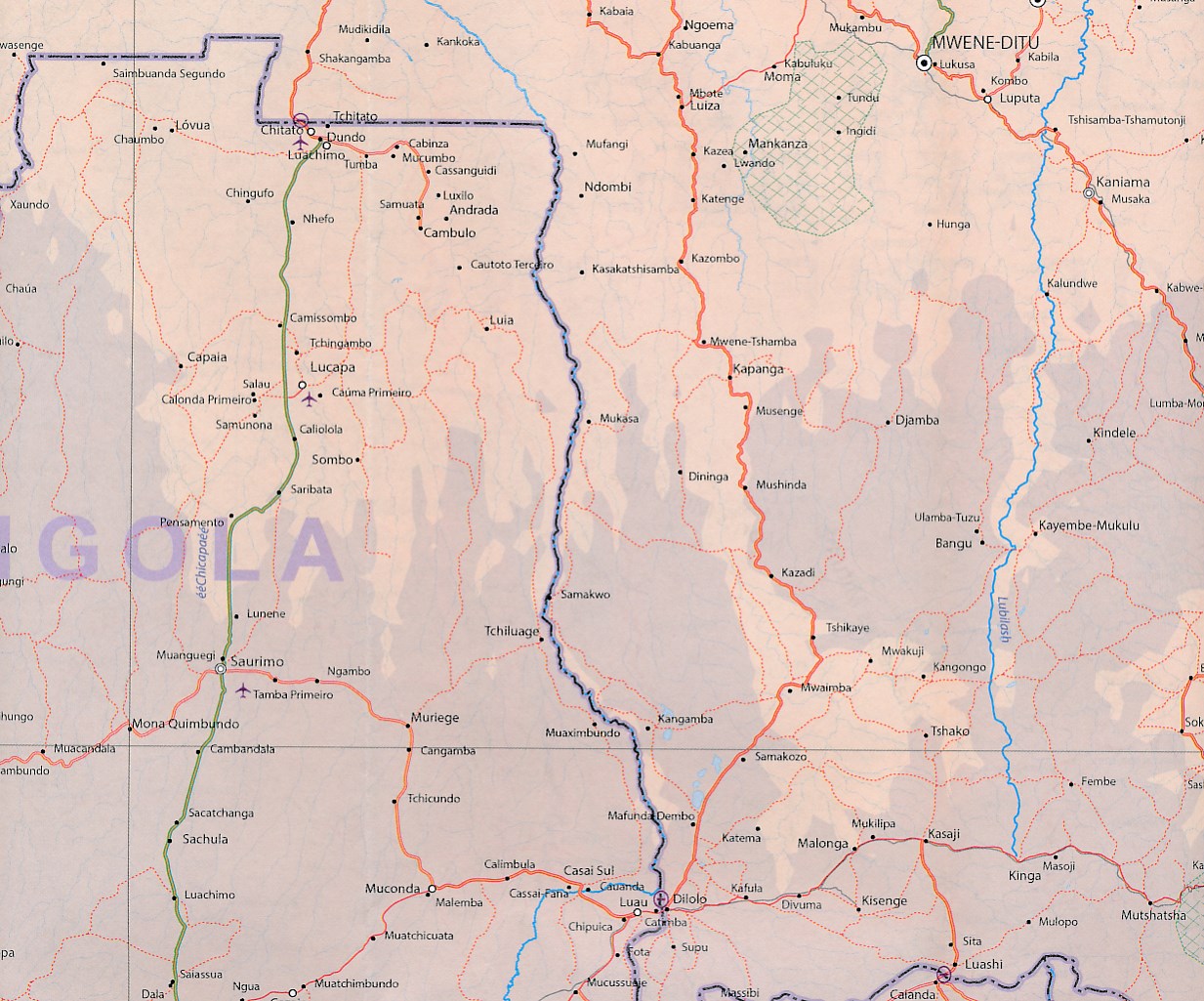
This is the third of our regional maps covering the African continent and covers the portion just south of Nigeria/Cameroun that, essentially, straddles the equator. The jungle-like western half has always been referred to as Equatorial Africa, which is a bit of a mis-nomer because Uganda and Kenya also straddle the equator. The area of coverage of this map is two-fold: to bring the western portion into our growing digital data base and to provide our first-ever ITM map of beautiful East Africa (the KUT countries, Rwanda, and Burundi). Unlike Michelin, that places what it calls Central and Southern Africa on to one large single-sided sheet, we have decided to divide the southern half of the African continent into three double-sided sheets at a better scale. This is the first one, covering Africa as far south as Zambia, with a bit of Zimbabwe. As with all of our regional African maps, this one focuses on road conditions, distances, urban areas, facilities, parks, and attractions.
Reviews
Geen reviews gevonden voor dit product.
Schrijf een review
Graag horen wij wat u van dit artikel vindt. Vindt u het goed, leuk, mooi, slecht, lelijk, onbruikbaar of erg handig: schrijf gerust alles op! Het is niet alleen leuk om te doen maar u informeert andere klanten er ook nog mee!
Ook interessant voor afrika
-

Wandkaart - Prikbord Afrika Politiek
€ 185,00Prikborden Afrika -

Reisverhaal Afrika, meer dan zand al
€ 23,50Reisverhalen Benin -

Kinderpuzzel GeoPuzzle Africa and th
€ 18,95Kinderpuzzels Afrika -

Aanwijswoordenboek - Woordenboek ICO
€ 9,50Aanwijswoordenboeken Afrika -

Natuurgids Dangerous Animals of Sout
€ 43,90Natuurgidsen Afrika