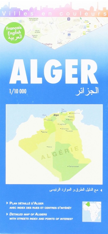
Stadsplattegrond Algiers | Laure Kane (9782917495025)
- ISBN / CODE: 9782917495025
- Editie: 16-03-2009
- Druk: 3
- Aantal blz.: 1
- Schaal: 1:10000
- Uitgever: Laure Kane
- Soort: Stadsplattegrond
- Taal: Frans
- Hoogte: 25.0 cm
- Breedte: 12.0 cm
- Gewicht: 46.0 g
- Bindwijze: -
- Uitvoering: Papier
- Schrijf als eerste een review
-
€ 11,50
Uitverkocht, nooit meer leverbaar
Beschrijving
Stadsplattegrond van Algiers met stratenindex. Frans- en engelstalig.
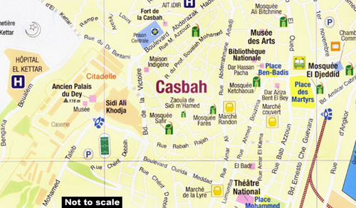
Central Algers on an indexed tourist street plan, showing landmarks and places of interest. Coverage extends from the Cathédrale Notre Dame d’Afrique and the European cemetery in the north to the Presidential Palace and the Riadh El Feth complex (Musée du Djihad) in the south.
Various public buildings, places of interest and facilities such as hotels, markets, tourist information, railway stations and bus terminals, religions buildings, petrol stations, etc, are highlighted in different colours and/or marked by various icons.
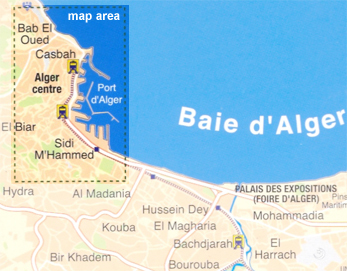
On the back cover is a small road map of the city and the Bay of Algiers area showing the Houari Boumediene international airport and main road and rail links.
The map has a street index, plus separate lists of points of interest, main governmental institutions, selected hotels, medical facilities and mosques.
The map legend is in English, French and Arabic
Reviews
Geen reviews gevonden voor dit product.
Schrijf een review
Graag horen wij wat u van dit artikel vindt. Vindt u het goed, leuk, mooi, slecht, lelijk, onbruikbaar of erg handig: schrijf gerust alles op! Het is niet alleen leuk om te doen maar u informeert andere klanten er ook nog mee!
Ook interessant voor afrika/algerije
-

Reisgids Alger | Petit Futé
€ 16,95Reisgidsen Algerije -

Wegenkaart - landkaart 02 Canadian R
€ 13,95Wegenkaarten Alberta -

Wegenkaart - landkaart Algeria - Alg
€ 14,95Wegenkaarten Algerije -

Vogelgids - Natuurgids Africa Birds
€ 10,95Natuurgidsen Algerije -

Woordenboek Miniwoordenboek Arabisch
€ 14,99Woordenboeken & Taalgidsen Algerije