National Geographic
Dit bekende tv-kanaal heeft naast prachtige natuurdocumontaires en magazines ook zijn eigen reisgidsen en wegenkaarten uitgegeven. De landkaarten zijn gedrukt op scheurvast en waterbestendig papier wat een vergrootte levensduur betekent. De kaarten zijn helder en bevatten een schat aan informatie voor zowel de 'gewone' toerist als de avonturier. De hoofdwegen zijn duidelijk aangegeven, maar ook de secundaire wegen en tracks staan er op. Met de nationale parken duidelijk en mooie zwemplekken of attracties aangegeven onderscheidt deze kaartenserie zich van de andere wegenkaarten. De kaarten heten dan ook niet voor niets Adventure Maps! Het avontuur wacht!
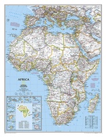 Prikbord Afrika, politiek, 61 x 78 cm | National Geographic
Mooie wandkaart van Afrika, staatkundig, met rustig kleurgebruik en helder kaartbeeld, Ondanks het wat kleiner formaat staan er toch heel wat topografische details op vermeld. Kaart is up-to-date, alleen …
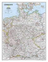 Wandkaart Germany – Duitsland, 58 x 76 cm | National Geographic
Decoratieve wandkaart van Duitsland. Naast de mooie kleuren staan er bijzonder veel plaatsen op vermeld. National Geographic's political map of Germany includes everything from country boundaries, major roads, towns and …
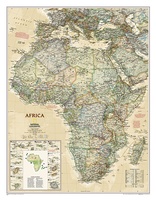 Wandkaart Afrika, politiek & antiek, 61 x 78 cm | National Geographic
Mooie wandkaart van Afrika, staatkundig, met rustig kleurgebruik en helder kaartbeeld, Ondanks het wat kleiner formaat staan er toch heel wat topografische details op vermeld. Kaart is up-to-date, alleen …
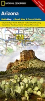 Wegenkaart - landkaart State Guide Map Arizona | National Geographic
Makkelijk leesbare kaart aan 2 zijden bedrukt. De ene kan met informatie en beperkte stadsplattegronden, de andere met de daadwerkelijke kaart. De kaart is geplastificeerd en dus watervast! The front …
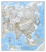 Magneetbord Azië, politiek, 84 x 96 cm | National Geographic
Mooie wandkaart van Azië, staatkundig, met rustig kleurgebruik en helder kaartbeeld, Ondanks het wat kleiner formaat staan er toch heel wat topografische details op vermeld. De kaart wordt in …
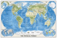 Wereldkaart Natuurkundig, oceaanbodem, 116 x 77 cm | National Geographic
Bijzonder fraaie natuurkundige kaart van National Geographic waarbij het accent ligt op de fysische aspecten van de aarde met veel details van de oceanen. Een schoonheid aan de muur! …
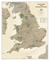 Wandkaart Engeland en Wales, antiek, 76 x 91 cm | National Geographic
This earth-toned, executive-style map of England and Wales shows political boundaries, major highways and roads, cities and towns, airports, and other geographic details. Thousands of place-names and exact borders are …
 Wandkaart Afghanistan & Pakistan, 55 x 83 cm | National Geographic
This is the latest and most detailed map of the region - a perfect complement for following today's news stories. Afghanistan's 34 administrative provinces and Pakistan's provinces and territorial boundaries …
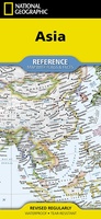 Wegenkaart - landkaart Asia - Azië | National Geographic
• Waterproof • Tear-Resistant • Reference Map Expertly researched and designed, National Geographic's Asia Flags & Facts Map is the authoritative map of Asia by which other reference maps …
 Wegenkaart - landkaart Australia and Oceania | National Geographic
• Waterproof • Tear-Resistant • Reference Map Expertly researched and designed, National Geographic's Australia and Oceania Flags & Facts Map is the authoritative map of Australia by which other …
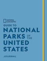 Reisgids Guide to National Parks of the United States Journal | National Geographic
Fans of National Geographic’s guides to the National Parks will flock to create a bucket list of their own in this one-of-a-kind journal. The companion to Guide to the National …
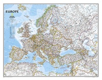 Wandkaart Europa, politiek, 114 x 88 cm | National Geographic
This colorful Europe political map clearly shows country boundaries, capitals, many major cities, bodies of water, airports, major highways and roads, and much more.
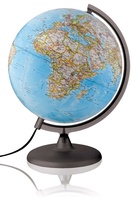 Wereldbol - Globe Classic | ø 30 cm | Engelstalig | Met verlichting | National Geographic★★★★★
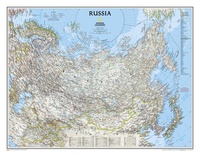 Wandkaart - Wandkaart Russia – Rusland, 77 x 60 cm | National Geographic
Decoratieve wandkaart van het land. Naast de mooie kleuren staan er bijzonder veel plaatsen op vermeld. National Geographic's classic wall map of Russia and the independent states of the former …
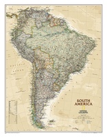 Wandkaart Zuid Amerika, politiek & antiek, 60 x 77 cm | National Geographic
This elegant, richly colored map of South America shows political boundaries, place names, airports, major roads and highways, and other geographic features for the entire continent.
 Wandkaart Zuid Amerika, politiek, 91 x 117 cm | National Geographic
Staatkundige kaart van Zuid-Amerika (in kleur). De kaart wordt verzonden in een koker. This classic map of South America shows political boundaries, place names, airports, major roads and highways, and …
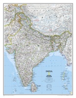 Wandkaart India, 60 x 77 cm | National Geographic
See India as only National Geographic can depict it. This new reference map is one of the most detailed and comprehensive ever published for India and southern Asia. It includes …
 Wandkaart Canada, antiek, 97 x 82 cm | National Geographic
Our most detailed wall map of Canada, features the classic National Geographic reference styling. Features thousands of place names, accurate political boundaries, national parks, archeological sites, and major infrastructure networks …
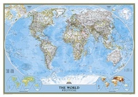 Wereldkaart Politiek, 92 x 61 cm | National Geographic
Politieke wereldkaart van National Geographic. De klassieke blauwe vorm, met helder kaartbeeld. De landen hebben met kleuren duidelijke grenzen en er staan opvallend veel topografische details op. Ondanks de schaal …
 Wandkaart Cuba, 92 x 61 cm | National Geographic
The most accurate and richly detailed reference map available for the iconic Caribbean island nation, our Cuba Classic Map contains National Geographic’s proprietary fonts and world recognized border bands in …
Laatste reviews

Prachtige wandelgids voorzien van alle voor de wandelaars benodigde informatie (accommodaties, restaurants en cafés, vervoersmogelijkheden enz.). Ook is de gids beschreven in twee richtingen en …
★★★★★ door Mathie Hoenjet 27 juni 2026 | Heeft dit artikel gekocht
Zoals altijd duidelijke en overzichtelijke kaart van Michelin
★★★★★ door Charles Trippelvitz 26 juni 2026 | Heeft dit artikel gekocht
Door deze gids konden we ons heel goed voorbereiden op onze fietstocht. En het gebruik onderweg was ook prima. Jammer dat de campings onderweg wat …
★★★★★ door Helma Feenstra 26 juni 2026 | Heeft dit artikel gekocht
Kort voor vakantie naar de Galapagos eilanden toch nog behoefte aan extra reisgids. Simpel kunnen bestellen en snelle levering. Zou niet weten wat er beter …
★★★★★ door Piet Grootenboer 25 juni 2026 | Heeft dit artikel gekocht