Winkelwagen
Geen items in winkelwagen
Ga naar winkelwagen
IGN - Institut Géographique National
IGN is de officiële instantie voor geografische informatie in Frankrijk ofwel Institut Géographique National. Ze staan bekend om de zeer goede wandelkaarten op schaal 1:25.000 (Serie Bleue en Top 25) van Frankrijk. De wandelkaarten zijn dan ook zeer uitgebreid. De wandelaar vindt hier alle wandelpaden, campings en langeafstandswandelpaden, ook wel GR-paden (Grande Randonnée) genoemd. Kleine weggetjes en paden, maar ook de verschillende types landschappen en bebouwingen, populaire gebieden en onontdekte parels: de wandelaar in Frankrijk vindt alles terug op deze betrouwbare kaarten van IGN.
Naast wandelkaarten geeft het IGN ook goede fiets- c.q. wegenkaarten op schaal 1:100.000 (serie Top 100) en fietskaarten op schaal 1:75.000 (serie Top 75) uit.
 Wandelkaart - Topografische kaart 1445 SB - Serie Bleue Mauléon-Licharre – St-Palais | IGN - Institut Géographique National
 Wandelkaart - Topografische kaart 1446ET Tardets-Sorholus, Arette | IGN - Institut Géographique National★★★★★
 Wegenkaart - landkaart 15 TOP 250 Auvergne - Rhône-Alpes - Massif Alpin | IGN - Institut Géographique National
 Wandelkaart - Topografische kaart 1512OT Bayeux Arromanches Les Bains Plages - Normandië | IGN - Institut Géographique National★★★★★
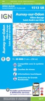 Wandelkaart - Topografische kaart 1513 SB - Serie Bleue Aunay-sur-Odon | IGN - Institut Géographique National
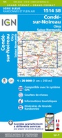 Topografische kaart - Wandelkaart 1514 SB - Serie Bleue Condé-sur-Noireau | IGN - Institut Géographique National★★★★★
 Wandelkaart - Topografische kaart 1515 SB - Serie Bleue Flers | IGN - Institut Géographique National
 Wandelkaart - Topografische kaart 1516SB SB - Serie Bleue Domfront | IGN - Institut Géographique National
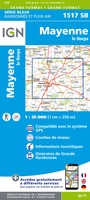 Wandelkaart - Topografische kaart 1517 SB - Serie Bleue Mayenne - Le Horps | IGN - Institut Géographique National★★★★★
 Wandelkaart - Topografische kaart 1518 SB - Serie Bleue Evron - Montsûrs | IGN - Institut Géographique National★★★★★
 Wandelkaart - Topografische kaart 1519 SB - Serie Bleue Meslay-du-Maine, Vaiges | IGN - Institut Géographique National
 Wandelkaart - Topografische kaart 1520 SB - Serie Bleue Château-Gontier | IGN - Institut Géographique National
 Wandelkaart - Topografische kaart 1521 SB - Serie Bleue le Lion-d'Angers | IGN - Institut Géographique National
 Wandelkaart - Topografische kaart 1522ET Angers | IGN - Institut Géographique National
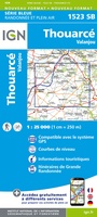 Wandelkaart - Topografische kaart 1523 SB - Serie Bleue Thouarcé | IGN - Institut Géographique National
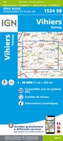 Topografische kaart - Wandelkaart 1524 SB - Serie Bleue Vihiers | IGN - Institut Géographique National
 Topografische kaart - Wandelkaart 1525 SB - Serie Bleue Bressuire | IGN - Institut Géographique National
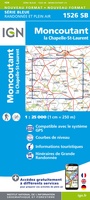 Wandelkaart - Topografische kaart 1526 SB - Serie Bleue Moncoutant - La Chapelle-Saint-Laurent | IGN - Institut Géographique National
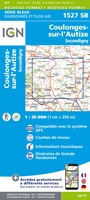 Wandelkaart - Topografische kaart 1527 SB - Serie Bleue Coulonges-sur-l'Autize, Secondigny | IGN - Institut Géographique National
 Wandelkaart - Topografische kaart 1528 SB - Serie Bleue Niort | IGN - Institut Géographique National
Laatste reviews

Compact en toch volledig
Een compact boekje met 6 kaartjes van de voor een toerist belangrijkste Londense buurten met veel details en een overzicht van de metrolijnen. Super handig …
★★★★★ door Corine van der Hoeven 12 januari 2026 | Heeft dit artikel gekocht
Superleuk fiets boek
Erg blij met het boek onbegrensd fietsen naar Andalusië. We zijn ons nu aan het inlezen en krijgen enorm veel zin om te gaan. Er …
★★★★★ door Monique 12 januari 2026 | Heeft dit artikel gekocht
Compact gedetailleerd en overzichtelijk!
Heel blij met dit wandelgidsje. Mooie kaartjes, per etappe, ook restaurants en overnachting. Ideaal vooraf om te plannen en onderweg. Mooi compact!
★★★★★ door Peter 12 januari 2026 | Heeft dit artikel gekocht
Prima gids.
Gewoon handig boekje voor de info en planning. Route is heel goed gemarkeerd.
★★★★★ door Pieter 12 januari 2026 | Heeft dit artikel gekocht