Winkelwagen
Geen items in winkelwagen
Ga naar winkelwagen
IGN - Institut Géographique National
IGN is de officiële instantie voor geografische informatie in Frankrijk ofwel Institut Géographique National. Ze staan bekend om de zeer goede wandelkaarten op schaal 1:25.000 (Serie Bleue en Top 25) van Frankrijk. De wandelkaarten zijn dan ook zeer uitgebreid. De wandelaar vindt hier alle wandelpaden, campings en langeafstandswandelpaden, ook wel GR-paden (Grande Randonnée) genoemd. Kleine weggetjes en paden, maar ook de verschillende types landschappen en bebouwingen, populaire gebieden en onontdekte parels: de wandelaar in Frankrijk vindt alles terug op deze betrouwbare kaarten van IGN.
Naast wandelkaarten geeft het IGN ook goede fiets- c.q. wegenkaarten op schaal 1:100.000 (serie Top 100) en fietskaarten op schaal 1:75.000 (serie Top 75) uit.
 Wandelkaart - Topografische kaart 3637OT Mont Viso | IGN - Institut Géographique National★★★★★
 Wandelkaart - Topografische kaart 3637OTR Mont Viso | IGN - Institut Géographique National★★★★★
 Wandelkaart - Topografische kaart 3639OT Haute Tinée 1 | IGN - Institut Géographique National
 Wandelkaart - Topografische kaart 3640ET Haute Tinée 2 | IGN - Institut Géographique National
 Wandelkaart - Topografische kaart 3640OT Haut Cians | IGN - Institut Géographique National
 Wandelkaart - Topografische kaart 3641ET Moyenne Tinée | IGN - Institut Géographique National
 Wandelkaart - Topografische kaart 3641OT Moyen Var | IGN - Institut Géographique National
 Wandelkaart - Topografische kaart 3642ET Vallée de l'Esteron | IGN - Institut Géographique National
 Wandelkaart 3643ET Cannes / Grasse / Côte d'Azur | IGN - Institut Géographique National
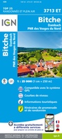 Wandelkaart - Topografische kaart 3713ET Pays de Bitche - Dambach - PNR des Vosges du Nord | IGN - Institut Géographique National
 Wandelkaart - Topografische kaart 3714ET la Petite Pierre - Petite Pierre, Niederbronn-les-Bains, PNR Vosges du Nord | IGN - Institut Géographique National
 Wandelkaart - Topografische kaart 3715ET Wasselone - Rocher de Dabo - Saverne | IGN - Institut Géographique National
 Wandelkaart - Topografische kaart 3715OT Sarrebourg - Phalsbourg - Pays des Etangs | IGN - Institut Géographique National★★★★★
 Wandelkaart - Topografische kaart 3716ET le Donon, Obernai, Mont Ste-Odile | IGN - Institut Géographique National★★★★★
 Wandelkaart - Topografische kaart 3716ETR Le Donon - Obernai | IGN - Institut Géographique National
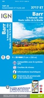 Wandelkaart - Topografische kaart 3717ET Barr - Le Howald - Villé - Vallée de la Bruche | IGN - Institut Géographique National★★★★★
 Wandelkaart - Topografische kaart 3717ETR Barr / Le Howald / Villé / Hte Vallée de la Bruche | IGN - Institut Géographique National
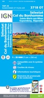 Wandelkaart - Topografische kaart 3718OT Selestat - Col Du Bonhomme | IGN - Institut Géographique National★★★★★
 Wandelkaart - Topografische kaart 3718OTR Sélestat, Col du Bonhomme | IGN - Institut Géographique National
 Wandelkaart - Topografische kaart 3719 SB - Serie Bleue Colmar | IGN - Institut Géographique National
Laatste reviews

Super
Rother wandelgidsen stellen nooit teleur. Mooie routes, goede opgave kilometers, hoogtemeters en horeca. Een aanrader!
★★★★★ door Anita Geel 13 januari 2026 | Heeft dit artikel gekocht
Prachtig boek!
Mooi boek met prachtige foto’s! Voldoet helemaal aan mijn verwachtingen.
★★★★★ door Hans Eldering 13 januari 2026 | Heeft dit artikel gekocht
zeer vlotte levering
het product voldeed aan mijn verwachtingen en was geplastificeerd wat natuurlijk perfect is voor kaart die veel wordt geraadpleegd!
★★★★★ door Peter Lantinga 13 januari 2026 | Heeft dit artikel gekocht
Gedetailleerde wegenkaart
Ik heb de wegenkaart Maleisië aangeschaft om zelf een rondreis per huurauto te kunnen plannen. Deze kaart heeft daar heel goed bij geholpen doordat er …
★★★★★ door M. Rizvi 13 januari 2026 | Heeft dit artikel gekocht