Winkelwagen
Geen items in winkelwagen
Ga naar winkelwagen
IGN - Institut Géographique National
IGN is de officiële instantie voor geografische informatie in Frankrijk ofwel Institut Géographique National. Ze staan bekend om de zeer goede wandelkaarten op schaal 1:25.000 (Serie Bleue en Top 25) van Frankrijk. De wandelkaarten zijn dan ook zeer uitgebreid. De wandelaar vindt hier alle wandelpaden, campings en langeafstandswandelpaden, ook wel GR-paden (Grande Randonnée) genoemd. Kleine weggetjes en paden, maar ook de verschillende types landschappen en bebouwingen, populaire gebieden en onontdekte parels: de wandelaar in Frankrijk vindt alles terug op deze betrouwbare kaarten van IGN.
Naast wandelkaarten geeft het IGN ook goede fiets- c.q. wegenkaarten op schaal 1:100.000 (serie Top 100) en fietskaarten op schaal 1:75.000 (serie Top 75) uit.
 Wandelkaart - Topografische kaart 2542OT Camarès - Avène | IGN - Institut Géographique National
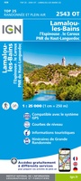 Wandelkaart - Topografische kaart 2543OT Lamalou-les-Bains, Olargues, Roquebrun, Le Caroux, PNR du Haut Languedoc | IGN - Institut Géographique National★★★★★
 Wandelkaart - Topografische kaart 2545OT St-Chinian - L'etang de Montady | IGN - Institut Géographique National
 Wandelkaart - Topografische kaart 2546OT Narbonne | IGN - Institut Géographique National
 Wandelkaart 2548OT Perpignan / Plages du Roussillon | IGN - Institut Géographique National
 Wandelkaart - Topografische kaart 2549OT Banyuls-sur-Mer | IGN - Institut Géographique National
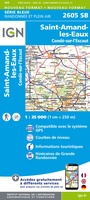 Wandelkaart - Topografische kaart 2605 SB - Serie Bleue Condé-sur-l'Escaut, St-Amand-les-Eaux | IGN - Institut Géographique National
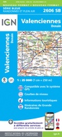 Wandelkaart - Topografische kaart 2606 SB - Serie Bleue Valenciennes - Denain | IGN - Institut Géographique National
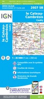 Wandelkaart - Topografische kaart 2607 SB - Serie Bleue Le Cateau-Cambrésis, Caudry | IGN - Institut Géographique National
 Wandelkaart - Topografische kaart 2608 SB - Serie Bleue Bohain-en-Vermandois, Guise | IGN - Institut Géographique National
 Wandelkaart - Topografische kaart 2609 SB - Serie Bleue Ribemont - Saint Quentin | IGN - Institut Géographique National
 Wandelkaart - Topografische kaart 2610 SB - Serie Bleue Tergnier, Forêt de St-Gobain et Coucy Basse | IGN - Institut Géographique National
 Wandelkaart - Topografische kaart 2611 SB - Serie Bleue Braine - Soissons | IGN - Institut Géographique National
 Wandelkaart - Topografische kaart 2612 SB - Serie Bleue Fère-en-Tardenois, Neuilly-St-Front | IGN - Institut Géographique National
 Wandelkaart - Topografische kaart 2613 SB - Serie Bleue Château-Thierry, Charly-sur-Marne | IGN - Institut Géographique National★★★★★
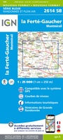 Wandelkaart - Topografische kaart 2614 SB - Serie Bleue La Ferté-Gaucher, Montmirail | IGN - Institut Géographique National
 Wandelkaart - Topografische kaart 2615 SB - Serie Bleue Esternay, Villiers-St-Georges | IGN - Institut Géographique National
 Wandelkaart - Topografische kaart 2616 SB - Serie Bleue Provins | IGN - Institut Géographique National
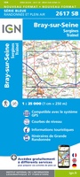 Wandelkaart - Topografische kaart 2617 SB - Serie Bleue Bray-sur-Seine | IGN - Institut Géographique National
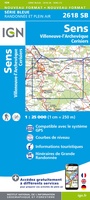 Wandelkaart - Topografische kaart 2618 SB - Serie Bleue Sens | IGN - Institut Géographique National
Laatste reviews

Super
Rother wandelgidsen stellen nooit teleur. Mooie routes, goede opgave kilometers, hoogtemeters en horeca. Een aanrader!
★★★★★ door Anita Geel 13 januari 2026 | Heeft dit artikel gekocht
Prachtig boek!
Mooi boek met prachtige foto’s! Voldoet helemaal aan mijn verwachtingen.
★★★★★ door Hans Eldering 13 januari 2026 | Heeft dit artikel gekocht
zeer vlotte levering
het product voldeed aan mijn verwachtingen en was geplastificeerd wat natuurlijk perfect is voor kaart die veel wordt geraadpleegd!
★★★★★ door Peter Lantinga 13 januari 2026 | Heeft dit artikel gekocht
Gedetailleerde wegenkaart
Ik heb de wegenkaart Maleisië aangeschaft om zelf een rondreis per huurauto te kunnen plannen. Deze kaart heeft daar heel goed bij geholpen doordat er …
★★★★★ door M. Rizvi 13 januari 2026 | Heeft dit artikel gekocht