Winkelwagen
Geen items in winkelwagen
Ga naar winkelwagen
IGN - Institut Géographique National
IGN is de officiële instantie voor geografische informatie in Frankrijk ofwel Institut Géographique National. Ze staan bekend om de zeer goede wandelkaarten op schaal 1:25.000 (Serie Bleue en Top 25) van Frankrijk. De wandelkaarten zijn dan ook zeer uitgebreid. De wandelaar vindt hier alle wandelpaden, campings en langeafstandswandelpaden, ook wel GR-paden (Grande Randonnée) genoemd. Kleine weggetjes en paden, maar ook de verschillende types landschappen en bebouwingen, populaire gebieden en onontdekte parels: de wandelaar in Frankrijk vindt alles terug op deze betrouwbare kaarten van IGN.
Naast wandelkaarten geeft het IGN ook goede fiets- c.q. wegenkaarten op schaal 1:100.000 (serie Top 100) en fietskaarten op schaal 1:75.000 (serie Top 75) uit.
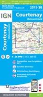 Wandelkaart - Topografische kaart 2519 SB - Serie Bleue Courtenay, Château-Renard | IGN - Institut Géographique National
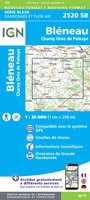 Wandelkaart - Topografische kaart 2520 SB - Serie Bleue Champignelles, Bléneau, Charny Orée de Puisaye | IGN - Institut Géographique National
 Wandelkaart - Topografische kaart 2521 SB - Serie Bleue St-Fargeau, Neuvy-sur-Loire | IGN - Institut Géographique National★★★★★
 Topografische kaart - Wandelkaart 2523 SB - Serie Bleue La Charité-sur-Loire | IGN - Institut Géographique National
 Wandelkaart - Topografische kaart 2524 SB - Serie Bleue Nevers, Jouet-sur-l'Aubois | IGN - Institut Géographique National
 Wandelkaart - Topografische kaart 2525 SB - Serie Bleue La Guerche-sur-l'Aubois, Sancoins, Magny-Cours | IGN - Institut Géographique National
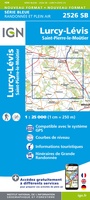 Topografische kaart - Wandelkaart 2526 SB - Serie Bleue Lurcy-Lévis | IGN - Institut Géographique National
 Wandelkaart 2527 SB - Serie Bleue Bourbon-l'Archambault | IGN - Institut Géographique National
 Wandelkaart - Topografische kaart 2528 SB - Serie Bleue Tronget - Montmarault | IGN - Institut Géographique National
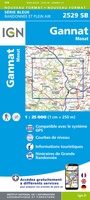 Wandelkaart - Topografische kaart 2529 SB - Serie Bleue Gannat | IGN - Institut Géographique National
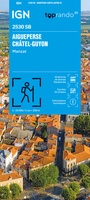 Wandelkaart 2530 SB - Serie Bleue Aigueperse / Châtel-Guyon / Manzat | IGN - Institut Géographique National
 Wandelkaart - Topografische kaart 2531 SB - Serie Bleue Clermont-Ferrand | IGN - Institut Géographique National
 Wandelkaart - Topografische kaart 2531ET Chaîne des Puys | IGN - Institut Géographique National
 Wandelkaart - Topografische kaart 2531ETR Chaîne des Puys / PNR Volcans d'Auvergne | IGN - Institut Géographique National
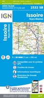 Wandelkaart - Topografische kaart 2532 SB - Serie Bleue Veyre-Monton, Issoire | IGN - Institut Géographique National
 Wandelkaart - Topografische kaart 2534 SB - Serie Bleue Massiac - Ardes | IGN - Institut Géographique National
 2534OT Monts du Cézallier | IGN - Institut Géographique National
 Wandelkaart - Topografische kaart 2535 SB - Serie Bleue St-Flour, Murat | IGN - Institut Géographique National
 Wandelkaart - Topografische kaart 2536 SB - Serie Bleue Chaudes-Aigues, Gorges de la Truyère, Faverolles | IGN - Institut Géographique National
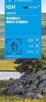 Wandelkaart 2537OT Nasbinals - Monts d'Aubrac | IGN - Institut Géographique National
Laatste reviews

Verassend goede en rijke wandelgids
Deze gids bevat een schat an informatie over talloze rondwandelingen langs de Jurassic Coast, met veel aandacht voor de geologische aspecten van deze kust. De …
★★★★★ door Raymond Franssen 13 juni 2026 | Heeft dit artikel gekocht
Informatief boekje
In deze nieuwe uitgave ontbreekt de routebeschrijving. Het bevat daar ipv veel info over de omgeving. Dat is leuk. De route is goed te wandelen …
★★★★★ door Irma Smit 13 juni 2026 | Heeft dit artikel gekocht
Goede kaart
Duidelijke kaart voor gebied te verkennen met Moto
★★★★★ door Van Puymbroeck René 12 juni 2026 | Heeft dit artikel gekocht
Fijne kaart
Goede leesbare kaart inclusief route suggesties. Heb alleen op de kaart gelopen, zonder mobiele apparatuur. Heel goed te doen.
★★★★★ door Nick 10 juni 2026 | Heeft dit artikel gekocht