Winkelwagen
Geen items in winkelwagen
Ga naar winkelwagen
IGN - Institut Géographique National
IGN is de officiële instantie voor geografische informatie in Frankrijk ofwel Institut Géographique National. Ze staan bekend om de zeer goede wandelkaarten op schaal 1:25.000 (Serie Bleue en Top 25) van Frankrijk. De wandelkaarten zijn dan ook zeer uitgebreid. De wandelaar vindt hier alle wandelpaden, campings en langeafstandswandelpaden, ook wel GR-paden (Grande Randonnée) genoemd. Kleine weggetjes en paden, maar ook de verschillende types landschappen en bebouwingen, populaire gebieden en onontdekte parels: de wandelaar in Frankrijk vindt alles terug op deze betrouwbare kaarten van IGN.
Naast wandelkaarten geeft het IGN ook goede fiets- c.q. wegenkaarten op schaal 1:100.000 (serie Top 100) en fietskaarten op schaal 1:75.000 (serie Top 75) uit.
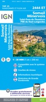 Wandelkaart - Topografische kaart 2444ET Somail - Minervois | IGN - Institut Géographique National
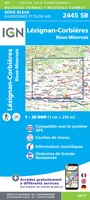 Wandelkaart - Topografische kaart 2445 SB - Serie Bleue Lézignan - Corbieres, Rieux-Minervois | IGN - Institut Géographique National
 Wandelkaart - Topografische kaart 2446 SB - Serie Bleue Ferrals-les-Corbières, Capendu | IGN - Institut Géographique National
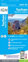 Wandelkaart - Topografische kaart 2447OT Tuchan | IGN - Institut Géographique National
 Wandelkaart - Topografische kaart 2448OT Thuir, Ille-sur-Tet, Latour-de-France, Estagel, Millas | IGN - Institut Géographique National
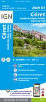 Wandelkaart - Topografische kaart 2449OT Céret, Amélie-les-Bains-Palalda, Vallée du Tech | IGN - Institut Géographique National
 Wandelkaart - Topografische kaart 2504 SB - Serie Bleue Lille - Roubaix - Tourcoing | IGN - Institut Géographique National
 Wandelkaart - Topografische kaart 2505 SB - Serie Bleue Leforest - Cysoing - Hénin-Beaumont - Carvin | IGN - Institut Géographique National
 Wandelkaart - Topografische kaart 2506 SB - Serie Bleue Douai - Rouvroy - Vitry-en-Artois | IGN - Institut Géographique National
 Wandelkaart - Topografische kaart 2507 SB - Serie Bleue Cambrai - Bertincourt | IGN - Institut Géographique National
 Wandelkaart - Topografische kaart 2508 SB - Serie Bleue Roisel - Péronne | IGN - Institut Géographique National
 Wandelkaart - Topografische kaart 2509 SB - Serie Bleue Ham - Nesle | IGN - Institut Géographique National
 Wandelkaart - Topografische kaart 2510 SB - Serie Bleue Chauny - Noyon | IGN - Institut Géographique National
 Wandelkaart - Topografische kaart 2511OT Forêts de Compiègne | IGN - Institut Géographique National★★★★★
 Wandelkaart - Topografische kaart 2512OT Villers-Cotterêts | IGN - Institut Géographique National
 Wandelkaart - Topografische kaart 2513OT Meaux - Vallée de l'Ourcq, Centre | IGN - Institut Géographique National
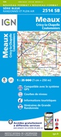 Wandelkaart - Topografische kaart 2514 SB - Serie Bleue Meaux | IGN - Institut Géographique National
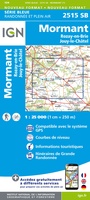 Wandelkaart - Topografische kaart 2515 SB - Serie Bleue Mormant, Rozay-en-Brie, Jouy-le-Châtel | IGN - Institut Géographique National
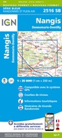 Wandelkaart - Topografische kaart 2516 SB - Serie Bleue Donnemarie-Dontilly, Nangis | IGN - Institut Géographique National
 Wandelkaart - Topografische kaart 2517 SB - Serie Bleue Montereau-Fault-Yonne, Moret-Loing-et-Orvanne | IGN - Institut Géographique National
Laatste reviews

Perfect geregeld.
Michelin Camping gids Frankrijk 2026: Per omgaande, netjes verpakt geleverd.
★★★★★ door Cor 27 april 2026 | Heeft dit artikel gekocht
Leuk informatief boekje
Het boekje geeft een goede indruk van de Mullerthal Trail met wat feitelijke info, heel handig, en vooral ook een mooi sfeerbeeld.
★★★★★ door Odette 27 april 2026 | Heeft dit artikel gekocht
Prima wandelkaart
De routes zijn zo goed bewegwijzerd, dat je bijna geen kaart nodig hebt. Wij hebben hem vooral gebruikt om per dag te bekijken wat we …
★★★★★ door Odette 27 april 2026 | Heeft dit artikel gekocht
Kwalitatieve topkaart
Heldere gedetailleerde kaart, onmisbaar voor tochtplanning, waterafstotend
★★★★★ door Walter 24 april 2026 | Heeft dit artikel gekocht