Winkelwagen
Geen items in winkelwagen
Ga naar winkelwagen
IGN - Institut Géographique National
IGN is de officiële instantie voor geografische informatie in Frankrijk ofwel Institut Géographique National. Ze staan bekend om de zeer goede wandelkaarten op schaal 1:25.000 (Serie Bleue en Top 25) van Frankrijk. De wandelkaarten zijn dan ook zeer uitgebreid. De wandelaar vindt hier alle wandelpaden, campings en langeafstandswandelpaden, ook wel GR-paden (Grande Randonnée) genoemd. Kleine weggetjes en paden, maar ook de verschillende types landschappen en bebouwingen, populaire gebieden en onontdekte parels: de wandelaar in Frankrijk vindt alles terug op deze betrouwbare kaarten van IGN.
Naast wandelkaarten geeft het IGN ook goede fiets- c.q. wegenkaarten op schaal 1:100.000 (serie Top 100) en fietskaarten op schaal 1:75.000 (serie Top 75) uit.
 Wandelkaart - Topografische kaart 0921OTR Vannes / Golfe du Morbihan | IGN - Institut Géographique National
 Fietskaart 1 Velo La Drome a Velo - Drome by bike | IGN - Institut Géographique National
 Wegenkaart - landkaart 10 TOP 250 Nouvelle-Aquitaine - Limousin - Poitou | IGN - Institut Géographique National
 Fietskaart 10 Velo Cotes-d'Armor a velo - by bike | IGN - Institut Géographique National★★★★★
 Wandelkaart - Topografische kaart 1016ET St.-Cast-le-Guildo - Cap Fréhel | IGN - Institut Géographique National
 Wandelkaart - Topografische kaart 1017 SB - Serie Bleue Broons - Plenee Jugon | IGN - Institut Géographique National
 Wandelkaart - Topografische kaart 1018 SB - Serie Bleue Saint-Méen-le-Grand – Merdrignac | IGN - Institut Géographique National
 Wandelkaart - Topografische kaart 1019 SB - Serie Bleue Paimpont - Ploërmel | IGN - Institut Géographique National
 Wandelkaart - Topografische kaart 1020 SB - Serie Bleue Malestroit - Peillac | IGN - Institut Géographique National
 Wandelkaart - Topografische kaart 1021 SB - Serie Bleue Questembert - La Roche-Bernard | IGN - Institut Géographique National
 Wandelkaart - Topografische kaart 1022ET Saint-Nazaire & Parc Naturel Regional de Briere | IGN - Institut Géographique National
 Wandelkaart - Topografische kaart 1022OT La Roche-Bernard & Parc Naturel Regional de Briere | IGN - Institut Géographique National
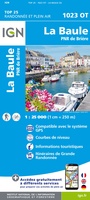 Topografische kaart - Wandelkaart 1023OT La Baule & Parc Naturel Regional de Briere | IGN - Institut Géographique National
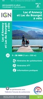 Fietskaart 11 Velo Lac d'Annecy - Lac du Bourget a velo - by bike | IGN - Institut Géographique National
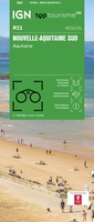 Wegenkaart - landkaart 11 TOP 250 Nouvelle-Aquitaine - Bassin Aquitain | IGN - Institut Géographique National
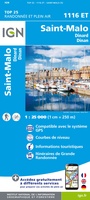 Wandelkaart - Topografische kaart 1116ET Saint-Malo – Dinard – Dinan – Rothéneuf – Cancale – Châteauneuf-d'ille-Vilaine | IGN - Institut Géographique National
 Wandelkaart 1117 SB - Serie Bleue Tinténiac / Caulnes | IGN - Institut Géographique National
 Wandelkaart 1118 SB - Serie Bleue Montfort-sur-Meu / Montauban-de-Bretagne | IGN - Institut Géographique National
 Topografische kaart - Wandelkaart 1119 Bréal-sous-Montfort, Guer | IGN - Institut Géographique National
 Wandelkaart - Topografische kaart 1120 SB - Serie Bleue Pipriac – La Gacilly | IGN - Institut Géographique National
Laatste reviews

Prachtig getekend
De ontvanger van dit cadeau is er erg blij mee. De Zwerver heeft het mooi naar het cadeaukaarten verstuurd. Er wordt vaak mee gespeeld.
★★★★★ door Carola 26 december 2025 | Heeft dit artikel gekocht
Geweldig
Super gedetailleerde kaart met alle routes en wandelroutes. Ik ben er blij mee.
★★★★★ door Rob 26 december 2025 | Heeft dit artikel gekocht
fijne atlas met duidelijke kaarten
Zeer gedetaillerd, fijn groot formaat atlas voor reizen met auto of camper. Niet geschikt voor backpackers want groot en vrij zwaar.
★★★★★ door Inge Hens 23 december 2025 | Heeft dit artikel gekocht
Goed ontvangen
Ik heb iemand met Sinterklaas héél blij gemaakt met de kaarten. Hij kon er niet genoeg van krijgen en gaf geregeld aan dat hij verheugd …
★★★★★ door Peet Maessen 23 december 2025 | Heeft dit artikel gekocht