Winkelwagen
Geen items in winkelwagen
Ga naar winkelwagen
IGN - Institut Géographique National
IGN is de officiële instantie voor geografische informatie in Frankrijk ofwel Institut Géographique National. Ze staan bekend om de zeer goede wandelkaarten op schaal 1:25.000 (Serie Bleue en Top 25) van Frankrijk. De wandelkaarten zijn dan ook zeer uitgebreid. De wandelaar vindt hier alle wandelpaden, campings en langeafstandswandelpaden, ook wel GR-paden (Grande Randonnée) genoemd. Kleine weggetjes en paden, maar ook de verschillende types landschappen en bebouwingen, populaire gebieden en onontdekte parels: de wandelaar in Frankrijk vindt alles terug op deze betrouwbare kaarten van IGN.
Naast wandelkaarten geeft het IGN ook goede fiets- c.q. wegenkaarten op schaal 1:100.000 (serie Top 100) en fietskaarten op schaal 1:75.000 (serie Top 75) uit.
 Wandelkaart - Topografische kaart 0921OTR Vannes / Golfe du Morbihan | IGN - Institut Géographique National
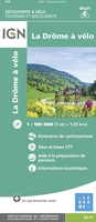 Fietskaart 1 Velo La Drome a Velo - Drome by bike | IGN - Institut Géographique National
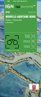 Wegenkaart - landkaart 10 TOP 250 Nouvelle-Aquitaine - Limousin - Poitou | IGN - Institut Géographique National
 Fietskaart 10 Velo Cotes-d'Armor a velo - by bike | IGN - Institut Géographique National★★★★★
 Wandelkaart - Topografische kaart 1016ET St.-Cast-le-Guildo - Cap Fréhel | IGN - Institut Géographique National
 Wandelkaart - Topografische kaart 1017 SB - Serie Bleue Broons - Plenee Jugon | IGN - Institut Géographique National
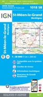 Wandelkaart - Topografische kaart 1018 SB - Serie Bleue Saint-Méen-le-Grand – Merdrignac | IGN - Institut Géographique National
 Wandelkaart - Topografische kaart 1019 SB - Serie Bleue Paimpont - Ploërmel | IGN - Institut Géographique National
 Wandelkaart - Topografische kaart 1020 SB - Serie Bleue Malestroit - Peillac | IGN - Institut Géographique National
 Wandelkaart - Topografische kaart 1021 SB - Serie Bleue Questembert - La Roche-Bernard | IGN - Institut Géographique National
 Wandelkaart - Topografische kaart 1022ET Saint-Nazaire & Parc Naturel Regional de Briere | IGN - Institut Géographique National
 Wandelkaart - Topografische kaart 1022OT La Roche-Bernard & Parc Naturel Regional de Briere | IGN - Institut Géographique National
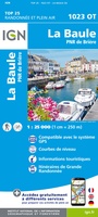 Topografische kaart - Wandelkaart 1023OT La Baule & Parc Naturel Regional de Briere | IGN - Institut Géographique National
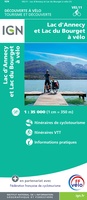 Fietskaart 11 Velo Lac d'Annecy - Lac du Bourget a velo - by bike | IGN - Institut Géographique National
 Wegenkaart - landkaart 11 TOP 250 Nouvelle-Aquitaine - Bassin Aquitain | IGN - Institut Géographique National
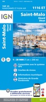 Wandelkaart - Topografische kaart 1116ET Saint-Malo – Dinard – Dinan – Rothéneuf – Cancale – Châteauneuf-d'ille-Vilaine | IGN - Institut Géographique National
 Wandelkaart 1117 SB - Serie Bleue Tinténiac / Caulnes | IGN - Institut Géographique National
 Wandelkaart 1118 SB - Serie Bleue Montfort-sur-Meu / Montauban-de-Bretagne | IGN - Institut Géographique National
 Topografische kaart - Wandelkaart 1119 Bréal-sous-Montfort, Guer | IGN - Institut Géographique National
 Wandelkaart - Topografische kaart 1120 SB - Serie Bleue Pipriac – La Gacilly | IGN - Institut Géographique National
Laatste reviews

Mooi overzichtelijk boekje
Gemakkelijk opzoeken en mooie kaarten
★★★★★ door Til Palm 09 januari 2026 | Heeft dit artikel gekocht
Een prachtig boek om vanuit je stoel op reis te gaan door een relatief ongekend gebied
Namaqualand en West Coast zijn de delen van Zuid-Afrika om in het voorjaar te bezoeken om te genieten van de uitbundige bloemenpracht die uitbarst na …
★★★★★ door Jan de Graaf 09 januari 2026 | Heeft dit artikel gekocht
Helemaal blij!
Echt prachtig boek, uniek mag ik wel zeggen. Als cadeau gegeven aan onze vriend. Een super gaaf ‘tafelboek’ . We hebben er ook en standaard …
★★★★★ door Visser 08 januari 2026 | Heeft dit artikel gekocht
Geweldig!
Wegens winter kunnen we het nog niet in de praktijk proberen, maar al enorm veel voorpret bij het lezen van deze prachtige wandelgids van de …
★★★★★ door Charlotte 08 januari 2026 | Heeft dit artikel gekocht