Winkelwagen
Geen items in winkelwagen
Ga naar winkelwagen
IGN - Institut Géographique National
IGN is de officiële instantie voor geografische informatie in Frankrijk ofwel Institut Géographique National. Ze staan bekend om de zeer goede wandelkaarten op schaal 1:25.000 (Serie Bleue en Top 25) van Frankrijk. De wandelkaarten zijn dan ook zeer uitgebreid. De wandelaar vindt hier alle wandelpaden, campings en langeafstandswandelpaden, ook wel GR-paden (Grande Randonnée) genoemd. Kleine weggetjes en paden, maar ook de verschillende types landschappen en bebouwingen, populaire gebieden en onontdekte parels: de wandelaar in Frankrijk vindt alles terug op deze betrouwbare kaarten van IGN.
Naast wandelkaarten geeft het IGN ook goede fiets- c.q. wegenkaarten op schaal 1:100.000 (serie Top 100) en fietskaarten op schaal 1:75.000 (serie Top 75) uit.
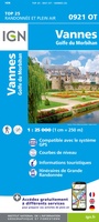 Wandelkaart - Topografische kaart 0921OT Vannes | IGN - Institut Géographique National★★★★★
 Wandelkaart - Topografische kaart 0921OTR Vannes / Golfe du Morbihan | IGN - Institut Géographique National
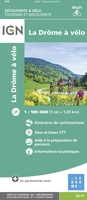 Fietskaart 1 Velo La Drome a Velo - Drome by bike | IGN - Institut Géographique National
 Fietskaart 10 Velo Cotes-d'Armor a velo - by bike | IGN - Institut Géographique National★★★★★
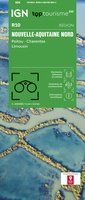 Wegenkaart - landkaart 10 TOP 250 Nouvelle-Aquitaine - Limousin - Poitou | IGN - Institut Géographique National
 Wandelkaart - Topografische kaart 1016ET St.-Cast-le-Guildo - Cap Fréhel | IGN - Institut Géographique National
 Wandelkaart - Topografische kaart 1017 SB - Serie Bleue Broons - Plenee Jugon | IGN - Institut Géographique National
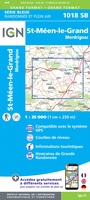 Wandelkaart - Topografische kaart 1018 SB - Serie Bleue Saint-Méen-le-Grand – Merdrignac | IGN - Institut Géographique National
 Wandelkaart - Topografische kaart 1019 SB - Serie Bleue Paimpont - Ploërmel | IGN - Institut Géographique National
 Wandelkaart - Topografische kaart 1020 SB - Serie Bleue Malestroit - Peillac | IGN - Institut Géographique National
 Wandelkaart - Topografische kaart 1021 SB - Serie Bleue Questembert - La Roche-Bernard | IGN - Institut Géographique National
 Wandelkaart - Topografische kaart 1022ET Saint-Nazaire & Parc Naturel Regional de Briere | IGN - Institut Géographique National
 Wandelkaart - Topografische kaart 1022OT La Roche-Bernard & Parc Naturel Regional de Briere | IGN - Institut Géographique National
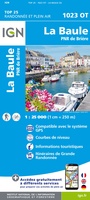 Topografische kaart - Wandelkaart 1023OT La Baule & Parc Naturel Regional de Briere | IGN - Institut Géographique National
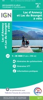 Fietskaart 11 Velo Lac d'Annecy - Lac du Bourget a velo - by bike | IGN - Institut Géographique National
 Wegenkaart - landkaart 11 TOP 250 Nouvelle-Aquitaine - Bassin Aquitain | IGN - Institut Géographique National
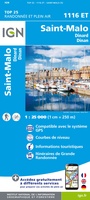 Wandelkaart - Topografische kaart 1116ET Saint-Malo – Dinard – Dinan – Rothéneuf – Cancale – Châteauneuf-d'ille-Vilaine | IGN - Institut Géographique National
 Wandelkaart 1117 SB - Serie Bleue Tinténiac / Caulnes | IGN - Institut Géographique National
 Wandelkaart 1118 SB - Serie Bleue Montfort-sur-Meu / Montauban-de-Bretagne | IGN - Institut Géographique National
 Topografische kaart - Wandelkaart 1119 Bréal-sous-Montfort, Guer | IGN - Institut Géographique National
Laatste reviews

Fijne kaart
Goede leesbare kaart inclusief route suggesties. Heb alleen op de kaart gelopen, zonder mobiele apparatuur. Heel goed te doen.
★★★★★ door Nick 10 juni 2026 | Heeft dit artikel gekocht
Mooie kaart van een prachtig gebied
Als een prachtig gebied zo'n kaart heeft, dan is het extra genieten om gedetailleerd op avontuur te gaan!
★★★★★ door Stephanie 10 juni 2026 | Heeft dit artikel gekocht
Direct geleverd
Ik had de kaart nodig voor onze motorvakantie en het was wat krap voor vertrek. Zwerver leverde snel en daardoor konden we met veel plezier …
★★★★★ door Wim 09 juni 2026 | Heeft dit artikel gekocht
Prima keuze
Prima gids, goed bruikbaar, handig formaat juist wat we zochten voor onze reis. Daarbij prima en snelle service van de Zwerver!
★★★★★ door Marti Kwakernaak 09 juni 2026 | Heeft dit artikel gekocht