Winkelwagen
Geen items in winkelwagen
Ga naar winkelwagen
IGN - Institut Géographique National
IGN is de officiële instantie voor geografische informatie in Frankrijk ofwel Institut Géographique National. Ze staan bekend om de zeer goede wandelkaarten op schaal 1:25.000 (Serie Bleue en Top 25) van Frankrijk. De wandelkaarten zijn dan ook zeer uitgebreid. De wandelaar vindt hier alle wandelpaden, campings en langeafstandswandelpaden, ook wel GR-paden (Grande Randonnée) genoemd. Kleine weggetjes en paden, maar ook de verschillende types landschappen en bebouwingen, populaire gebieden en onontdekte parels: de wandelaar in Frankrijk vindt alles terug op deze betrouwbare kaarten van IGN.
Naast wandelkaarten geeft het IGN ook goede fiets- c.q. wegenkaarten op schaal 1:100.000 (serie Top 100) en fietskaarten op schaal 1:75.000 (serie Top 75) uit.
 Wandelkaart - Topografische kaart 2249ETR Font-Romeu | IGN - Institut Géographique National
 Wandelkaart - Topografische kaart 2249OT Bourg-Madame, Pic Carlit, Col de Puymorens, Port d'Envalira | IGN - Institut Géographique National★★★★★
 Wandelkaart - Topografische kaart 2249OTR Bourg-Madame | IGN - Institut Géographique National
 Wandelkaart - Topografische kaart 2250ET Bourg-Madame - Mont-Louis | IGN - Institut Géographique National★★★★★
 Wandelkaart - Topografische kaart 2250ETR Bourg-Madame - Mont-Louis | IGN - Institut Géographique National
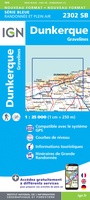 Topografische kaart - Wandelkaart 2302 SB - Serie Bleue Dunkerque - Gravelines | IGN - Institut Géographique National
 Wandelkaart - Topografische kaart 2303 SB - Serie Bleue Wormhout - Cassel - Watten | IGN - Institut Géographique National
 Wandelkaart - Topografische kaart 2304 SB - Serie Bleue Aire-Sur-La-Lys, St-Omer | IGN - Institut Géographique National
 Wandelkaart - Topografische kaart 2305 SB - Serie Bleue Lillers - Heuchin | IGN - Institut Géographique National
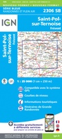 Wandelkaart - Topografische kaart 2306 SB - Serie Bleue Saint-Michel-Sur-Ternoise, Frévent | IGN - Institut Géographique National
 Wandelkaart - Topografische kaart 2307 SB - Serie Bleue Doullens - Beauval | IGN - Institut Géographique National★★★★★
 Wandelkaart - Topografische kaart 2308 SB - Serie Bleue Corbie - Amiens | IGN - Institut Géographique National
 Wandelkaart - Topografische kaart 2309 SB - Serie Bleue Moreuil - Saleux | IGN - Institut Géographique National
 Wandelkaart - Topografische kaart 2310 SB - Serie Bleue Saint-Just-en-Chaussée , Breteuil | IGN - Institut Géographique National
 Wandelkaart - Topografische kaart 2311 SB - Serie Bleue Beauvais - Mouy | IGN - Institut Géographique National
 Wandelkaart - Topografische kaart 2312ET Clermont - Creil | IGN - Institut Géographique National
 Wandelkaart - Topografische kaart 2313OT Forêts de Montmorency de l'Isle-Adam et de Carnelle | IGN - Institut Géographique National
 Wandelkaart 2314OT Paris / Forêts de Meudon et de Fausses Reposes | IGN - Institut Géographique National★★★★★
 Wandelkaart - Topografische kaart 2315OT Palaiseau - Arpajon, Forêt de Verrières | IGN - Institut Géographique National
 Wandelkaart 2316ET Milly-la-Forêt / Malesherbes / La Ferté-Alais | IGN - Institut Géographique National
Laatste reviews

Perfect geregeld.
Michelin Camping gids Frankrijk 2026: Per omgaande, netjes verpakt geleverd.
★★★★★ door Cor 27 april 2026 | Heeft dit artikel gekocht
Leuk informatief boekje
Het boekje geeft een goede indruk van de Mullerthal Trail met wat feitelijke info, heel handig, en vooral ook een mooi sfeerbeeld.
★★★★★ door Odette 27 april 2026 | Heeft dit artikel gekocht
Prima wandelkaart
De routes zijn zo goed bewegwijzerd, dat je bijna geen kaart nodig hebt. Wij hebben hem vooral gebruikt om per dag te bekijken wat we …
★★★★★ door Odette 27 april 2026 | Heeft dit artikel gekocht
Kwalitatieve topkaart
Heldere gedetailleerde kaart, onmisbaar voor tochtplanning, waterafstotend
★★★★★ door Walter 24 april 2026 | Heeft dit artikel gekocht