Winkelwagen
Geen items in winkelwagen
Ga naar winkelwagen
IGN - Institut Géographique National
IGN is de officiële instantie voor geografische informatie in Frankrijk ofwel Institut Géographique National. Ze staan bekend om de zeer goede wandelkaarten op schaal 1:25.000 (Serie Bleue en Top 25) van Frankrijk. De wandelkaarten zijn dan ook zeer uitgebreid. De wandelaar vindt hier alle wandelpaden, campings en langeafstandswandelpaden, ook wel GR-paden (Grande Randonnée) genoemd. Kleine weggetjes en paden, maar ook de verschillende types landschappen en bebouwingen, populaire gebieden en onontdekte parels: de wandelaar in Frankrijk vindt alles terug op deze betrouwbare kaarten van IGN.
Naast wandelkaarten geeft het IGN ook goede fiets- c.q. wegenkaarten op schaal 1:100.000 (serie Top 100) en fietskaarten op schaal 1:75.000 (serie Top 75) uit.
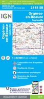 Wandelkaart - Topografische kaart 2118 SB - Serie Bleue Orgères-en-Beauce, Sancheville | IGN - Institut Géographique National
 Wandelkaart - Topografische kaart 2119 SB - Serie Bleue Patay, Ouzouer-le-Marché | IGN - Institut Géographique National
 Wandelkaart - Topografische kaart 2120 SB - Serie Bleue Beaugency, Mer, Meung-sur-Loire | IGN - Institut Géographique National★★★★★
 Wandelkaart - Topografische kaart 2121 SB - Serie Bleue Mer | IGN - Institut Géographique National
 Wandelkaart - Topografische kaart 2121OT Blois - Chambord - Cheverny | IGN - Institut Géographique National
 Wandelkaart - Topografische kaart 2122 SB - Serie Bleue Romorantin-Lanthenay | IGN - Institut Géographique National
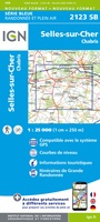 Wandelkaart - Topografische kaart 2123 SB - Serie Bleue Selles-sur-Cher, Chabris | IGN - Institut Géographique National
 Wandelkaart - Topografische kaart 2124 SB - Serie Bleue Lucay-le-Male | IGN - Institut Géographique National
 Wandelkaart - Topografische kaart 2125 SB - Serie Bleue Châteauroux, Levroux, Villedieu-sur-Indre | IGN - Institut Géographique National
 Wandelkaart - Topografische kaart 2126 SB - Serie Bleue Le Poinçonnet, Velles, Luant | IGN - Institut Géographique National
 Topografische kaart - Wandelkaart 2127 SB - Serie Bleue Argenton-sur-Creuse | IGN - Institut Géographique National
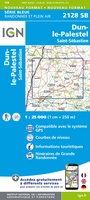 Wandelkaart - Topografische kaart 2128 SB - Serie Bleue Dun-le-Palestel | IGN - Institut Géographique National★★★★★
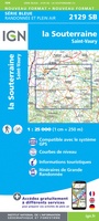 Wandelkaart - Topografische kaart 2129 SB - Serie Bleue La Souterraine | IGN - Institut Géographique National
 Wandelkaart 2130 SB - Serie Bleue Bourganeuf / St-Sulpice-Laurière | IGN - Institut Géographique National
 Wandelkaart - Topografische kaart 2131 SB - Serie Bleue St-Léonard-de-Noblat, Eymoutiers | IGN - Institut Géographique National
 Wandelkaart - Topografische kaart 2132 SB - Serie Bleue Châteauneuf-la-Forêt, Chamberet | IGN - Institut Géographique National
 Wandelkaart - Topografische kaart 2133 SB - Serie Bleue Uzerche, Treignac, Seilhac | IGN - Institut Géographique National
 Wandelkaart - Topografische kaart 2134 SB - Serie Bleue Tulle | IGN - Institut Géographique National
 Wandelkaart - Topografische kaart 2135 SB - Serie Bleue Beynat, Meyssac, Collonges-la-Rouge, Brive-la-Gaillarde | IGN - Institut Géographique National
 Wandelkaart 2136ET Rocamadour / Padirac / Vallée de la Dordogne | IGN - Institut Géographique National★★★★★
Laatste reviews

Perfect geregeld.
Michelin Camping gids Frankrijk 2026: Per omgaande, netjes verpakt geleverd.
★★★★★ door Cor 27 april 2026 | Heeft dit artikel gekocht
Leuk informatief boekje
Het boekje geeft een goede indruk van de Mullerthal Trail met wat feitelijke info, heel handig, en vooral ook een mooi sfeerbeeld.
★★★★★ door Odette 27 april 2026 | Heeft dit artikel gekocht
Prima wandelkaart
De routes zijn zo goed bewegwijzerd, dat je bijna geen kaart nodig hebt. Wij hebben hem vooral gebruikt om per dag te bekijken wat we …
★★★★★ door Odette 27 april 2026 | Heeft dit artikel gekocht
Kwalitatieve topkaart
Heldere gedetailleerde kaart, onmisbaar voor tochtplanning, waterafstotend
★★★★★ door Walter 24 april 2026 | Heeft dit artikel gekocht