Winkelwagen
Geen items in winkelwagen
Ga naar winkelwagen
IGN - Institut Géographique National
IGN is de officiële instantie voor geografische informatie in Frankrijk ofwel Institut Géographique National. Ze staan bekend om de zeer goede wandelkaarten op schaal 1:25.000 (Serie Bleue en Top 25) van Frankrijk. De wandelkaarten zijn dan ook zeer uitgebreid. De wandelaar vindt hier alle wandelpaden, campings en langeafstandswandelpaden, ook wel GR-paden (Grande Randonnée) genoemd. Kleine weggetjes en paden, maar ook de verschillende types landschappen en bebouwingen, populaire gebieden en onontdekte parels: de wandelaar in Frankrijk vindt alles terug op deze betrouwbare kaarten van IGN.
Naast wandelkaarten geeft het IGN ook goede fiets- c.q. wegenkaarten op schaal 1:100.000 (serie Top 100) en fietskaarten op schaal 1:75.000 (serie Top 75) uit.
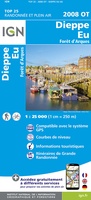 Wandelkaart - Topografische kaart 2008OT Dieppe - Envermeu - Fresnoy - Folny | IGN - Institut Géographique National★★★★★★★★★★
 Topografische kaart - Wandelkaart 2009OT Forêt d'Eawy, Neufchâtel-en-Bray | IGN - Institut Géographique National★★★★★
 Wandelkaart - Topografische kaart 2010 SB - Serie Bleue Saint-Saëns | IGN - Institut Géographique National
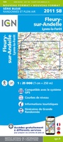 Wandelkaart - Topografische kaart 2011 SB - Serie Bleue Fleury-sur-Andelle | IGN - Institut Géographique National
 Wandelkaart - Topografische kaart 2012OT Foret De Bord-Louviers | IGN - Institut Géographique National
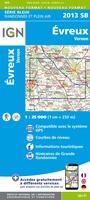 Wandelkaart - Topografische kaart 2013 SB - Serie Bleue Evreux - Vernon - Pacy-sur-Eure | IGN - Institut Géographique National★★★★★
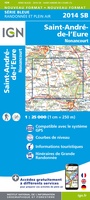 Wandelkaart - Topografische kaart 2014 SB - Serie Bleue Saint-André-de-l'Eure, Nonancourt | IGN - Institut Géographique National
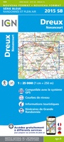 Wandelkaart - Topografische kaart 2015 SB - Serie Bleue Dreux - Nonancourt | IGN - Institut Géographique National
 Wandelkaart - Topografische kaart 2016 SB - Serie Bleue Chartres, Courville-sur-Eure | IGN - Institut Géographique National
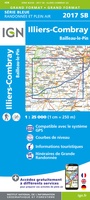 Wandelkaart - Topografische kaart 2017 SB - Serie Bleue Illiers-Combray, Bailleau-le-Pin | IGN - Institut Géographique National
 Topografische kaart - Wandelkaart 2018 SB - Serie Bleue Châteaudun - Brou | IGN - Institut Géographique National
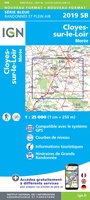 Topografische kaart - Wandelkaart 2019 SB - Serie Bleue Cloyes-sur-le-Loir | IGN - Institut Géographique National
 Topografische kaart - Wandelkaart 2020 Oucques - Selommes - St-Ouen | IGN - Institut Géographique National
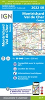 Wandelkaart - Topografische kaart 2022 SB - Serie Bleue Montrichard, Contres | IGN - Institut Géographique National
 Wandelkaart - Topografische kaart 2023 SB - Serie Bleue Montrichard, St-Aignan | IGN - Institut Géographique National
 Wandelkaart - Topografische kaart 2024 SB - Serie Bleue Chatillon-sur-Indre, Ecueille | IGN - Institut Géographique National
 Wandelkaart - Topografische kaart 2025 SB - Serie Bleue Buzançais, Mézières-en-Brenne | IGN - Institut Géographique National
 Wandelkaart - Topografische kaart 2026 SB - Serie Bleue St-Gaultier, Rosney | IGN - Institut Géographique National
 Wandelkaart 2027 SB - Serie Bleue Bélâbre / Saint-Benoît-du-Sault | IGN - Institut Géographique National
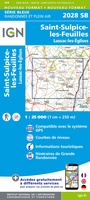 Wandelkaart - Topografische kaart 2028 SB - Serie Bleue Saint-Sulpice-les-Feuilles | IGN - Institut Géographique National
Laatste reviews

Super
Rother wandelgidsen stellen nooit teleur. Mooie routes, goede opgave kilometers, hoogtemeters en horeca. Een aanrader!
★★★★★ door Anita Geel 13 januari 2026 | Heeft dit artikel gekocht
Prachtig boek!
Mooi boek met prachtige foto’s! Voldoet helemaal aan mijn verwachtingen.
★★★★★ door Hans Eldering 13 januari 2026 | Heeft dit artikel gekocht
zeer vlotte levering
het product voldeed aan mijn verwachtingen en was geplastificeerd wat natuurlijk perfect is voor kaart die veel wordt geraadpleegd!
★★★★★ door Peter Lantinga 13 januari 2026 | Heeft dit artikel gekocht
Gedetailleerde wegenkaart
Ik heb de wegenkaart Maleisië aangeschaft om zelf een rondreis per huurauto te kunnen plannen. Deze kaart heeft daar heel goed bij geholpen doordat er …
★★★★★ door M. Rizvi 13 januari 2026 | Heeft dit artikel gekocht