Winkelwagen
Geen items in winkelwagen
Ga naar winkelwagen
IGN - Institut Géographique National
IGN is de officiële instantie voor geografische informatie in Frankrijk ofwel Institut Géographique National. Ze staan bekend om de zeer goede wandelkaarten op schaal 1:25.000 (Serie Bleue en Top 25) van Frankrijk. De wandelkaarten zijn dan ook zeer uitgebreid. De wandelaar vindt hier alle wandelpaden, campings en langeafstandswandelpaden, ook wel GR-paden (Grande Randonnée) genoemd. Kleine weggetjes en paden, maar ook de verschillende types landschappen en bebouwingen, populaire gebieden en onontdekte parels: de wandelaar in Frankrijk vindt alles terug op deze betrouwbare kaarten van IGN.
Naast wandelkaarten geeft het IGN ook goede fiets- c.q. wegenkaarten op schaal 1:100.000 (serie Top 100) en fietskaarten op schaal 1:75.000 (serie Top 75) uit.
 Wandelkaart - Topografische kaart 1942 SB - Serie Bleue Beaumont-de-Lomagne | IGN - Institut Géographique National
 Wandelkaart - Topografische kaart 1943 SB - Serie Bleue L'Isle-Jourdain | IGN - Institut Géographique National
 Wandelkaart - Topografische kaart 1944 SB - Serie Bleue Samatan | IGN - Institut Géographique National
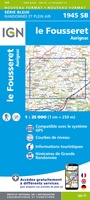 Wandelkaart - Topografische kaart 1945 SB - Serie Bleue Le Fousseret - Aurignac | IGN - Institut Géographique National
 Wandelkaart - Topografische kaart 1946 SB - Serie Bleue St-Gaudens, Salies-du-Salat | IGN - Institut Géographique National
 Wandelkaart - Topografische kaart 1947OT Aspet, Pic de Mauberme | IGN - Institut Géographique National★★★★★
 Fietskaart 2 Velo Ile-de-France a velo - by bike | IGN - Institut Géographique National
 Wegenkaart - landkaart 200202 TOP 200 Haut-Jura / Alpes du Nord | IGN - Institut Géographique National
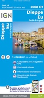 Wandelkaart - Topografische kaart 2008OT Dieppe - Envermeu - Fresnoy - Folny | IGN - Institut Géographique National★★★★★★★★★★
 Topografische kaart - Wandelkaart 2009OT Forêt d'Eawy, Neufchâtel-en-Bray | IGN - Institut Géographique National★★★★★
 Wandelkaart - Topografische kaart 2010 SB - Serie Bleue Saint-Saëns | IGN - Institut Géographique National
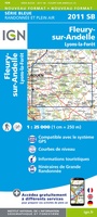 Wandelkaart - Topografische kaart 2011 SB - Serie Bleue Fleury-sur-Andelle | IGN - Institut Géographique National
 Wandelkaart - Topografische kaart 2012OT Foret De Bord-Louviers | IGN - Institut Géographique National
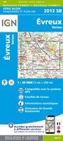 Wandelkaart - Topografische kaart 2013 SB - Serie Bleue Evreux - Vernon - Pacy-sur-Eure | IGN - Institut Géographique National★★★★★
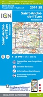 Wandelkaart - Topografische kaart 2014 SB - Serie Bleue Saint-André-de-l'Eure, Nonancourt | IGN - Institut Géographique National
 Wandelkaart - Topografische kaart 2015 SB - Serie Bleue Dreux - Nonancourt | IGN - Institut Géographique National
 Wandelkaart - Topografische kaart 2016 SB - Serie Bleue Chartres, Courville-sur-Eure | IGN - Institut Géographique National
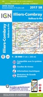 Wandelkaart - Topografische kaart 2017 SB - Serie Bleue Illiers-Combray, Bailleau-le-Pin | IGN - Institut Géographique National
 Topografische kaart - Wandelkaart 2018 SB - Serie Bleue Châteaudun - Brou | IGN - Institut Géographique National
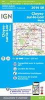 Topografische kaart - Wandelkaart 2019 SB - Serie Bleue Cloyes-sur-le-Loir | IGN - Institut Géographique National
Laatste reviews

Jacobspad Uithuizen - Hasselt; De ontvanger was er heel blij mee
Mooi om te geven
★★★★★ door Martsjen Wiersma 01 januari 2026 | Heeft dit artikel gekocht
Moeilijk te zien
Voor mij een lastig te gebruiken plattegrond. Moeilijk om hiermee te oriënteren in de omgeving.
★★★★★ door Marco 01 januari 2026 | Heeft dit artikel gekocht
vermoedelijk een nuttig boekje naast Google translate
dit boekje aangeschaft ter ondersteuning bij mogelijke taalproblemen; de waarde ervan zal blijken tijden de reis in juni 2026
★★★★★ door Bert Bosch 31 december 2025 | Heeft dit artikel gekocht
inspiratie voor de te kiezen reisroute
het is nog te vroeg om iets zinnigs over het up-to-date zijn van de wegenkaart te vermelden, daar de reis pas over enige maanden start
★★★★★ door Bert Bosch 31 december 2025 | Heeft dit artikel gekocht