Winkelwagen
Geen items in winkelwagen
Ga naar winkelwagen
IGN - Institut Géographique National
IGN is de officiële instantie voor geografische informatie in Frankrijk ofwel Institut Géographique National. Ze staan bekend om de zeer goede wandelkaarten op schaal 1:25.000 (Serie Bleue en Top 25) van Frankrijk. De wandelkaarten zijn dan ook zeer uitgebreid. De wandelaar vindt hier alle wandelpaden, campings en langeafstandswandelpaden, ook wel GR-paden (Grande Randonnée) genoemd. Kleine weggetjes en paden, maar ook de verschillende types landschappen en bebouwingen, populaire gebieden en onontdekte parels: de wandelaar in Frankrijk vindt alles terug op deze betrouwbare kaarten van IGN.
Naast wandelkaarten geeft het IGN ook goede fiets- c.q. wegenkaarten op schaal 1:100.000 (serie Top 100) en fietskaarten op schaal 1:75.000 (serie Top 75) uit.
 Historische Kaart Grande Guerre - Chemin des Dames 1917 | IGN - Institut Géographique National
 Historische Kaart Battle of the Somme 1916 | IGN - Institut Géographique National★★★★★
 Historische Kaart Bataille de Verdun 1916 - Slag om Verdun | IGN - Institut Géographique National★★★★★
 Wegenkaart - landkaart 01 TOP 250 Hauts-de-France | IGN - Institut Géographique National
 Wegenkaart - landkaart 02 TOP 250 Normandie | IGN - Institut Géographique National
 Wegenkaart - landkaart 03 TOP 250 Ile-de-France | IGN - Institut Géographique National
 Wandelkaart - Topografische kaart 0317OT Île d'Ouessant, Le Conquet | IGN - Institut Géographique National
 Wegenkaart - landkaart 04 TOP 250 Grand Est - Ardenne - Champagne | IGN - Institut Géographique National
 Wandelkaart - Topografische kaart 0416ET Plouguerneau, Les Abers, Plabennec, Ploudalmezeau | IGN - Institut Géographique National
 Wandelkaart - Topografische kaart 0417ET Brest, Pointe de St.Mathieu, St.-Renan, Le Conquet, Guipavas | IGN - Institut Géographique National
 Wandelkaart - Topografische kaart 0418ET Camaret, Presqu'Île de Crozon, Morgat | IGN - Institut Géographique National★★★★★
 Wandelkaart - Topografische kaart 0419ET Audierne, Pointe du Raz, Pont-Croix,Plouhinec, Plozévet | IGN - Institut Géographique National
 Wegenkaart - landkaart 05 TOP 250 Grand Est - Massif des Vosges - Alsace - Lorraine | IGN - Institut Géographique National
 Fietskaart 05 Velo Morbihan à vélo | IGN - Institut Géographique National
 Topografische kaart - Wandelkaart 0515ET St-Pol-de-Léon | IGN - Institut Géographique National
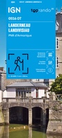 Wandelkaart 0516OT Landerneau / Landisvisiau / PNR d'Armorique | IGN - Institut Géographique National
 Wandelkaart - Topografische kaart 0517OT Plougastel, Daoulas, Le Faou, PNR D'Armorique | IGN - Institut Géographique National
 Wandelkaart - Topografische kaart 0518OT Chateaulin, Douarnenez, Locronan, Ménez Hom, Le Faou | IGN - Institut Géographique National
 Wandelkaart - Topografische kaart 0519ET Quimper, Concarneau, Fouesnant, Beg-Meil, iles de Glénan | IGN - Institut Géographique National
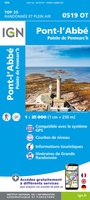 Wandelkaart - Topografische kaart 0519OT Pont l Abbé, Pointe de Penmarc h, Plogastel-St.-Germain, Plonéour-Lanvern | IGN - Institut Géographique National
- 1
- 2
- 3
- Volgende >>
- 70
Laatste reviews

Mooie gedetailleerde kaart
We hebben de kaart nog niet mee op pad genomen maar al wel gebruikt voor de voorbereiding van onze vakantie. De kaart geeft voldoende detail …
★★★★★ door Pieter 02 maart 2026 | Heeft dit artikel gekocht
Fijne stadsplattegrond met duidelijke details
Voor iedere citytrip gebruik ik de stadsplattegronden van Borch. Het is een duidelijke kaart, op goede schaal en fijn dat de kaart geplastificeerd is.
★★★★★ door Mirte 27 februari 2026 | Heeft dit artikel gekocht
Fantastische puzzel
Prachtige puzzel met leuke extra’s, een standaard om de deksel in te zetten. Leuke weetjes over de wijnen aan de binnenkant van de deksel en …
★★★★★ door Angelique de Jonge 26 februari 2026 | Heeft dit artikel gekocht
perfect geleverd en ongeschonden aangekregen
perfect geleverd en ongeschonden aangekregen
★★★★★ door Steven Vansteenkiste 26 februari 2026 | Heeft dit artikel gekocht