Harvey Maps
Superhandige wandelkaarten van Harvey Maps voor Engeland, Schotland & Wales
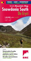 Wandelkaart Snowdonia Zuid | Harvey Maps
"The 1:40,000 scale used by British Mountain Maps is excellent for hill walking. These maps provide clear, detailed information." Sir Chris Bonington, mountaineer. The key mountains of Southern Snowdonia …
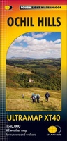 Wandelkaart Ochil Hills | Harvey Maps
Pocket perfect! Well known hills are Dumyat, Ben Cleuch and Castle Craig Hill. Magnificent views over the Forth Valley. Places of interest and enlargements of the steep and narrow glens: …
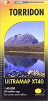 Wandelkaart Torridon | Harvey Maps
Covers a large area yet is handily compact. Pocket perfect!Includes Slioch, Beinn Eighe, Liathach and Beinn Alligin.Detailed map for runners and walkers of the Torridon Hills at the magic scale …
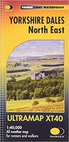 Wandelkaart Yorkshire Dales Noord Oost | Harvey Maps
Covers a large area yet is handily compact. Pocket perfect! Detailed map for runners and walkers of the north eastern part of the Yorkshire Dales National Park at the …
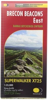
 Wandelkaart Brecon Beacons Oost | Harvey Maps
Covers a large area yet is handily compact. Pocket perfect! Detailed map for runners and walkers of the eastern part of the Brecon Beacons National Park and the Black …
 Wandelkaart Skye Trotternish | Harvey Maps
Een bijzonder handige kaart van dit gebied. Op waterafstotend papier met veel details. Detailed map for walking, scrambling and climbing The Trotternish Ridge from Portree north. This map for …
 Wandelkaart Thames Path | Harvey Maps
Mooie, duidelijke kaart van het Thames Path in Engeland. Geplastificeerd met veel extra informatie en uitsnedes van de route. Thames Path National Trail The Thames Path follows the …
 Wandelkaart Two Moors Way | Harvey Maps
Een bijzonder handige kaart van dit lange-afstands-wandelpad. Op waterafstotend papier met veel details. Het enige dat je eigenlijk een beetje mist is een overzicht. Verder uitstekend en voldoende voor de …
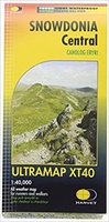 Wandelkaart Snowdonia Central | Harvey Maps
Covers a large area yet is handily compact. Pocket perfect! Detailed map for runners and walkers of the central part of the Snowdonia National Park at the magic scale …
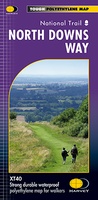 Wandelkaart North Downs Way | Harvey Maps
Mooie, duidelijke kaart van de North Downs Way in Engeland. Geplastificeerd met veel extra informatie en uitsnedes van de route. XT40 - Leap forward in technical excellence. Tough, light …
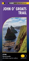 Wandelkaart John O'Groats trail | Harvey Maps
Mooie, duidelijke kaart van de John O'Groats trail in Schotland. Geplastificeerd met veel extra informatie en uitsnedes van de route. The John o' Groats Trail is a 237 km (147 …
★★★★★★★★★★ Wandelkaart Yorkshire Dales Noord West | Harvey Maps
Covers a large area yet is handily compact. Pocket perfect! Detailed map for runners and walkers of the north western part of the Yorkshire Dales National Park at the …
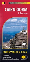 Wandelkaart Cairn Gorm | Harvey Maps
Includes 18 Munros of which 5 over 4000' (Cairn Gorm, Ben Macdui, Cairn Toul, Braeriach & Sgor an Loachain Uaine) and 3 Corbetts. Detailed map for hillwalkers of the …
 Wandelkaart Mull - Iona - Ulva | Harvey Maps
Zeer duidelijke kaart van Mull, met o.a. hoogtelijnen en geschikt voor gebruik met GPS.Two maps in one! 1:25,000 scale walking map of the mountains of Mull with a recreation …
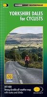 Fietskaart Yorkshire Dales for Cyclists | Harvey Maps
The area covered by this new 100% waterproof map provides fabulous opportunities from gentle routes in the valleys to some challenging climbs over the moorland that separates them. It is …
 Wandelkaart Brecon Beacons Oost | Harvey Maps
Includes Pen y Fan and the Black Mountains. Detailed map for hillwalkers of the western part of the Brecon Beacons National Park at the popular scale of 1:25,000. …
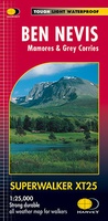 Wandelkaart Ben Nevis | Harvey Maps
Een bijzonder mooie en handige kaart van dit prachtige bergachtige gebied. Op waterafstotend papier met veel details. HARVEY Superwalker map at 1:25,000 scale Detailed map of Ben Nevis for walkers …
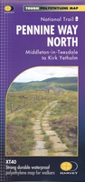 Wandelkaart Pennine Way North | Harvey Maps
Mooie, duidelijke kaart van het Noordelijke gedeelte van de Pennine Way (Middleton-in-Teesdale naar Kirk Yetholm). The whole of the Pennine Way on just 2 maps! Pennine Way North map …
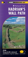 Wandelkaart Hadrian's Wall | Harvey Maps
Een bijzonder handige kaart van dit lange-afstands-wandelpad. Op waterafstotend papier met veel details. Het enige dat je eigenlijk een beetje mist is een overzicht. Verder uitstekend en voldoende voor de …
★★★★★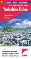 Wandelkaart Yorkshire Dales | Harvey Maps
A huge area on one map. Yorkshire Dales - the latest addition to the British Mountain Map series - is the sixth title in this highly successful & innovative range. …
Laatste reviews

Niet echt voor beginners. Ook zijn de routes soms moeilijk qua logistiek. Weer terugkomen aan het eind bv. En in voorseizoen (mei) blijft er niet …
★★★★★ door Tjeerd 17 mei 2024 | Heeft dit artikel gekocht
Van te voren had ik een andere kaart op het oog. Toen ik in de winkel was adviseerde zij mij deze kaart. Op hun verzoek …
★★★★★ door Koen 17 mei 2024 | Heeft dit artikel gekocht
Ideale schaal waar ook de kleinere wegen duidelijk zijn aangegeven. Beschrijving op website is correct.
★★★★★ door Peter 16 mei 2024 | Heeft dit artikel gekocht
Overzichtelijke kaart. Niks op aan te merken.
★★★★★ door Bastiaan de Leeuw 16 mei 2024 | Heeft dit artikel gekocht