Winkelwagen
Geen items in winkelwagen
Ga naar winkelwagen
Kaarten
De beste wegenkaarten, routekaarten, fiets- of wandelkaarten en topografische kaarten vindt u hier!
Gaat u wandelen, met de auto toeren of op andere manier de omgeving op uw vakantiebestemming verkennen? Onze tip: neem een goede kaart mee! Er zijn speciale kaarten beschikbaar voor campervakanties, fietsroutes, pelgrimsroutes, wandeltochten en veel meer. Ook wegenatlassen en wegenkaarten kunnen handig zijn onderweg.
 Wandelkaart - Topografische kaart 3344OT Saint-Maximin-la-Sainte-Baume | IGN - Institut Géographique National
 Wandelkaart - Topografische kaart 3345OT Signes – Tourves | IGN - Institut Géographique National
 Wandelkaart - Topografische kaart 3346OT Toulon | IGN - Institut Géographique National
 Wegenkaart - landkaart 335 Gironde - Landes | Michelin★★★★★
 Topografische kaart 335 MT50 Palafrugell | CNIG - Instituto Geográfico Nacional1
 Wandelkaart - Topografische kaart 335 OS Explorer Map Lanark, Tinto Hills | Ordnance Survey
 Wegenkaart - landkaart 335 Limnos | Orama
 Wandelkaart 335 Patmos | Terrain maps★★★★★
 Topografische kaart 335-I Palafrugell | CNIG - Instituto Geográfico Nacional1
 Topografische kaart 335-III Calella de Palafrugell | CNIG - Instituto Geográfico Nacional1
 Fietskaart 3358 Osnabrücker Land, Grafschaft Bentheim, Enschede | Kompass
 Wegenkaart - landkaart 336 Samos | Orama
 Wandelkaart - Wegenkaart - landkaart 336 Leros | Terrain maps
 Wandelkaart - Topografische kaart 336 OS Explorer Map Biggar, Broughton | Ordnance Survey
 Wegenkaart - landkaart 336 Gers - Lot et Garonne | Michelin★★★★★
 Fietskaart 3366 Wildeshauser Geest - Vechta - Cloppenburg | Kompass
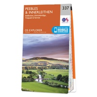 Wandelkaart - Topografische kaart 337 OS Explorer Map Peebles, Interleithen | Ordnance Survey
 Wandelkaart 337 Kalymnos | Terrain maps★★★★★
 Wegenkaart - landkaart 337 Chios | Orama
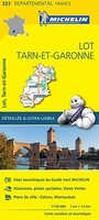 Wegenkaart - landkaart 337 Lot - Tarn et Garonne | Michelin★★★★★
Laatste reviews

Een zeer onhandige wegenkaart
Wij dachten er goed aanrecht doen een zeer uitgebreide wegenatlas aan te schaffen, maar toen wij deze goed bestudeerden kwamen wij erachter dat dit een …
★★★★★ door Herman van Mal 18 juni 2026 | Heeft dit artikel gekocht
Nuttige en handige reisgids!
De gids geeft brede informatie over Transsylvanië, inclusief zijn gecompliceerde geschiedenis, musea, kerken en andere bezienswaardigheden, en wat praktische zaken. Dit laatste onderwerp is wel …
★★★★★ door Frank Bakx 16 juni 2026 | Heeft dit artikel gekocht
Super service
Makkelijk bestelproces. Snel geleverd en goede service!
★★★★★ door tanja kleerekoper 16 juni 2026 | Heeft dit artikel gekocht
Wandelkaart Noord Drente / Drentse Aa
Prachtige wandelkaart.Handzaam mooie routes. Prima verpakt en snel verzonden!
★★★★★ door Gerard 16 juni 2026 | Heeft dit artikel gekocht